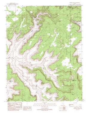
Gordon Flats Topo Map Utah
To zoom in, hover over the map of Gordon Flats
USGS Topo Quad 38110b2 - 1:24,000 scale
| Topo Map Name: | Gordon Flats |
| USGS Topo Quad ID: | 38110b2 |
| Print Size: | ca. 21 1/4" wide x 27" high |
| Southeast Coordinates: | 38.125° N latitude / 110.125° W longitude |
| Map Center Coordinates: | 38.1875° N latitude / 110.1875° W longitude |
| U.S. State: | UT |
| Filename: | o38110b2.jpg |
| Download Map JPG Image: | Gordon Flats topo map 1:24,000 scale |
| Map Type: | Topographic |
| Topo Series: | 7.5´ |
| Map Scale: | 1:24,000 |
| Source of Map Images: | United States Geological Survey (USGS) |
| Alternate Map Versions: |
Orange Cliffs 4 NW UT 1953, updated 1954 Download PDF Buy paper map Gordon Flats UT 1988, updated 1988 Download PDF Buy paper map Gordon Flats UT 2010 Download PDF Buy paper map Gordon Flats UT 2014 Download PDF Buy paper map |
1:24,000 Topo Quads surrounding Gordon Flats
> Back to 38110a1 at 1:100,000 scale
> Back to 38110a1 at 1:250,000 scale
> Back to U.S. Topo Maps home
Gordon Flats topo map: Gazetteer
Gordon Flats: Airports
Gordon Flats Airport elevation 1983m 6505′Gordon Flats: Flats
Flint Flat elevation 2097m 6879′Gordon Flats elevation 1977m 6486′
Gordon Flats: Springs
Flint Seep elevation 2051m 6729′French Spring elevation 1989m 6525′
Gordon Flats: Summits
Observation Rock elevation 2044m 6706′The Hat elevation 2031m 6663′
The Hat elevation 2027m 6650′
Gordon Flats: Valleys
French Spring Fork elevation 1464m 4803′Main Fork Happy Canyon elevation 1466m 4809′
South Fork Happy Canyon elevation 1475m 4839′
Gordon Flats digital topo map on disk
Buy this Gordon Flats topo map showing relief, roads, GPS coordinates and other geographical features, as a high-resolution digital map file on DVD:


