The Pinnacle Topo Map Utah
To zoom in, hover over the map of The Pinnacle
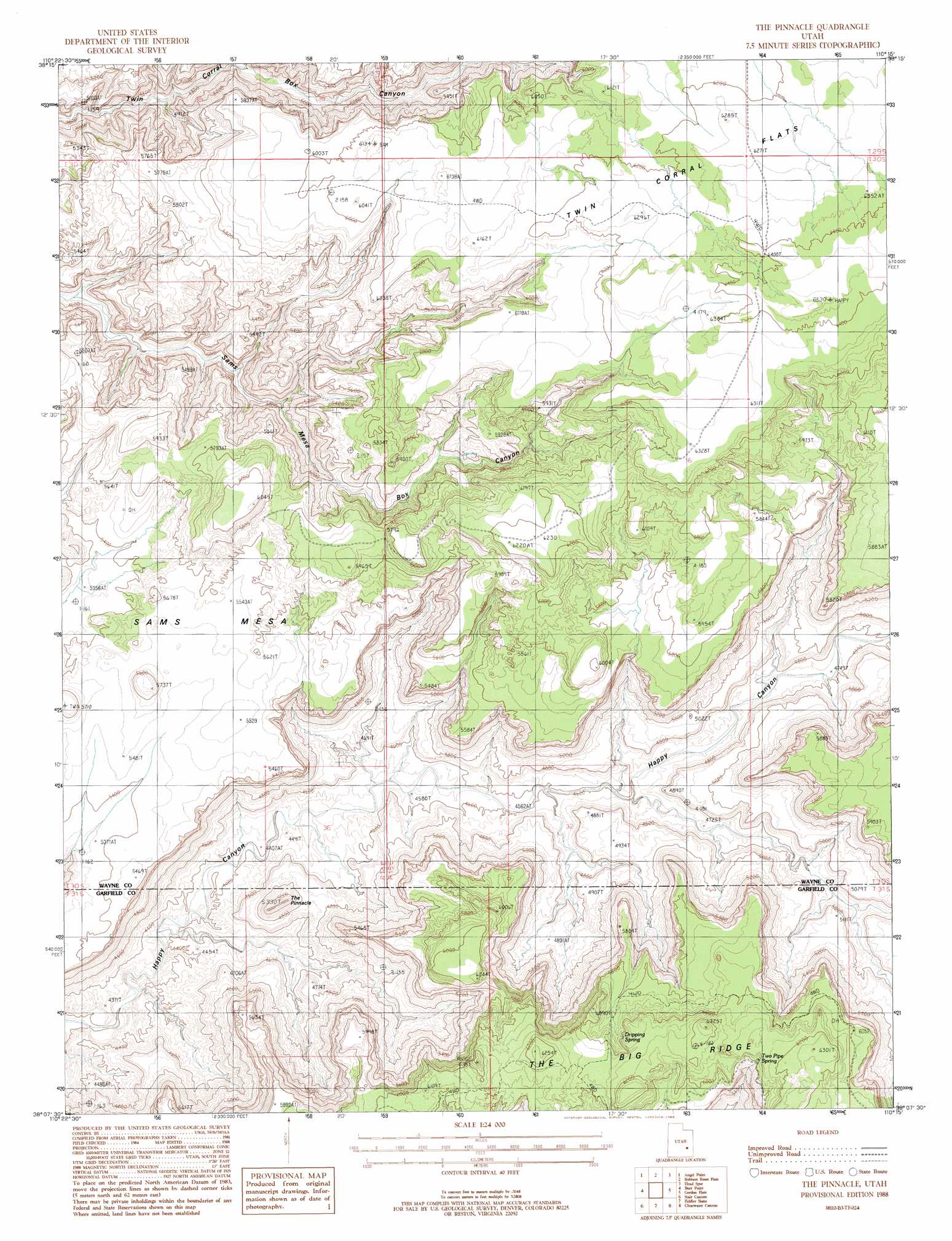
USGS Topo Quad 38110b3 - 1:24,000 scale
| Topo Map Name: | The Pinnacle |
| USGS Topo Quad ID: | 38110b3 |
| Print Size: | ca. 21 1/4" wide x 27" high |
| Southeast Coordinates: | 38.125° N latitude / 110.25° W longitude |
| Map Center Coordinates: | 38.1875° N latitude / 110.3125° W longitude |
| U.S. State: | UT |
| Filename: | o38110b3.jpg |
| Download Map JPG Image: | The Pinnacle topo map 1:24,000 scale |
| Map Type: | Topographic |
| Topo Series: | 7.5´ |
| Map Scale: | 1:24,000 |
| Source of Map Images: | United States Geological Survey (USGS) |
| Alternate Map Versions: |
Orange Cliffs 3 NE UT 1953, updated 1954 Download PDF Buy paper map The Pinnacle UT 1988, updated 1988 Download PDF Buy paper map The Pinnacle UT 2010 Download PDF Buy paper map The Pinnacle UT 2014 Download PDF Buy paper map |
1:24,000 Topo Quads surrounding The Pinnacle
Point Of Rocks West |
Point Of Rocks East |
Whitbeck Knoll |
Sugarloaf Butte |
Horsethief Canyon |
Angel Cove |
Angel Point |
Robbers Roost Flats |
Head Spur |
Cleopatras Chair |
Baking Skillet Knoll |
Burr Point |
The Pinnacle |
Gordon Flats |
Elaterite Basin |
Turkey Knob |
Stair Canyon |
Fiddler Butte |
Clearwater Canyon |
Teapot Rock |
Black Table |
Hite North |
Sewing Machine |
Bowdie Canyon West |
Bowdie Canyon East |
> Back to 38110a1 at 1:100,000 scale
> Back to 38110a1 at 1:250,000 scale
> Back to U.S. Topo Maps home
The Pinnacle topo map: Gazetteer
The Pinnacle: Pillars
The Pinnacle elevation 1600m 5249′The Pinnacle: Springs
Dripping Spring elevation 1820m 5971′Two Pipe Springs elevation 1826m 5990′
The Pinnacle digital topo map on disk
Buy this The Pinnacle topo map showing relief, roads, GPS coordinates and other geographical features, as a high-resolution digital map file on DVD: