Point Of Rocks West Topo Map Utah
To zoom in, hover over the map of Point Of Rocks West
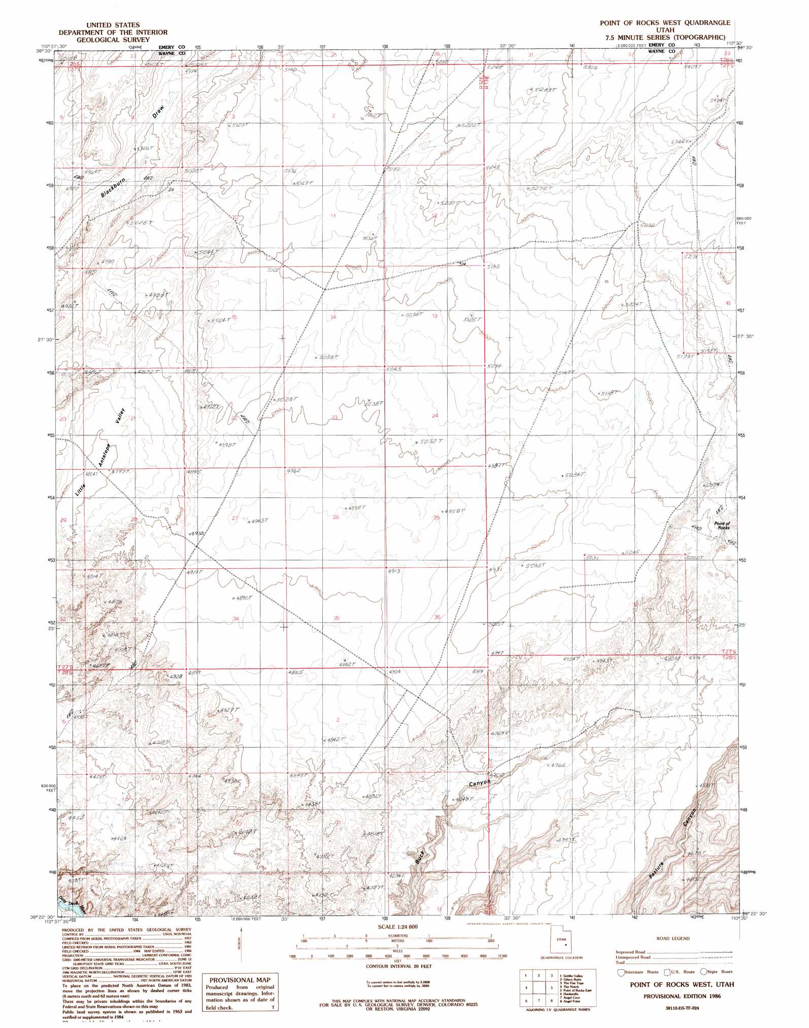
USGS Topo Quad 38110d5 - 1:24,000 scale
| Topo Map Name: | Point Of Rocks West |
| USGS Topo Quad ID: | 38110d5 |
| Print Size: | ca. 21 1/4" wide x 27" high |
| Southeast Coordinates: | 38.375° N latitude / 110.5° W longitude |
| Map Center Coordinates: | 38.4375° N latitude / 110.5625° W longitude |
| U.S. State: | UT |
| Filename: | o38110d5.jpg |
| Download Map JPG Image: | Point Of Rocks West topo map 1:24,000 scale |
| Map Type: | Topographic |
| Topo Series: | 7.5´ |
| Map Scale: | 1:24,000 |
| Source of Map Images: | United States Geological Survey (USGS) |
| Alternate Map Versions: |
Point of Rocks West UT 1986 Download PDF Buy paper map Point of Rocks West UT 1986, updated 1987 Download PDF Buy paper map Point of Rocks West UT 2011 Download PDF Buy paper map Point of Rocks West UT 2014 Download PDF Buy paper map |
1:24,000 Topo Quads surrounding Point Of Rocks West
Horse Valley |
Temple Mountain |
Old Woman Wash |
Crows Nest Spring |
Spring Canyon |
Little Wild Horse Mesa |
Goblin Valley |
Gilson Butte |
The Flat Tops |
Jacks Knob |
Skyline Rim |
The Notch |
Point Of Rocks West |
Point Of Rocks East |
Whitbeck Knoll |
Steamboat Point |
Hanksville |
Angel Cove |
Angel Point |
Robbers Roost Flats |
Dry Lakes Peak |
Bull Mountain |
Baking Skillet Knoll |
Burr Point |
The Pinnacle |
> Back to 38110a1 at 1:100,000 scale
> Back to 38110a1 at 1:250,000 scale
> Back to U.S. Topo Maps home
Point Of Rocks West topo map: Gazetteer
Point Of Rocks West: Valleys
Little Antelope Valley elevation 1458m 4783′Point Of Rocks West: Wells
Muller Well elevation 1520m 4986′Point Of Rocks West digital topo map on disk
Buy this Point Of Rocks West topo map showing relief, roads, GPS coordinates and other geographical features, as a high-resolution digital map file on DVD: