Hunt Draw Topo Map Utah
To zoom in, hover over the map of Hunt Draw
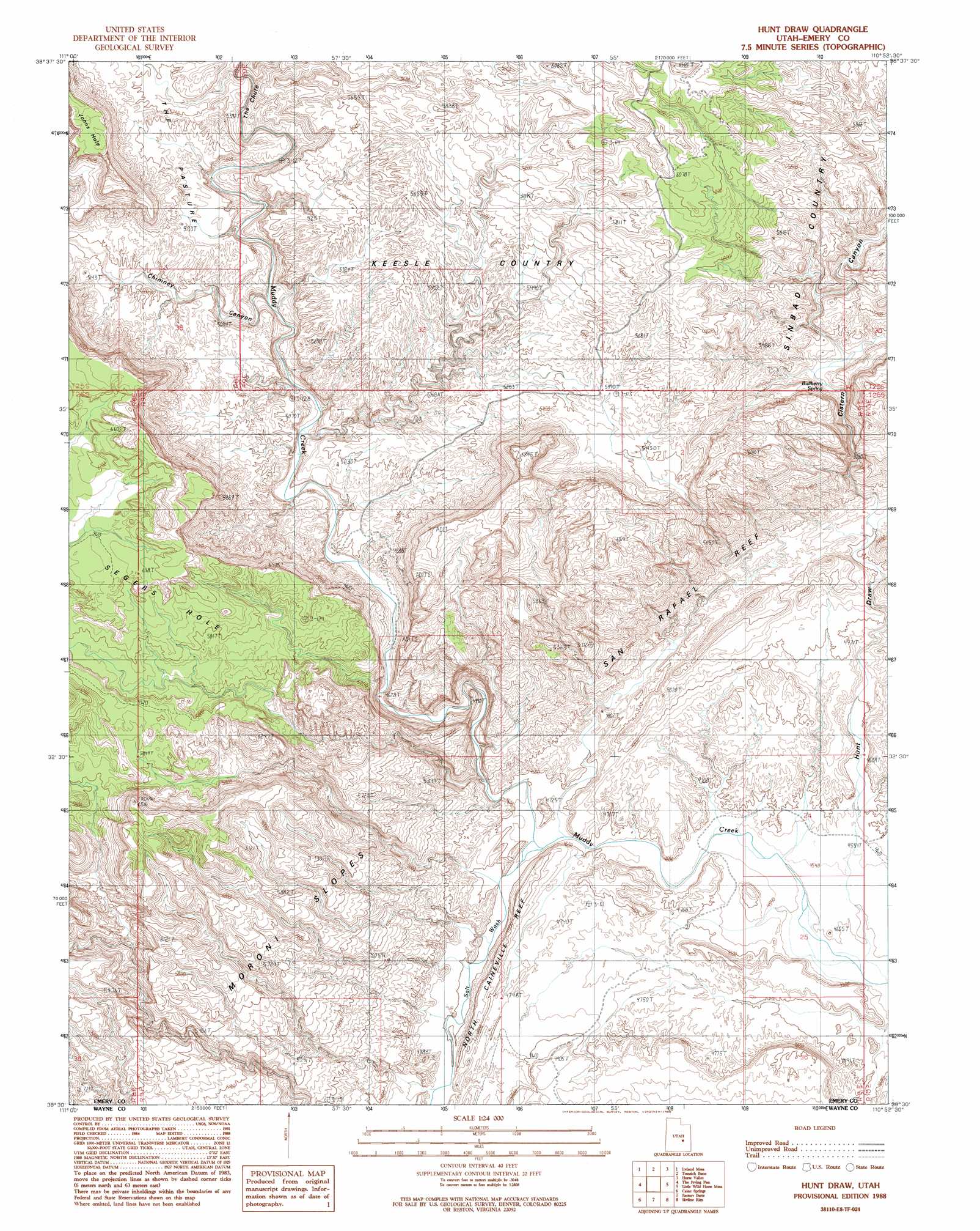
USGS Topo Quad 38110e8 - 1:24,000 scale
| Topo Map Name: | Hunt Draw |
| USGS Topo Quad ID: | 38110e8 |
| Print Size: | ca. 21 1/4" wide x 27" high |
| Southeast Coordinates: | 38.5° N latitude / 110.875° W longitude |
| Map Center Coordinates: | 38.5625° N latitude / 110.9375° W longitude |
| U.S. State: | UT |
| Filename: | o38110e8.jpg |
| Download Map JPG Image: | Hunt Draw topo map 1:24,000 scale |
| Map Type: | Topographic |
| Topo Series: | 7.5´ |
| Map Scale: | 1:24,000 |
| Source of Map Images: | United States Geological Survey (USGS) |
| Alternate Map Versions: |
Stinking Spring Creek 3 SW UT 1954 Download PDF Buy paper map Hunt Draw UT 1988, updated 1988 Download PDF Buy paper map Hunt Draw UT 1988, updated 1988 Download PDF Buy paper map Hunt Draw UT 1996, updated 2002 Download PDF Buy paper map Hunt Draw UT 2010 Download PDF Buy paper map Hunt Draw UT 2014 Download PDF Buy paper map |
1:24,000 Topo Quads surrounding Hunt Draw
Mesa Butte |
Big Bend Draw |
Copper Globe |
San Rafael Knob |
Twin Knolls |
Mussentuchit Flat |
Ireland Mesa |
Tomsich Butte |
Horse Valley |
Temple Mountain |
Salvation Creek |
The Frying Pan |
Hunt Draw |
Little Wild Horse Mesa |
Goblin Valley |
Fruita Nw |
Caine Springs |
Factory Butte |
Skyline Rim |
The Notch |
Fruita |
Caineville |
Town Point |
Steamboat Point |
Hanksville |
> Back to 38110e1 at 1:100,000 scale
> Back to 38110a1 at 1:250,000 scale
> Back to U.S. Topo Maps home
Hunt Draw topo map: Gazetteer
Hunt Draw: Areas
Keesle Country elevation 1669m 5475′Hunt Draw: Arroyos
Salt Wash elevation 1584m 5196′Hunt Draw: Basins
Segers Hole elevation 1864m 6115′Hunt Draw: Flats
The Pasture elevation 1550m 5085′Hunt Draw: Springs
Bullberry Spring elevation 1535m 5036′Hunt Draw: Streams
Salt Wash elevation 1385m 4543′Stinking Spring Creek elevation 1391m 4563′
Hunt Draw: Summits
Sy Butte elevation 1891m 6204′Hunt Draw: Valleys
Chimney Canyon elevation 1457m 4780′Cistern Canyon elevation 1476m 4842′
Hunt Draw elevation 1378m 4520′
Salt Wash elevation 1385m 4543′
The Chute elevation 1473m 4832′
Hunt Draw digital topo map on disk
Buy this Hunt Draw topo map showing relief, roads, GPS coordinates and other geographical features, as a high-resolution digital map file on DVD: