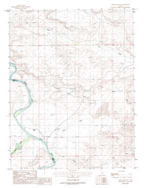
Green River Se Topo Map Utah
To zoom in, hover over the map of Green River Se
USGS Topo Quad 38110g1 - 1:24,000 scale
| Topo Map Name: | Green River Se |
| USGS Topo Quad ID: | 38110g1 |
| Print Size: | ca. 21 1/4" wide x 27" high |
| Southeast Coordinates: | 38.75° N latitude / 110° W longitude |
| Map Center Coordinates: | 38.8125° N latitude / 110.0625° W longitude |
| U.S. State: | UT |
| Filename: | o38110g1.jpg |
| Download Map JPG Image: | Green River Se topo map 1:24,000 scale |
| Map Type: | Topographic |
| Topo Series: | 7.5´ |
| Map Scale: | 1:24,000 |
| Source of Map Images: | United States Geological Survey (USGS) |
| Alternate Map Versions: |
Tidwell 1 SE UT 1954, updated 1955 Download PDF Buy paper map Green River SE UT 1988, updated 1988 Download PDF Buy paper map Green River SE UT 2010 Download PDF Buy paper map Green River SE UT 2014 Download PDF Buy paper map |
1:24,000 Topo Quads surrounding Green River Se
> Back to 38110e1 at 1:100,000 scale
> Back to 38110a1 at 1:250,000 scale
> Back to U.S. Topo Maps home
Green River Se topo map: Gazetteer
Green River Se: Streams
San Rafael River elevation 1219m 3999′Green River Se: Summits
Dellenbaugh Butte elevation 1322m 4337′Green River Se: Valleys
Red Wash elevation 1219m 3999′White Wash elevation 1217m 3992′
Green River Se digital topo map on disk
Buy this Green River Se topo map showing relief, roads, GPS coordinates and other geographical features, as a high-resolution digital map file on DVD:


