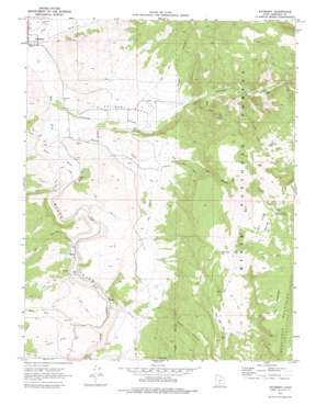
Antimony Topo Map Utah
To zoom in, hover over the map of Antimony
USGS Topo Quad 38111a8 - 1:24,000 scale
| Topo Map Name: | Antimony |
| USGS Topo Quad ID: | 38111a8 |
| Print Size: | ca. 21 1/4" wide x 27" high |
| Southeast Coordinates: | 38° N latitude / 111.875° W longitude |
| Map Center Coordinates: | 38.0625° N latitude / 111.9375° W longitude |
| U.S. State: | UT |
| Filename: | o38111a8.jpg |
| Download Map JPG Image: | Antimony topo map 1:24,000 scale |
| Map Type: | Topographic |
| Topo Series: | 7.5´ |
| Map Scale: | 1:24,000 |
| Source of Map Images: | United States Geological Survey (USGS) |
| Alternate Map Versions: |
Antimony UT 1970, updated 1972 Download PDF Buy paper map Antimony UT 1970, updated 1977 Download PDF Buy paper map Antimony UT 2011 Download PDF Buy paper map Antimony UT 2014 Download PDF Buy paper map |
| FStopo: | US Forest Service topo Antimony is available: Download FStopo PDF Download FStopo TIF |
1:24,000 Topo Quads surrounding Antimony
> Back to 38111a1 at 1:100,000 scale
> Back to 38110a1 at 1:250,000 scale
> Back to U.S. Topo Maps home
Antimony topo map: Gazetteer
Antimony: Basins
The Pockets elevation 2935m 9629′Antimony: Benches
Antimony Bench elevation 2022m 6633′Poison Creek Bench elevation 2728m 8950′
Antimony: Flats
Mud Lake Flat elevation 2587m 8487′Antimony: Lakes
Antimony Lake elevation 2558m 8392′Mud Lake elevation 2609m 8559′
Antimony: Populated Places
Antimony elevation 1966m 6450′Osiris elevation 2049m 6722′
Antimony: Reservoirs
Dan Day Reservoir elevation 2585m 8480′Poison Creek Reservoir Number 2 elevation 2726m 8943′
Antimony: Streams
Antimony Creek elevation 1963m 6440′Center Creek elevation 2232m 7322′
Deer Creek elevation 2091m 6860′
Forest Creek elevation 1972m 6469′
Little Forest Creek elevation 2083m 6833′
North Creek elevation 2053m 6735′
Pine Creek elevation 1984m 6509′
Poison Creek elevation 1981m 6499′
Antimony: Valleys
Black Canyon elevation 1981m 6499′Dry Hollow elevation 2023m 6637′
Johns Valley elevation 2176m 7139′
Russell Hollow elevation 2073m 6801′
Antimony digital topo map on disk
Buy this Antimony topo map showing relief, roads, GPS coordinates and other geographical features, as a high-resolution digital map file on DVD:


