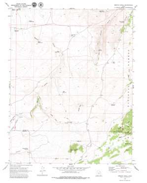
Smooth Knoll Topo Map Utah
To zoom in, hover over the map of Smooth Knoll
USGS Topo Quad 38111b6 - 1:24,000 scale
| Topo Map Name: | Smooth Knoll |
| USGS Topo Quad ID: | 38111b6 |
| Print Size: | ca. 21 1/4" wide x 27" high |
| Southeast Coordinates: | 38.125° N latitude / 111.625° W longitude |
| Map Center Coordinates: | 38.1875° N latitude / 111.6875° W longitude |
| U.S. State: | UT |
| Filename: | o38111b6.jpg |
| Download Map JPG Image: | Smooth Knoll topo map 1:24,000 scale |
| Map Type: | Topographic |
| Topo Series: | 7.5´ |
| Map Scale: | 1:24,000 |
| Source of Map Images: | United States Geological Survey (USGS) |
| Alternate Map Versions: |
Smooth Knoll UT 1969, updated 1972 Download PDF Buy paper map Smooth Knoll UT 2002, updated 2005 Download PDF Buy paper map Smooth Knoll UT 2011 Download PDF Buy paper map Smooth Knoll UT 2014 Download PDF Buy paper map |
| FStopo: | US Forest Service topo Smooth Knoll is available: Download FStopo PDF Download FStopo TIF |
1:24,000 Topo Quads surrounding Smooth Knoll
> Back to 38111a1 at 1:100,000 scale
> Back to 38110a1 at 1:250,000 scale
> Back to U.S. Topo Maps home
Smooth Knoll topo map: Gazetteer
Smooth Knoll: Basins
Hare Valley elevation 2713m 8900′Smooth Knoll: Lakes
Mud Lake elevation 2616m 8582′Rock Lake elevation 2895m 9498′
Smooth Knoll: Reservoirs
Bald Knoll Reservoir elevation 2560m 8398′Blackburn Reservoir elevation 2741m 8992′
Dry Lake Reservoir elevation 2591m 8500′
Lower Balsam Reservoir elevation 2548m 8359′
Middle Balsam Reservoir elevation 2562m 8405′
Mitts Reservoir elevation 2711m 8894′
Pelham Hollow Reservoir elevation 2784m 9133′
Pole Canyon Reservoir elevation 2467m 8093′
Right Fork Wildcat Reservoir elevation 2468m 8097′
Smooth Knoll Reservoir elevation 2799m 9183′
Upper Balsam Reservoir elevation 2585m 8480′
Wildcat Reservoir elevation 2553m 8375′
Smooth Knoll: Summits
Smooth Knoll elevation 2869m 9412′Timbered Knoll elevation 2984m 9790′
Smooth Knoll: Valleys
Antelope Spring Draw elevation 2720m 8923′Pelham Hollow elevation 2719m 8920′
Sage Hen Draw elevation 2677m 8782′
Smooth Knoll digital topo map on disk
Buy this Smooth Knoll topo map showing relief, roads, GPS coordinates and other geographical features, as a high-resolution digital map file on DVD:


