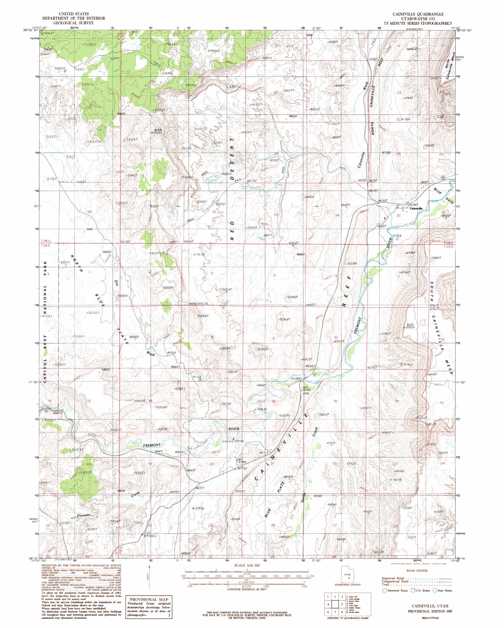
Caineville Topo Map Utah
To zoom in, hover over the map of Caineville
USGS Topo Quad 38111c1 - 1:24,000 scale
| Topo Map Name: | Caineville |
| USGS Topo Quad ID: | 38111c1 |
| Print Size: | ca. 21 1/4" wide x 27" high |
| Southeast Coordinates: | 38.25° N latitude / 111° W longitude |
| Map Center Coordinates: | 38.3125° N latitude / 111.0625° W longitude |
| U.S. State: | UT |
| Filename: | o38111c1.jpg |
| Download Map JPG Image: | Caineville topo map 1:24,000 scale |
| Map Type: | Topographic |
| Topo Series: | 7.5´ |
| Map Scale: | 1:24,000 |
| Source of Map Images: | United States Geological Survey (USGS) |
| Alternate Map Versions: |
Notom 1 SE UT 1954, updated 1957 Download PDF Buy paper map Caineville UT 1987, updated 1987 Download PDF Buy paper map Caineville UT 2011 Download PDF Buy paper map Caineville UT 2014 Download PDF Buy paper map |
1:24,000 Topo Quads surrounding Caineville
Solomons Temple |
Salvation Creek |
The Frying Pan |
Hunt Draw |
Little Wild Horse Mesa |
Cathedral Mountain |
Fruita Nw |
Caine Springs |
Factory Butte |
Skyline Rim |
Twin Rocks |
Fruita |
Caineville |
Town Point |
Steamboat Point |
Grover |
Golden Throne |
Notom |
Stevens Mesa |
Dry Lakes Peak |
Lower Bowns Reservoir |
Bear Canyon |
Sandy Creek Benches |
Steele Butte |
Mount Ellen |
> Back to 38111a1 at 1:100,000 scale
> Back to 38110a1 at 1:250,000 scale
> Back to U.S. Topo Maps home
Caineville topo map: Gazetteer
Caineville: Capes
Town Point elevation 1752m 5748′Caineville: Cliffs
Caineville Reef elevation 1461m 4793′Caineville: Flats
Blue Flats elevation 1500m 4921′North Blue Flats elevation 1545m 5068′
Caineville: Plains
Red Desert elevation 1503m 4931′Caineville: Populated Places
Caineville elevation 1402m 4599′Caineville: Streams
Pleasant Creek elevation 1474m 4835′Sandy Creek elevation 1414m 4639′
Caineville: Valleys
Caineville Wash elevation 1399m 4589′Caineville digital topo map on disk
Buy this Caineville topo map showing relief, roads, GPS coordinates and other geographical features, as a high-resolution digital map file on DVD: