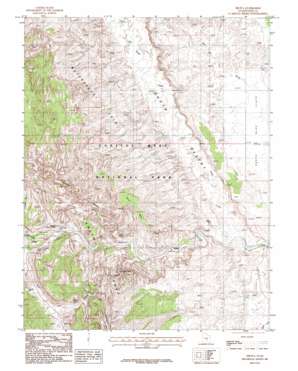
Fruita Topo Map Utah
To zoom in, hover over the map of Fruita
USGS Topo Quad 38111c2 - 1:24,000 scale
| Topo Map Name: | Fruita |
| USGS Topo Quad ID: | 38111c2 |
| Print Size: | ca. 21 1/4" wide x 27" high |
| Southeast Coordinates: | 38.25° N latitude / 111.125° W longitude |
| Map Center Coordinates: | 38.3125° N latitude / 111.1875° W longitude |
| U.S. State: | UT |
| Filename: | o38111c2.jpg |
| Download Map JPG Image: | Fruita topo map 1:24,000 scale |
| Map Type: | Topographic |
| Topo Series: | 7.5´ |
| Map Scale: | 1:24,000 |
| Source of Map Images: | United States Geological Survey (USGS) |
| Alternate Map Versions: |
Notom 1 SW UT 1952, updated 1954 Download PDF Buy paper map Fruita UT 1987, updated 1987 Download PDF Buy paper map Fruita UT 1987, updated 1987 Download PDF Buy paper map Fruita UT 2011 Download PDF Buy paper map Fruita UT 2014 Download PDF Buy paper map |
1:24,000 Topo Quads surrounding Fruita
> Back to 38111a1 at 1:100,000 scale
> Back to 38110a1 at 1:250,000 scale
> Back to U.S. Topo Maps home
Fruita topo map: Gazetteer
Fruita: Arches
Cassidys Arch elevation 1802m 5912′Hickman Natural Bridge elevation 1735m 5692′
Fruita: Flats
Longleaf Flat elevation 1947m 6387′Fruita: Gaps
The Narrows elevation 1669m 5475′The Notch elevation 1624m 5328′
Fruita: Populated Places
Fruita elevation 1657m 5436′Fruita: Ridges
Capitol Reef elevation 1859m 6099′Fruita: Springs
Notch Water elevation 1618m 5308′Fruita: Streams
Deep Creek elevation 1533m 5029′Sulphur Creek elevation 1643m 5390′
Fruita: Summits
Danish Hill elevation 1727m 5666′Horse Mesa elevation 1921m 6302′
Fruita: Valleys
Bear Canyon elevation 1644m 5393′Cohab Canyon elevation 1630m 5347′
Cuts Canyon elevation 1680m 5511′
Dry Wash elevation 1642m 5387′
Grand Wash elevation 1606m 5269′
Spring Canyon elevation 1625m 5331′
Fruita digital topo map on disk
Buy this Fruita topo map showing relief, roads, GPS coordinates and other geographical features, as a high-resolution digital map file on DVD:


