Jakes Knoll Topo Map Utah
To zoom in, hover over the map of Jakes Knoll
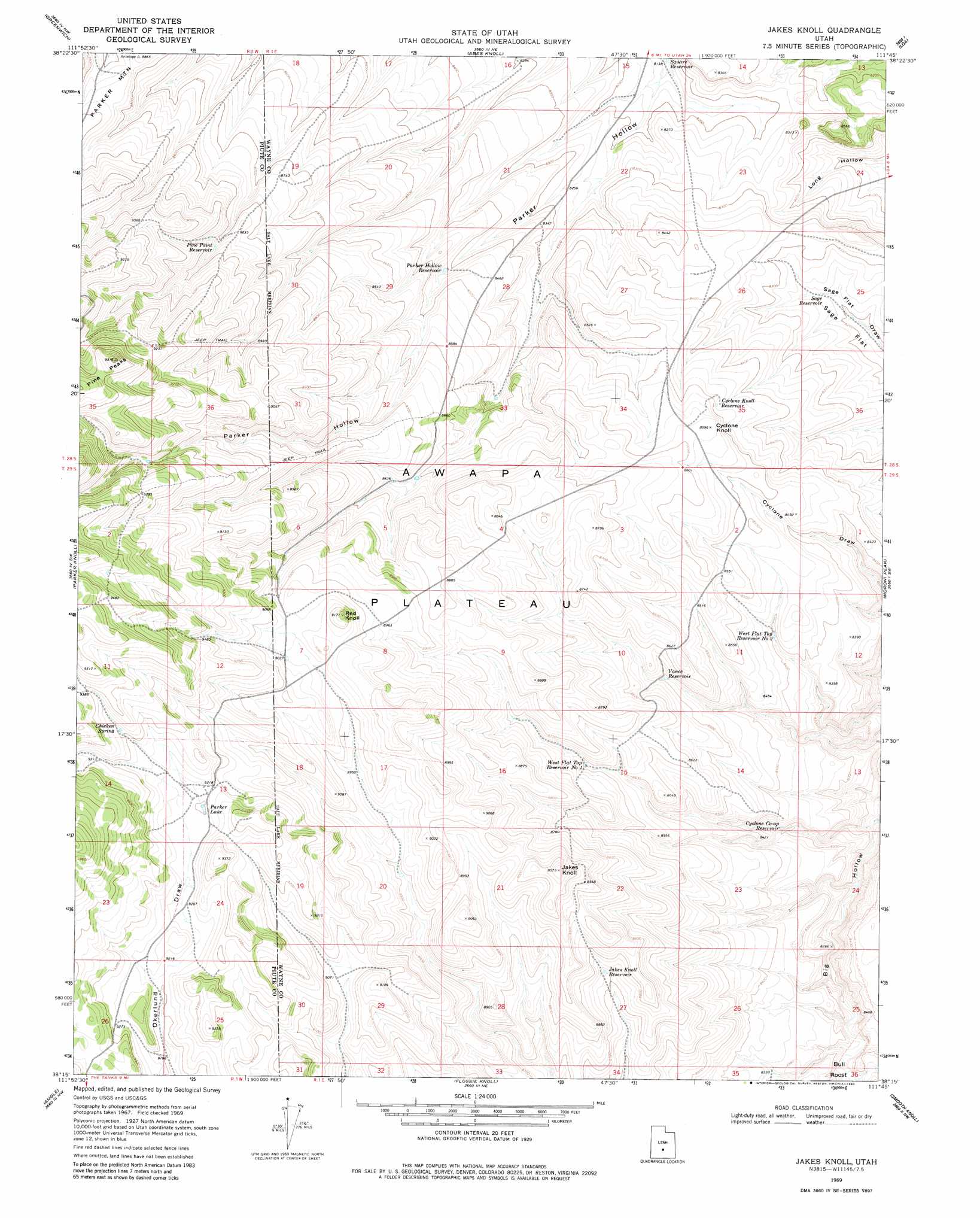
USGS Topo Quad 38111c7 - 1:24,000 scale
| Topo Map Name: | Jakes Knoll |
| USGS Topo Quad ID: | 38111c7 |
| Print Size: | ca. 21 1/4" wide x 27" high |
| Southeast Coordinates: | 38.25° N latitude / 111.75° W longitude |
| Map Center Coordinates: | 38.3125° N latitude / 111.8125° W longitude |
| U.S. State: | UT |
| Filename: | o38111c7.jpg |
| Download Map JPG Image: | Jakes Knoll topo map 1:24,000 scale |
| Map Type: | Topographic |
| Topo Series: | 7.5´ |
| Map Scale: | 1:24,000 |
| Source of Map Images: | United States Geological Survey (USGS) |
| Alternate Map Versions: |
Jakes Knoll UT 1969, updated 1972 Download PDF Buy paper map Jakes Knoll UT 1969, updated 1980 Download PDF Buy paper map Jakes Knoll UT 2010 Download PDF Buy paper map Jakes Knoll UT 2014 Download PDF Buy paper map |
1:24,000 Topo Quads surrounding Jakes Knoll
Monroe Peak |
Koosharem |
Burrville |
Fish Lake |
Forsyth Reservoir |
Marysvale Peak |
Greenwich |
Abes Knoll |
Loa |
Lyman |
Malmsten Peak |
Parker Knoll |
Jakes Knoll |
Moroni Peak |
Bicknell |
Phonolite Hill |
Angle |
Flossie Knoll |
Smooth Knoll |
Government Point |
Deep Creek |
Antimony |
Pollywog Lake |
Big Lake |
Jacobs Reservoir |
> Back to 38111a1 at 1:100,000 scale
> Back to 38110a1 at 1:250,000 scale
> Back to U.S. Topo Maps home
Jakes Knoll topo map: Gazetteer
Jakes Knoll: Lakes
Parker Lake elevation 2809m 9215′Jakes Knoll: Reservoirs
Cyclone Co-op Reservoir elevation 2537m 8323′Cyclone Knoll Reservoir elevation 2586m 8484′
Jakes Knoll Reservoir elevation 2661m 8730′
Parker Hollow Reservoir elevation 2566m 8418′
Pine Point Reservoir elevation 2694m 8838′
Sage Reservoir elevation 2509m 8231′
Square Reservoir elevation 2481m 8139′
Vance Reservoir elevation 2589m 8494′
West Flat Top Reservoir Number 1 elevation 2622m 8602′
West Flat Top Reservoir Number 2 elevation 2560m 8398′
Jakes Knoll: Springs
Chicken Spring elevation 2841m 9320′Jakes Knoll: Summits
Bull Roost elevation 2530m 8300′Cyclone Knoll elevation 2619m 8592′
Jakes Knoll elevation 2763m 9064′
Red Knoll elevation 2795m 9169′
Jakes Knoll: Valleys
Balsam Hollow elevation 2509m 8231′Jakes Knoll digital topo map on disk
Buy this Jakes Knoll topo map showing relief, roads, GPS coordinates and other geographical features, as a high-resolution digital map file on DVD: