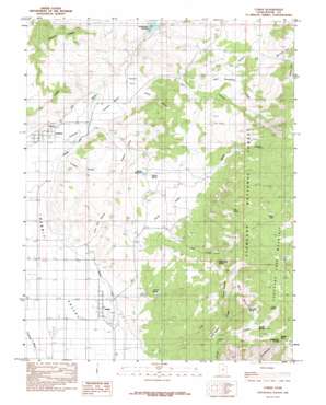
Lyman Topo Map Utah
To zoom in, hover over the map of Lyman
USGS Topo Quad 38111d5 - 1:24,000 scale
| Topo Map Name: | Lyman |
| USGS Topo Quad ID: | 38111d5 |
| Print Size: | ca. 21 1/4" wide x 27" high |
| Southeast Coordinates: | 38.375° N latitude / 111.5° W longitude |
| Map Center Coordinates: | 38.4375° N latitude / 111.5625° W longitude |
| U.S. State: | UT |
| Filename: | o38111d5.jpg |
| Download Map JPG Image: | Lyman topo map 1:24,000 scale |
| Map Type: | Topographic |
| Topo Series: | 7.5´ |
| Map Scale: | 1:24,000 |
| Source of Map Images: | United States Geological Survey (USGS) |
| Alternate Map Versions: |
Loa 1 NE UT 1952, updated 1973 Download PDF Buy paper map Lyman UT 1967, updated 1973 Download PDF Buy paper map Lyman UT 1985, updated 1985 Download PDF Buy paper map Lyman UT 2001, updated 2003 Download PDF Buy paper map Lyman UT 2011 Download PDF Buy paper map Lyman UT 2014 Download PDF Buy paper map |
| FStopo: | US Forest Service topo Lyman is available: Download FStopo PDF Download FStopo TIF |
1:24,000 Topo Quads surrounding Lyman
> Back to 38111a1 at 1:100,000 scale
> Back to 38110a1 at 1:250,000 scale
> Back to U.S. Topo Maps home
Lyman topo map: Gazetteer
Lyman: Bars
Yellow Ledges elevation 2803m 9196′Lyman: Basins
Tidwell Valley elevation 2251m 7385′Lyman: Benches
Fremont Bench elevation 2243m 7358′Lyman: Canals
High Line Ditch elevation 2211m 7253′Highline Ditch elevation 2204m 7230′
Lyman: Cliffs
Second Ledges elevation 2542m 8339′The Ledges elevation 2415m 7923′
Lyman: Dams
Mill Meadow Dam elevation 2343m 7687′Lyman: Flats
Bare Spot elevation 2617m 8585′Horse Pasture elevation 2584m 8477′
Sage Flat elevation 2510m 8234′
Teedee Flat elevation 2290m 7513′
Lyman: Gaps
Saddle Pass elevation 2950m 9678′Lyman: Lakes
Blind Lake elevation 3060m 10039′Lyman: Populated Places
Fremont elevation 2207m 7240′Lyman elevation 2189m 7181′
Lyman: Reservoirs
Mill Meadow Reservoir elevation 2343m 7687′Tidwell Reservoir elevation 2327m 7634′
Lyman: Springs
Bare Spot Spring elevation 2832m 9291′Bicknell Springs elevation 2841m 9320′
Burnt Springs elevation 2380m 7808′
Cedar Creek Spring elevation 2691m 8828′
Clay Spring elevation 2820m 9251′
Cold Spring elevation 3050m 10006′
Saddle Pass Spring elevation 2878m 9442′
Tidwell Spring elevation 2342m 7683′
Lyman: Streams
Cedar Creek elevation 2398m 7867′Lyges Fork elevation 2709m 8887′
Reese Creek elevation 2371m 7778′
Sweetwater Creek elevation 2473m 8113′
Lyman: Trails
Jackson Dugway elevation 2569m 8428′Lyman: Valleys
Forsyth Valley elevation 2443m 8015′Hector Hollow elevation 2285m 7496′
Horse Valley elevation 2343m 7687′
Lighah Fork elevation 2717m 8914′
Lime Kill Hollow elevation 2201m 7221′
Mormon Fork elevation 2627m 8618′
Morrell Fork elevation 2635m 8645′
Pole Canyon elevation 2315m 7595′
Red Canyon elevation 2377m 7798′
Turnbull Hollow elevation 2202m 7224′
Lyman digital topo map on disk
Buy this Lyman topo map showing relief, roads, GPS coordinates and other geographical features, as a high-resolution digital map file on DVD:


