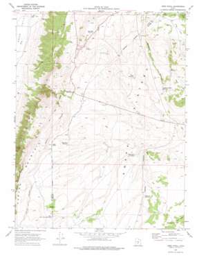
Abes Knoll Topo Map Utah
To zoom in, hover over the map of Abes Knoll
USGS Topo Quad 38111d7 - 1:24,000 scale
| Topo Map Name: | Abes Knoll |
| USGS Topo Quad ID: | 38111d7 |
| Print Size: | ca. 21 1/4" wide x 27" high |
| Southeast Coordinates: | 38.375° N latitude / 111.75° W longitude |
| Map Center Coordinates: | 38.4375° N latitude / 111.8125° W longitude |
| U.S. State: | UT |
| Filename: | o38111d7.jpg |
| Download Map JPG Image: | Abes Knoll topo map 1:24,000 scale |
| Map Type: | Topographic |
| Topo Series: | 7.5´ |
| Map Scale: | 1:24,000 |
| Source of Map Images: | United States Geological Survey (USGS) |
| Alternate Map Versions: |
Abes Knoll UT 1969, updated 1976 Download PDF Buy paper map Abes Knoll UT 2001, updated 2003 Download PDF Buy paper map Abes Knoll UT 2011 Download PDF Buy paper map Abes Knoll UT 2014 Download PDF Buy paper map |
| FStopo: | US Forest Service topo Abes Knoll is available: Download FStopo PDF Download FStopo TIF |
1:24,000 Topo Quads surrounding Abes Knoll
> Back to 38111a1 at 1:100,000 scale
> Back to 38110a1 at 1:250,000 scale
> Back to U.S. Topo Maps home
Abes Knoll topo map: Gazetteer
Abes Knoll: Cliffs
Black Point elevation 2444m 8018′Abes Knoll: Flats
Dog Flat elevation 2708m 8884′Abes Knoll: Reservoirs
Abes Knoll Reservoir elevation 2534m 8313′Black Point Reservoir elevation 2438m 7998′
Deadman Hollow Reservoir elevation 2504m 8215′
Eightmile Reservoir elevation 2464m 8083′
Evans Reservoir elevation 2521m 8270′
Fish Lake Reservoir elevation 2584m 8477′
Pass Reservoir elevation 2486m 8156′
Spray Reservoir elevation 2578m 8458′
West Cedar Grove Reservoir elevation 2591m 8500′
Windy Ridge Reservoir elevation 2520m 8267′
Abes Knoll: Springs
Cabin Spring elevation 2723m 8933′Abes Knoll: Summits
Abes Knoll elevation 2581m 8467′Abes Knoll: Valleys
Deadman Hollow elevation 2386m 7828′Hatch Canyon elevation 2103m 6899′
Parker Hollow elevation 2390m 7841′
Abes Knoll: Woods
Cedar Grove elevation 2579m 8461′Abes Knoll digital topo map on disk
Buy this Abes Knoll topo map showing relief, roads, GPS coordinates and other geographical features, as a high-resolution digital map file on DVD:


