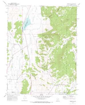
Burrville Topo Map Utah
To zoom in, hover over the map of Burrville
USGS Topo Quad 38111e7 - 1:24,000 scale
| Topo Map Name: | Burrville |
| USGS Topo Quad ID: | 38111e7 |
| Print Size: | ca. 21 1/4" wide x 27" high |
| Southeast Coordinates: | 38.5° N latitude / 111.75° W longitude |
| Map Center Coordinates: | 38.5625° N latitude / 111.8125° W longitude |
| U.S. State: | UT |
| Filename: | o38111e7.jpg |
| Download Map JPG Image: | Burrville topo map 1:24,000 scale |
| Map Type: | Topographic |
| Topo Series: | 7.5´ |
| Map Scale: | 1:24,000 |
| Source of Map Images: | United States Geological Survey (USGS) |
| Alternate Map Versions: |
Burrville UT 1968, updated 1972 Download PDF Buy paper map Burrville UT 2001, updated 2003 Download PDF Buy paper map Burrville UT 2011 Download PDF Buy paper map Burrville UT 2014 Download PDF Buy paper map |
| FStopo: | US Forest Service topo Burrville is available: Download FStopo PDF Download FStopo TIF |
1:24,000 Topo Quads surrounding Burrville
> Back to 38111e1 at 1:100,000 scale
> Back to 38110a1 at 1:250,000 scale
> Back to U.S. Topo Maps home
Burrville topo map: Gazetteer
Burrville: Dams
Koosharem Dam elevation 2134m 7001′Burrville: Flats
Buck Flat elevation 3013m 9885′Hancock Flat elevation 2983m 9786′
Na-Gah Flat elevation 3223m 10574′
Pole Flat elevation 2812m 9225′
Torgerson Flat elevation 2808m 9212′
Burrville: Parks
Koosharem Reservoir Recreation Site elevation 2143m 7030′Burrville: Populated Places
Burrville elevation 2137m 7011′Burrville: Reservoirs
Koosharem Reservoir elevation 2135m 7004′Burrville: Slopes
Praetor Slopes elevation 2148m 7047′Burrville: Springs
Deer Spring elevation 2884m 9461′Gahew Spring elevation 3279m 10757′
Hancock Spring elevation 3050m 10006′
Oak Spring elevation 2269m 7444′
Praetor Spring elevation 2386m 7828′
Rust Spring elevation 3165m 10383′
Stag Spring elevation 2977m 9767′
Teeples Spring elevation 3208m 10524′
Torgerson Spring elevation 2982m 9783′
Burrville: Streams
Boobe Hole Creek elevation 2134m 7001′Burr Creek elevation 2117m 6945′
Gooseberry Creek elevation 2289m 7509′
Mill Creek elevation 2114m 6935′
Burrville: Valleys
Daniels Canyon elevation 2176m 7139′Oak Creek Canyon elevation 2131m 6991′
Oak Spring Hollow elevation 2242m 7355′
Plateau Valley elevation 2115m 6938′
Praetor Canyon elevation 2316m 7598′
Rock Canyon elevation 3075m 10088′
Skougaard Canyon elevation 2246m 7368′
Burrville digital topo map on disk
Buy this Burrville topo map showing relief, roads, GPS coordinates and other geographical features, as a high-resolution digital map file on DVD:


