Big Bend Draw Topo Map Utah
To zoom in, hover over the map of Big Bend Draw
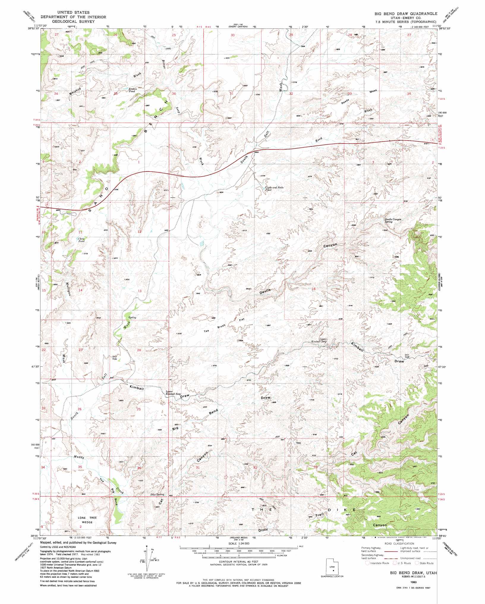
USGS Topo Quad 38111g1 - 1:24,000 scale
| Topo Map Name: | Big Bend Draw |
| USGS Topo Quad ID: | 38111g1 |
| Print Size: | ca. 21 1/4" wide x 27" high |
| Southeast Coordinates: | 38.75° N latitude / 111° W longitude |
| Map Center Coordinates: | 38.8125° N latitude / 111.0625° W longitude |
| U.S. State: | UT |
| Filename: | o38111g1.jpg |
| Download Map JPG Image: | Big Bend Draw topo map 1:24,000 scale |
| Map Type: | Topographic |
| Topo Series: | 7.5´ |
| Map Scale: | 1:24,000 |
| Source of Map Images: | United States Geological Survey (USGS) |
| Alternate Map Versions: |
Emery 1 SE UT 1953, updated 1954 Download PDF Buy paper map Big Bend Draw UT 1983, updated 1983 Download PDF Buy paper map Big Bend Draw UT 2010 Download PDF Buy paper map Big Bend Draw UT 2014 Download PDF Buy paper map |
1:24,000 Topo Quads surrounding Big Bend Draw
Flagstaff Peak |
Ferron |
Molen |
Horn Silver Gulch |
Sids Mountain |
Emery West |
Emery East |
Short Canyon |
Sid And Charley |
The Blocks |
Walker Flat |
Mesa Butte |
Big Bend Draw |
Copper Globe |
San Rafael Knob |
Willow Springs |
Mussentuchit Flat |
Ireland Mesa |
Tomsich Butte |
Horse Valley |
Solomons Temple |
Salvation Creek |
The Frying Pan |
Hunt Draw |
Little Wild Horse Mesa |
> Back to 38111e1 at 1:100,000 scale
> Back to 38110a1 at 1:250,000 scale
> Back to U.S. Topo Maps home
Big Bend Draw topo map: Gazetteer
Big Bend Draw: Benches
Sand Bench elevation 1784m 5853′Big Bend Draw: Bends
The Big Bend elevation 1641m 5383′Big Bend Draw: Flats
Tea Brush Flat elevation 1749m 5738′Big Bend Draw: Reservoirs
Broken Pond elevation 1766m 5793′Chris Pond elevation 1728m 5669′
Clyde and Neils Pond elevation 1706m 5597′
Big Bend Draw: Springs
Devils Canyon Spring elevation 1803m 5915′Lower Kimball Seep elevation 1671m 5482′
Upper Kimball Seep elevation 1822m 5977′
Big Bend Draw: Summits
Reeds Mesa elevation 1805m 5921′Big Bend Draw: Valleys
Bitter Seep Wash elevation 1687m 5534′Devils Canyon elevation 1678m 5505′
Kimball Draw elevation 1644m 5393′
Mulligan Wash elevation 1640m 5380′
Reed Wash elevation 1704m 5590′
South Salt Wash elevation 1635m 5364′
Whiskey Wash elevation 1719m 5639′
Big Bend Draw: Wells
Dennises Well elevation 1646m 5400′Big Bend Draw digital topo map on disk
Buy this Big Bend Draw topo map showing relief, roads, GPS coordinates and other geographical features, as a high-resolution digital map file on DVD: