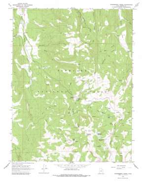
Gooseberry Creek Topo Map Utah
To zoom in, hover over the map of Gooseberry Creek
USGS Topo Quad 38111g6 - 1:24,000 scale
| Topo Map Name: | Gooseberry Creek |
| USGS Topo Quad ID: | 38111g6 |
| Print Size: | ca. 21 1/4" wide x 27" high |
| Southeast Coordinates: | 38.75° N latitude / 111.625° W longitude |
| Map Center Coordinates: | 38.8125° N latitude / 111.6875° W longitude |
| U.S. State: | UT |
| Filename: | o38111g6.jpg |
| Download Map JPG Image: | Gooseberry Creek topo map 1:24,000 scale |
| Map Type: | Topographic |
| Topo Series: | 7.5´ |
| Map Scale: | 1:24,000 |
| Source of Map Images: | United States Geological Survey (USGS) |
| Alternate Map Versions: |
Gooseberry Creek UT 1966, updated 1979 Download PDF Buy paper map Gooseberry Creek UT 1966, updated 1979 Download PDF Buy paper map Gooseberry Creek UT 2001, updated 2003 Download PDF Buy paper map Gooseberry Creek UT 2011 Download PDF Buy paper map Gooseberry Creek UT 2014 Download PDF Buy paper map |
| FStopo: | US Forest Service topo Gooseberry Creek is available: Download FStopo PDF Download FStopo TIF |
1:24,000 Topo Quads surrounding Gooseberry Creek
> Back to 38111e1 at 1:100,000 scale
> Back to 38110a1 at 1:250,000 scale
> Back to U.S. Topo Maps home
Gooseberry Creek topo map: Gazetteer
Gooseberry Creek: Dams
Farnsworth Dam elevation 2897m 9504′Salina City Dam elevation 2768m 9081′
Gooseberry Creek: Flats
German Flat elevation 2201m 7221′Taylor Flat elevation 2681m 8795′
Gooseberry Creek: Reservoirs
Abes Reservoir elevation 2666m 8746′Farnsworth Reservoir elevation 2899m 9511′
Gates Lake elevation 2943m 9655′
Hamilton Reservoir elevation 2964m 9724′
Harves River Reservoir elevation 2898m 9507′
Salina Reservoir elevation 2950m 9678′
Twin Ponds elevation 2726m 8943′
Gooseberry Creek: Ridges
Oak Ridge elevation 2457m 8061′Gooseberry Creek: Springs
Cold Spring elevation 2770m 9087′Creepy Spring elevation 2260m 7414′
Gooseberry Creek: Streams
Abes Creek elevation 2475m 8120′Gates Creek elevation 1976m 6482′
Hoodoo Creek elevation 2033m 6669′
Porcupine Creek elevation 1990m 6528′
Sheep Creek elevation 2395m 7857′
Gooseberry Creek: Valleys
Brush Trail Hollow elevation 1994m 6541′Catamount Canyon elevation 2079m 6820′
Jack Went Hollow elevation 2199m 7214′
Long Hollow elevation 2341m 7680′
Squaw Hollow elevation 2401m 7877′
Telephone Hollow elevation 2196m 7204′
Gooseberry Creek digital topo map on disk
Buy this Gooseberry Creek topo map showing relief, roads, GPS coordinates and other geographical features, as a high-resolution digital map file on DVD:


