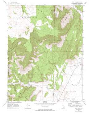
Emery West Topo Map Utah
To zoom in, hover over the map of Emery West
USGS Topo Quad 38111h3 - 1:24,000 scale
| Topo Map Name: | Emery West |
| USGS Topo Quad ID: | 38111h3 |
| Print Size: | ca. 21 1/4" wide x 27" high |
| Southeast Coordinates: | 38.875° N latitude / 111.25° W longitude |
| Map Center Coordinates: | 38.9375° N latitude / 111.3125° W longitude |
| U.S. State: | UT |
| Filename: | o38111h3.jpg |
| Download Map JPG Image: | Emery West topo map 1:24,000 scale |
| Map Type: | Topographic |
| Topo Series: | 7.5´ |
| Map Scale: | 1:24,000 |
| Source of Map Images: | United States Geological Survey (USGS) |
| Alternate Map Versions: |
Emery West UT 1968, updated 1972 Download PDF Buy paper map Emery West UT 2001, updated 2004 Download PDF Buy paper map Emery West UT 2011 Download PDF Buy paper map Emery West UT 2014 Download PDF Buy paper map |
| FStopo: | US Forest Service topo Emery West is available: Download FStopo PDF Download FStopo TIF |
1:24,000 Topo Quads surrounding Emery West
> Back to 38111e1 at 1:100,000 scale
> Back to 38110a1 at 1:250,000 scale
> Back to U.S. Topo Maps home
Emery West topo map: Gazetteer
Emery West: Areas
The Pines elevation 2651m 8697′Emery West: Benches
Water Hollow Benches elevation 2107m 6912′Emery West: Mines
Link Canyon Mine elevation 2307m 7568′Emery West: Streams
Dry Fork elevation 2135m 7004′East Fork Quitchupah Creek elevation 2079m 6820′
Link Canyon Wash elevation 1838m 6030′
North Fork Quitchupah Creek elevation 1950m 6397′
Emery West: Summits
Wildcat Knolls elevation 2750m 9022′Emery West: Valleys
Link Canyon elevation 2089m 6853′Wash Rock Canyon elevation 2000m 6561′
Emery West: Woods
The Pines elevation 2598m 8523′Emery West digital topo map on disk
Buy this Emery West topo map showing relief, roads, GPS coordinates and other geographical features, as a high-resolution digital map file on DVD:


