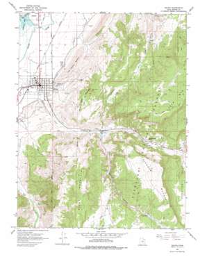
Salina Topo Map Utah
To zoom in, hover over the map of Salina
USGS Topo Quad 38111h7 - 1:24,000 scale
| Topo Map Name: | Salina |
| USGS Topo Quad ID: | 38111h7 |
| Print Size: | ca. 21 1/4" wide x 27" high |
| Southeast Coordinates: | 38.875° N latitude / 111.75° W longitude |
| Map Center Coordinates: | 38.9375° N latitude / 111.8125° W longitude |
| U.S. State: | UT |
| Filename: | o38111h7.jpg |
| Download Map JPG Image: | Salina topo map 1:24,000 scale |
| Map Type: | Topographic |
| Topo Series: | 7.5´ |
| Map Scale: | 1:24,000 |
| Source of Map Images: | United States Geological Survey (USGS) |
| Alternate Map Versions: |
Salina UT 1966, updated 1968 Download PDF Buy paper map Salina UT 1966, updated 1978 Download PDF Buy paper map Salina UT 2001, updated 2003 Download PDF Buy paper map Salina UT 2011 Download PDF Buy paper map Salina UT 2014 Download PDF Buy paper map |
| FStopo: | US Forest Service topo Salina is available: Download FStopo PDF Download FStopo TIF |
1:24,000 Topo Quads surrounding Salina
> Back to 38111e1 at 1:100,000 scale
> Back to 38110a1 at 1:250,000 scale
> Back to U.S. Topo Maps home
Salina topo map: Gazetteer
Salina: Canals
Stone Quarry Ditch elevation 1580m 5183′Trunk Ditch elevation 1598m 5242′
Salina: Dams
Redmond Dam elevation 1561m 5121′Salina Canyon Dam elevation 1649m 5410′
Soldier Canyon Dam Number 1 elevation 1736m 5695′
Soldier Canyon Dam Number 2 elevation 1889m 6197′
Salina: Gaps
Salt Gap elevation 1689m 5541′Salina: Parks
Salina Creek RV and Camp elevation 1573m 5160′Salina: Populated Places
Salina elevation 1573m 5160′Salina: Post Offices
Salina Post Office elevation 1573m 5160′Salina: Reservoirs
Redmond Lake elevation 1561m 5121′Salina: Springs
Prous Spring elevation 1822m 5977′Salina: Streams
Gooseberry Creek elevation 1744m 5721′Salina: Summits
Black Cap Mountain elevation 2005m 6578′Black Mountain elevation 2015m 6610′
Rattlesnake Point elevation 1795m 5889′
The Stone Quarry elevation 1816m 5958′
Triangle Mountain elevation 2098m 6883′
Salina: Valleys
Gooseberry Valley elevation 1765m 5790′Soldier Canyon elevation 1657m 5436′
Steves Wash elevation 1731m 5679′
Trunk Canyon elevation 1583m 5193′
Twist Canyon elevation 1647m 5403′
Twist Canyon elevation 1717m 5633′
Salina digital topo map on disk
Buy this Salina topo map showing relief, roads, GPS coordinates and other geographical features, as a high-resolution digital map file on DVD:


