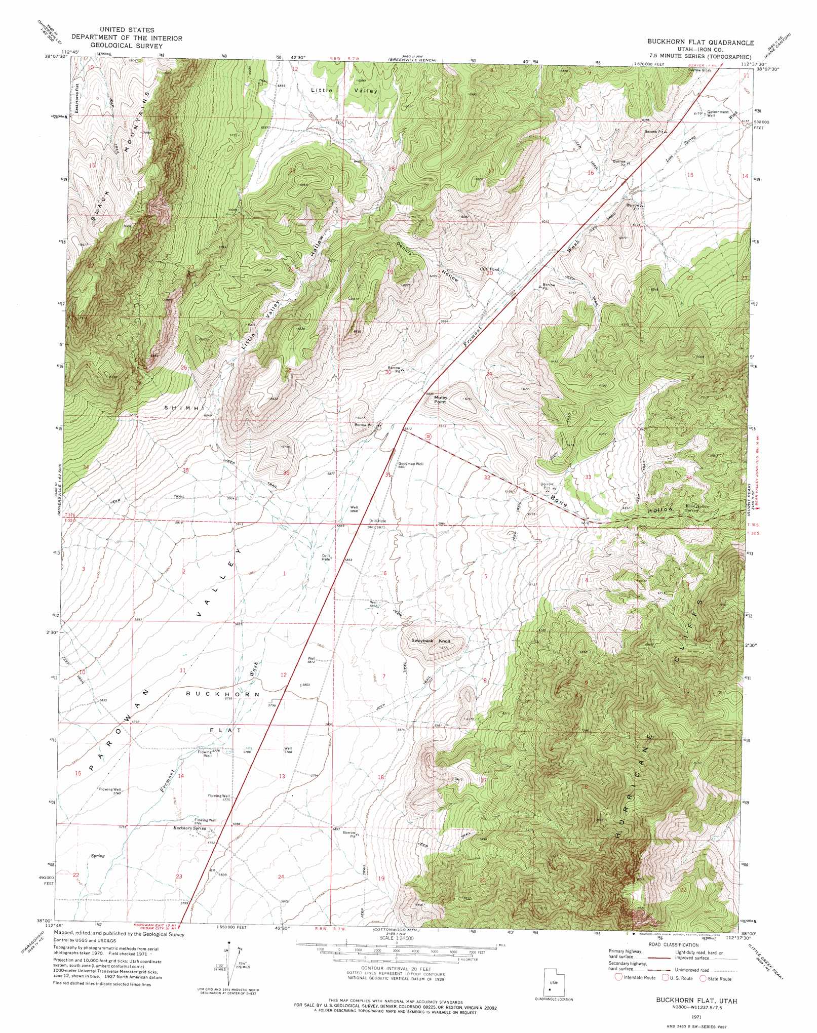
Buckhorn Flat Topo Map Utah
To zoom in, hover over the map of Buckhorn Flat
USGS Topo Quad 38112a6 - 1:24,000 scale
| Topo Map Name: | Buckhorn Flat |
| USGS Topo Quad ID: | 38112a6 |
| Print Size: | ca. 21 1/4" wide x 27" high |
| Southeast Coordinates: | 38° N latitude / 112.625° W longitude |
| Map Center Coordinates: | 38.0625° N latitude / 112.6875° W longitude |
| U.S. State: | UT |
| Filename: | o38112a6.jpg |
| Download Map JPG Image: | Buckhorn Flat topo map 1:24,000 scale |
| Map Type: | Topographic |
| Topo Series: | 7.5´ |
| Map Scale: | 1:24,000 |
| Source of Map Images: | United States Geological Survey (USGS) |
| Alternate Map Versions: |
Buckhorn Flat UT 1971, updated 1974 Download PDF Buy paper map Buckhorn Flat UT 2010 Download PDF Buy paper map Buckhorn Flat UT 2014 Download PDF Buy paper map |
1:24,000 Topo Quads surrounding Buckhorn Flat
Cave Canyon |
Adamsville |
Beaver |
Beaver Se |
Shelly Baldy Peak |
Minersville |
Minersville Reservoir |
Greenville Bench |
Kane Canyon |
Circleville Mountain |
Dry Willow Peak |
Jack Henry Knoll |
Buckhorn Flat |
Burnt Peak |
Fremont Pass |
Parowan Gap |
Paragonah |
Cottonwood Mountain |
Little Creek Peak |
Panguitch Nw |
Summit |
Parowan |
Red Creek Reservoir |
Fivemile Ridge |
Panguitch |
> Back to 38112a1 at 1:100,000 scale
> Back to 38112a1 at 1:250,000 scale
> Back to U.S. Topo Maps home
Buckhorn Flat topo map: Gazetteer
Buckhorn Flat: Basins
Little Valley elevation 2004m 6574′Buckhorn Flat: Cliffs
Muley Point elevation 1832m 6010′Buckhorn Flat: Flats
Buckhorn Flat elevation 1771m 5810′East Horse Flat elevation 2331m 7647′
Buckhorn Flat: Lakes
CCC Pond elevation 1833m 6013′Buckhorn Flat: Slopes
Shimhi elevation 1880m 6167′Buckhorn Flat: Springs
Bone Hollow Spring elevation 1955m 6414′Buckhorn Spring elevation 1761m 5777′
Buckhorn Flat: Summits
Swayback Knoll elevation 1879m 6164′Buckhorn Flat: Valleys
Bone Hollow elevation 1807m 5928′Dennis Hollow elevation 1827m 5994′
Lees Spring Wash elevation 1856m 6089′
Little Valley Hollow elevation 1830m 6003′
Buckhorn Flat: Wells
Goodman Well elevation 1801m 5908′Buckhorn Flat digital topo map on disk
Buy this Buckhorn Flat topo map showing relief, roads, GPS coordinates and other geographical features, as a high-resolution digital map file on DVD: