Junction Topo Map Utah
To zoom in, hover over the map of Junction
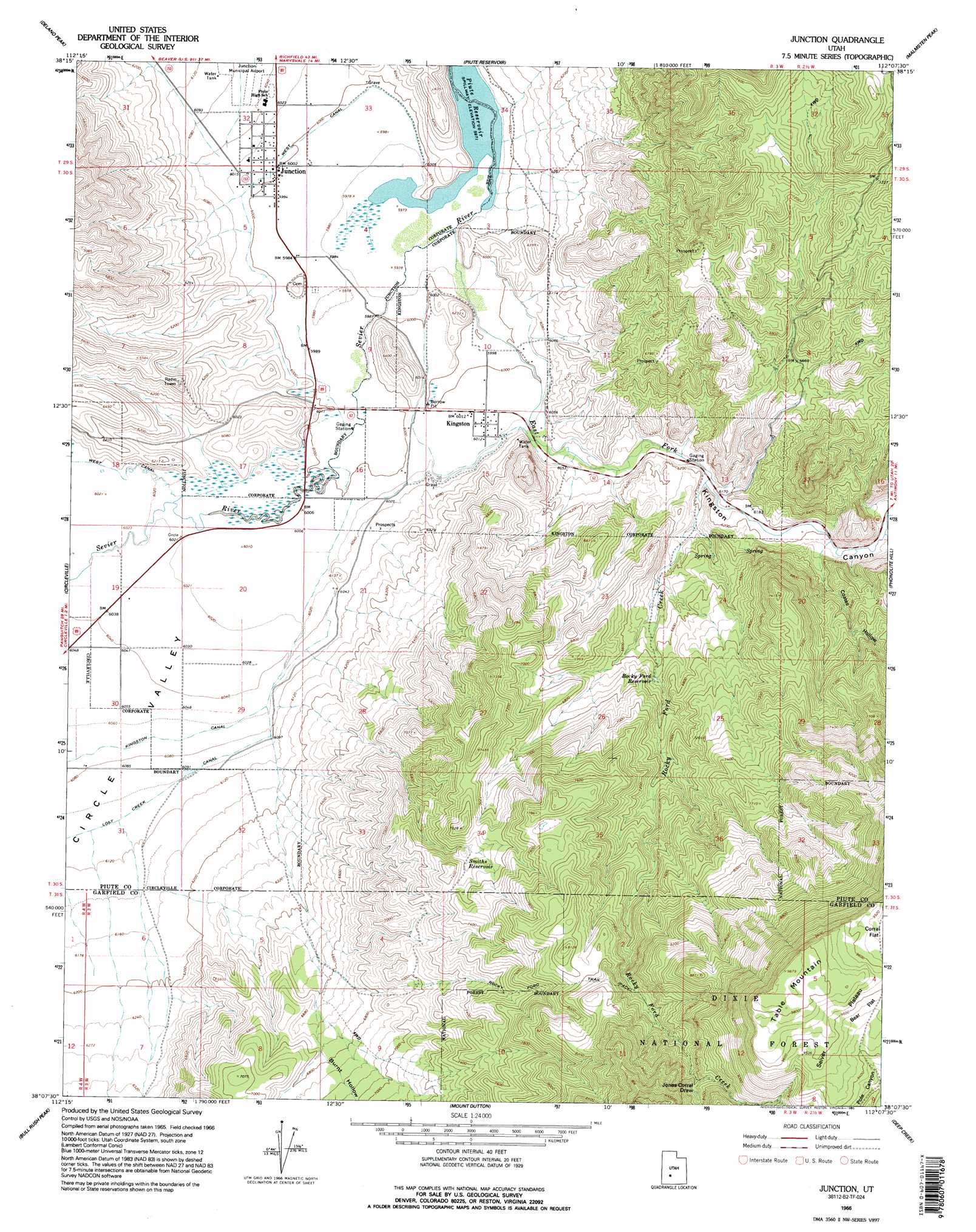
USGS Topo Quad 38112b2 - 1:24,000 scale
| Topo Map Name: | Junction |
| USGS Topo Quad ID: | 38112b2 |
| Print Size: | ca. 21 1/4" wide x 27" high |
| Southeast Coordinates: | 38.125° N latitude / 112.125° W longitude |
| Map Center Coordinates: | 38.1875° N latitude / 112.1875° W longitude |
| U.S. State: | UT |
| Filename: | o38112b2.jpg |
| Download Map JPG Image: | Junction topo map 1:24,000 scale |
| Map Type: | Topographic |
| Topo Series: | 7.5´ |
| Map Scale: | 1:24,000 |
| Source of Map Images: | United States Geological Survey (USGS) |
| Alternate Map Versions: |
Junction UT 1966, updated 1968 Download PDF Buy paper map Junction UT 1966, updated 1981 Download PDF Buy paper map Junction UT 1966, updated 1995 Download PDF Buy paper map Junction UT 2002, updated 2005 Download PDF Buy paper map Junction UT 2011 Download PDF Buy paper map Junction UT 2014 Download PDF Buy paper map |
| FStopo: | US Forest Service topo Junction is available: Download FStopo PDF Download FStopo TIF |
1:24,000 Topo Quads surrounding Junction
Mount Belknap |
Mount Brigham |
Marysvale |
Marysvale Peak |
Greenwich |
Shelly Baldy Peak |
Delano Peak |
Piute Reservoir |
Malmsten Peak |
Parker Knoll |
Circleville Mountain |
Circleville |
Junction |
Phonolite Hill |
Angle |
Fremont Pass |
Bull Rush Peak |
Mount Dutton |
Deep Creek |
Antimony |
Panguitch Nw |
Blind Spring Mountain |
Adams Head |
Cow Creek |
Grass Lakes |
> Back to 38112a1 at 1:100,000 scale
> Back to 38112a1 at 1:250,000 scale
> Back to U.S. Topo Maps home
Junction topo map: Gazetteer
Junction: Canals
West Canal elevation 1830m 6003′Junction: Populated Places
Junction elevation 1831m 6007′Kingston elevation 1834m 6017′
Junction: Post Offices
Junction Post Office elevation 1831m 6007′Junction: Reservoirs
Rocky Ford Reservoir elevation 2028m 6653′Smiths Reservoir elevation 2218m 7276′
Junction: Streams
East Fork Sevier River elevation 1823m 5980′Rocky Ford Creek elevation 1872m 6141′
Junction: Summits
Table Mountain elevation 3004m 9855′Junction: Trails
Rocky Ford Trail elevation 2405m 7890′Junction: Valleys
Burnt Hollow elevation 2022m 6633′Circle Valley elevation 1830m 6003′
Coates Hollow elevation 1896m 6220′
Jones Corral Draw elevation 2554m 8379′
Kingston Canyon elevation 1836m 6023′
Junction digital topo map on disk
Buy this Junction topo map showing relief, roads, GPS coordinates and other geographical features, as a high-resolution digital map file on DVD: