Ranch Canyon Topo Map Utah
To zoom in, hover over the map of Ranch Canyon
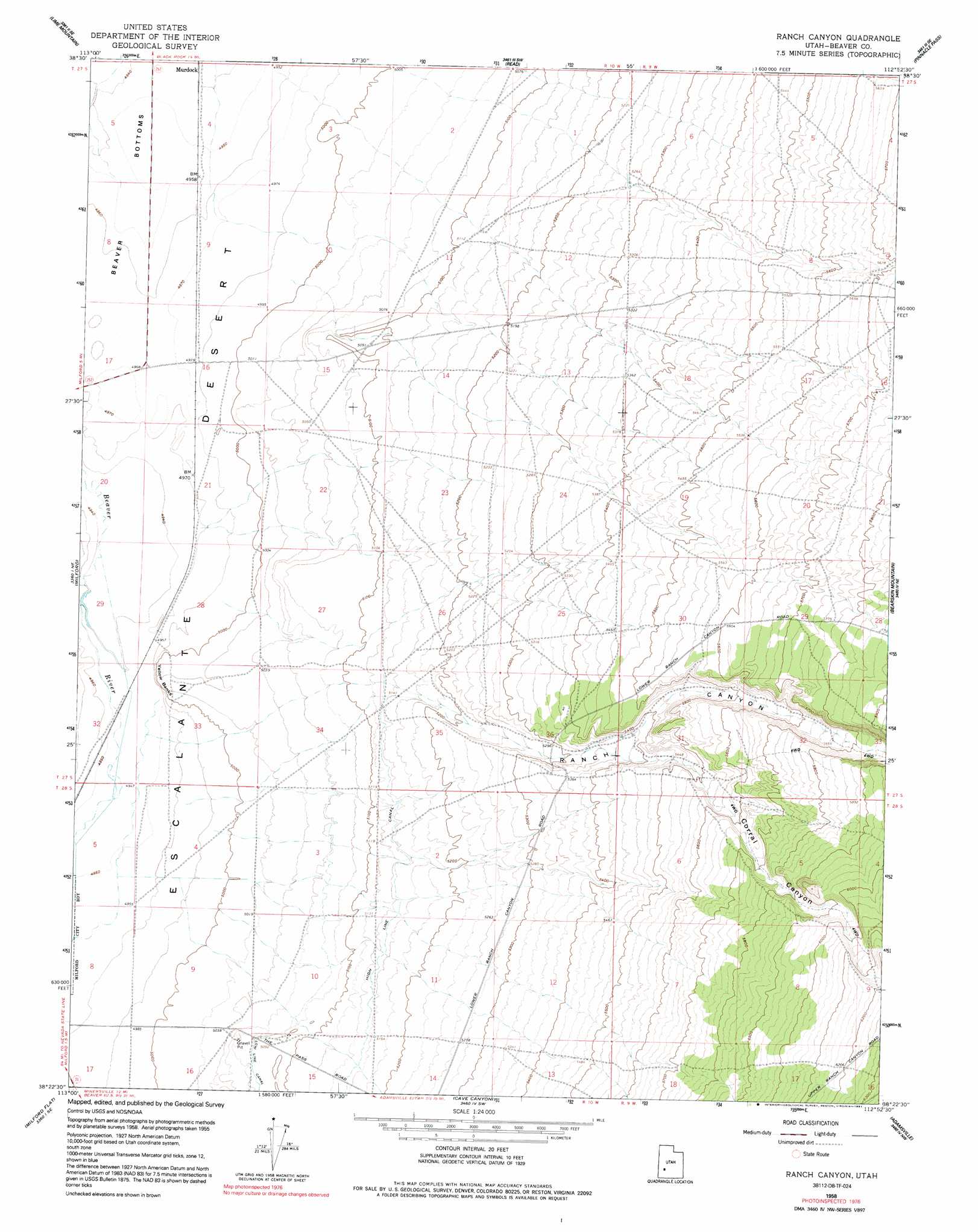
USGS Topo Quad 38112d8 - 1:24,000 scale
| Topo Map Name: | Ranch Canyon |
| USGS Topo Quad ID: | 38112d8 |
| Print Size: | ca. 21 1/4" wide x 27" high |
| Southeast Coordinates: | 38.375° N latitude / 112.875° W longitude |
| Map Center Coordinates: | 38.4375° N latitude / 112.9375° W longitude |
| U.S. State: | UT |
| Filename: | o38112d8.jpg |
| Download Map JPG Image: | Ranch Canyon topo map 1:24,000 scale |
| Map Type: | Topographic |
| Topo Series: | 7.5´ |
| Map Scale: | 1:24,000 |
| Source of Map Images: | United States Geological Survey (USGS) |
| Alternate Map Versions: |
Ranch Canyon UT 1958, updated 1960 Download PDF Buy paper map Ranch Canyon UT 1958, updated 1975 Download PDF Buy paper map Ranch Canyon UT 1958, updated 1991 Download PDF Buy paper map Ranch Canyon UT 2010 Download PDF Buy paper map Ranch Canyon UT 2014 Download PDF Buy paper map |
1:24,000 Topo Quads surrounding Ranch Canyon
Iron Mine Pass |
Red Rock Knoll |
Black Rock |
Antelope Spring |
Antelope Valley |
High Rock |
Lime Mountain |
Read |
Pinnacle Pass |
Cinder Crater |
Milford Nw |
Milford |
Ranch Canyon |
Bearskin Mountain |
Gillies Hill |
Picacho Peak |
Milford Flat |
Cave Canyon |
Adamsville |
Beaver |
Thermo |
Ninemile Knoll |
Minersville |
Minersville Reservoir |
Greenville Bench |
> Back to 38112a1 at 1:100,000 scale
> Back to 38112a1 at 1:250,000 scale
> Back to U.S. Topo Maps home
Ranch Canyon topo map: Gazetteer
Ranch Canyon: Populated Places
Yellow Banks elevation 1524m 5000′Ranch Canyon: Valleys
Corral Canyon elevation 1646m 5400′Ranch Canyon elevation 1573m 5160′
Ranch Canyon digital topo map on disk
Buy this Ranch Canyon topo map showing relief, roads, GPS coordinates and other geographical features, as a high-resolution digital map file on DVD: