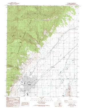
Richfield Topo Map Utah
To zoom in, hover over the map of Richfield
USGS Topo Quad 38112g1 - 1:24,000 scale
| Topo Map Name: | Richfield |
| USGS Topo Quad ID: | 38112g1 |
| Print Size: | ca. 21 1/4" wide x 27" high |
| Southeast Coordinates: | 38.75° N latitude / 112° W longitude |
| Map Center Coordinates: | 38.8125° N latitude / 112.0625° W longitude |
| U.S. State: | UT |
| Filename: | o38112g1.jpg |
| Download Map JPG Image: | Richfield topo map 1:24,000 scale |
| Map Type: | Topographic |
| Topo Series: | 7.5´ |
| Map Scale: | 1:24,000 |
| Source of Map Images: | United States Geological Survey (USGS) |
| Alternate Map Versions: |
Richfield UT 1986, updated 1986 Download PDF Buy paper map Richfield UT 2001, updated 2003 Download PDF Buy paper map Richfield UT 2011 Download PDF Buy paper map Richfield UT 2014 Download PDF Buy paper map |
| FStopo: | US Forest Service topo Richfield is available: Download FStopo PDF Download FStopo TIF |
1:24,000 Topo Quads surrounding Richfield
> Back to 38112e1 at 1:100,000 scale
> Back to 38112a1 at 1:250,000 scale
> Back to U.S. Topo Maps home
Richfield topo map: Gazetteer
Richfield: Airports
Sevier Valley Hospital Heliport elevation 1653m 5423′Richfield: Canals
Prattsville Canal elevation 1606m 5269′Richfield Canal elevation 1613m 5291′
Sevier Valley Canal elevation 1642m 5387′
State Canal elevation 1640m 5380′
Richfield: Populated Places
Gramse elevation 1611m 5285′Kema elevation 1605m 5265′
Prattsville elevation 1602m 5255′
Richfield elevation 1632m 5354′
Venice elevation 1592m 5223′
Richfield: Post Offices
Richfield Post Office elevation 1628m 5341′Richfield: Streams
Cottonwood Creek elevation 1647m 5403′North Fork Willow Creek elevation 1988m 6522′
South Fork Willow Creek elevation 1988m 6522′
Willow Creek elevation 1644m 5393′
Richfield: Summits
Table Mountain elevation 2223m 7293′Richfield: Valleys
Newts Canyon elevation 2135m 7004′North Fork Willow Creek Canyon elevation 1998m 6555′
South Cedar Ridge Canyon elevation 1703m 5587′
South Fork Willow Creek Canyon elevation 1988m 6522′
Strawberry Canyon elevation 1969m 6459′
Willow Creek Canyon elevation 1713m 5620′
Richfield digital topo map on disk
Buy this Richfield topo map showing relief, roads, GPS coordinates and other geographical features, as a high-resolution digital map file on DVD:


