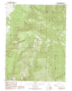
Sunset Peak Topo Map Utah
To zoom in, hover over the map of Sunset Peak
USGS Topo Quad 38112g3 - 1:24,000 scale
| Topo Map Name: | Sunset Peak |
| USGS Topo Quad ID: | 38112g3 |
| Print Size: | ca. 21 1/4" wide x 27" high |
| Southeast Coordinates: | 38.75° N latitude / 112.25° W longitude |
| Map Center Coordinates: | 38.8125° N latitude / 112.3125° W longitude |
| U.S. State: | UT |
| Filename: | o38112g3.jpg |
| Download Map JPG Image: | Sunset Peak topo map 1:24,000 scale |
| Map Type: | Topographic |
| Topo Series: | 7.5´ |
| Map Scale: | 1:24,000 |
| Source of Map Images: | United States Geological Survey (USGS) |
| Alternate Map Versions: |
Sunset Peak UT 1986, updated 1986 Download PDF Buy paper map Sunset Peak UT 2001, updated 2003 Download PDF Buy paper map Sunset Peak UT 2011 Download PDF Buy paper map Sunset Peak UT 2014 Download PDF Buy paper map |
| FStopo: | US Forest Service topo Sunset Peak is available: Download FStopo PDF Download FStopo TIF |
1:24,000 Topo Quads surrounding Sunset Peak
> Back to 38112e1 at 1:100,000 scale
> Back to 38112a1 at 1:250,000 scale
> Back to U.S. Topo Maps home
Sunset Peak topo map: Gazetteer
Sunset Peak: Basins
The Devils Armchair elevation 2651m 8697′Sunset Peak: Ridges
Woolsey Ridge elevation 2101m 6893′Sunset Peak: Springs
Crazy Hollow Spring elevation 2591m 8500′Indian Spring elevation 2836m 9304′
Leavitts Spring elevation 2181m 7155′
Monk Spring elevation 2191m 7188′
Mortensen Spring elevation 1751m 5744′
Walker Spring elevation 2682m 8799′
Sunset Peak: Streams
Cherry Creek elevation 2148m 7047′East Fork Corn Creek elevation 2230m 7316′
First Creek elevation 1706m 5597′
Huncup Creek elevation 1962m 6437′
Misery Creek elevation 2245m 7365′
North Fork Corn Creek elevation 1689m 5541′
North Fork Meadow Creek elevation 2085m 6840′
West Fork Corn Creek elevation 2230m 7316′
Sunset Peak: Summits
Leavitts Peak elevation 2629m 8625′Mine Camp Peak elevation 3081m 10108′
Sunset Peak elevation 3050m 10006′
Sunset Peak: Valleys
Big Cottonwood Canyon elevation 1721m 5646′Crazy Hollow elevation 2271m 7450′
Hell Hole Canyon elevation 2151m 7057′
Leavitts Canyon elevation 1977m 6486′
Mortensen Canyon elevation 1749m 5738′
North Fork Kanosh Canyon elevation 1853m 6079′
Sunset Canyon elevation 1784m 5853′
Sunset Peak digital topo map on disk
Buy this Sunset Peak topo map showing relief, roads, GPS coordinates and other geographical features, as a high-resolution digital map file on DVD:


