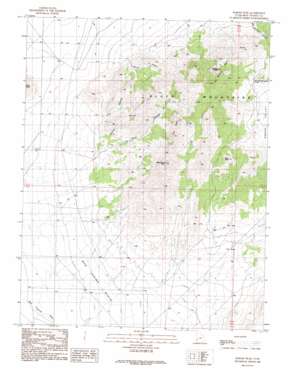
Badger Peak Topo Map Utah
To zoom in, hover over the map of Badger Peak
USGS Topo Quad 38113a2 - 1:24,000 scale
| Topo Map Name: | Badger Peak |
| USGS Topo Quad ID: | 38113a2 |
| Print Size: | ca. 21 1/4" wide x 27" high |
| Southeast Coordinates: | 38° N latitude / 113.125° W longitude |
| Map Center Coordinates: | 38.0625° N latitude / 113.1875° W longitude |
| U.S. State: | UT |
| Filename: | o38113a2.jpg |
| Download Map JPG Image: | Badger Peak topo map 1:24,000 scale |
| Map Type: | Topographic |
| Topo Series: | 7.5´ |
| Map Scale: | 1:24,000 |
| Source of Map Images: | United States Geological Survey (USGS) |
| Alternate Map Versions: |
Badger Peak UT 1989, updated 1989 Download PDF Buy paper map Badger Peak UT 2010 Download PDF Buy paper map Badger Peak UT 2014 Download PDF Buy paper map |
1:24,000 Topo Quads surrounding Badger Peak
> Back to 38113a1 at 1:100,000 scale
> Back to 38112a1 at 1:250,000 scale
> Back to U.S. Topo Maps home
Badger Peak topo map: Gazetteer
Badger Peak: Benches
Mud Spring Bench elevation 1597m 5239′The Neck elevation 1689m 5541′
Badger Peak: Lakes
Hot Springs Canyon Pond elevation 1838m 6030′Badger Peak: Summits
Badger Peak elevation 2034m 6673′Hot Springs Peaks elevation 1892m 6207′
Monument Peak elevation 2057m 6748′
Mule Peak elevation 1766m 5793′
Twin Peaks elevation 2053m 6735′
Badger Peak: Valleys
First Canyon elevation 1586m 5203′Second Canyon elevation 1635m 5364′
Third Canyon elevation 1586m 5203′
Wood Canyon elevation 1575m 5167′
Badger Peak digital topo map on disk
Buy this Badger Peak topo map showing relief, roads, GPS coordinates and other geographical features, as a high-resolution digital map file on DVD:


