Latimer Topo Map Utah
To zoom in, hover over the map of Latimer
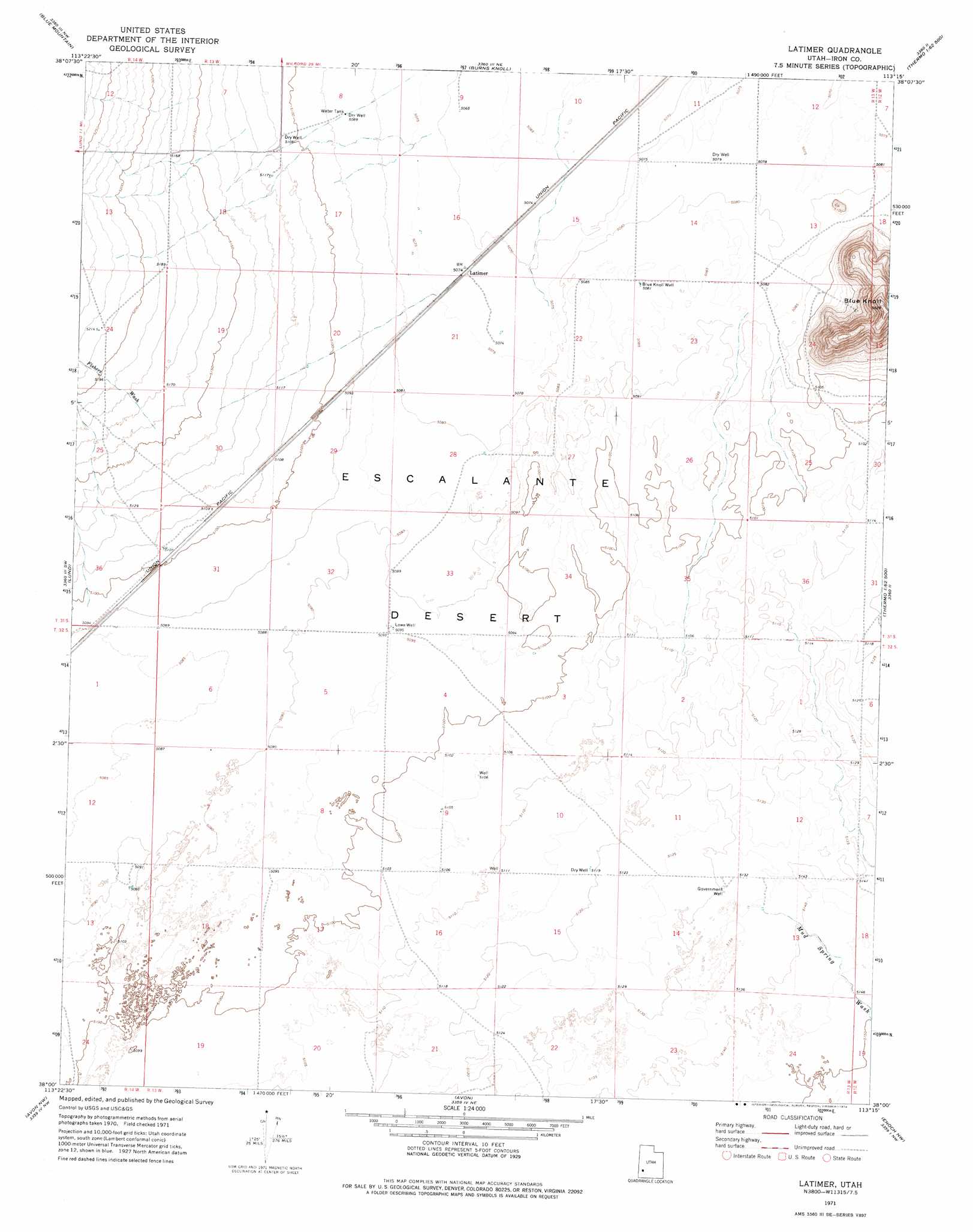
USGS Topo Quad 38113a3 - 1:24,000 scale
| Topo Map Name: | Latimer |
| USGS Topo Quad ID: | 38113a3 |
| Print Size: | ca. 21 1/4" wide x 27" high |
| Southeast Coordinates: | 38° N latitude / 113.25° W longitude |
| Map Center Coordinates: | 38.0625° N latitude / 113.3125° W longitude |
| U.S. State: | UT |
| Filename: | o38113a3.jpg |
| Download Map JPG Image: | Latimer topo map 1:24,000 scale |
| Map Type: | Topographic |
| Topo Series: | 7.5´ |
| Map Scale: | 1:24,000 |
| Source of Map Images: | United States Geological Survey (USGS) |
| Alternate Map Versions: |
Latimer UT 1971, updated 1974 Download PDF Buy paper map Latimer UT 2010 Download PDF Buy paper map Latimer UT 2014 Download PDF Buy paper map |
1:24,000 Topo Quads surrounding Latimer
Lamerdorf Peak |
Frisco Sw |
White Mountain |
Picacho Peak |
Milford Flat |
The Tetons |
Blue Mountain |
Burns Knoll |
Thermo |
Ninemile Knoll |
Mountain Spring Peak |
Lund |
Latimer |
Badger Peak |
Baboon Peak |
Zane |
Avon Nw |
Avon |
Enoch Nw |
Enoch Ne |
Clark Farm |
Antelope Peak |
Avon Se |
The Three Peaks |
Enoch |
> Back to 38113a1 at 1:100,000 scale
> Back to 38112a1 at 1:250,000 scale
> Back to U.S. Topo Maps home
Latimer topo map: Gazetteer
Latimer: Populated Places
Latimer elevation 1548m 5078′Latimer: Summits
Blue Knoll elevation 1711m 5613′Latimer: Valleys
Fishers Wash elevation 1574m 5164′Mud Spring Wash elevation 1566m 5137′
Latimer: Wells
Blue Knoll Well elevation 1551m 5088′Lowe Well elevation 1554m 5098′
Latimer digital topo map on disk
Buy this Latimer topo map showing relief, roads, GPS coordinates and other geographical features, as a high-resolution digital map file on DVD: