Mountain Spring Peak Topo Map Utah
To zoom in, hover over the map of Mountain Spring Peak
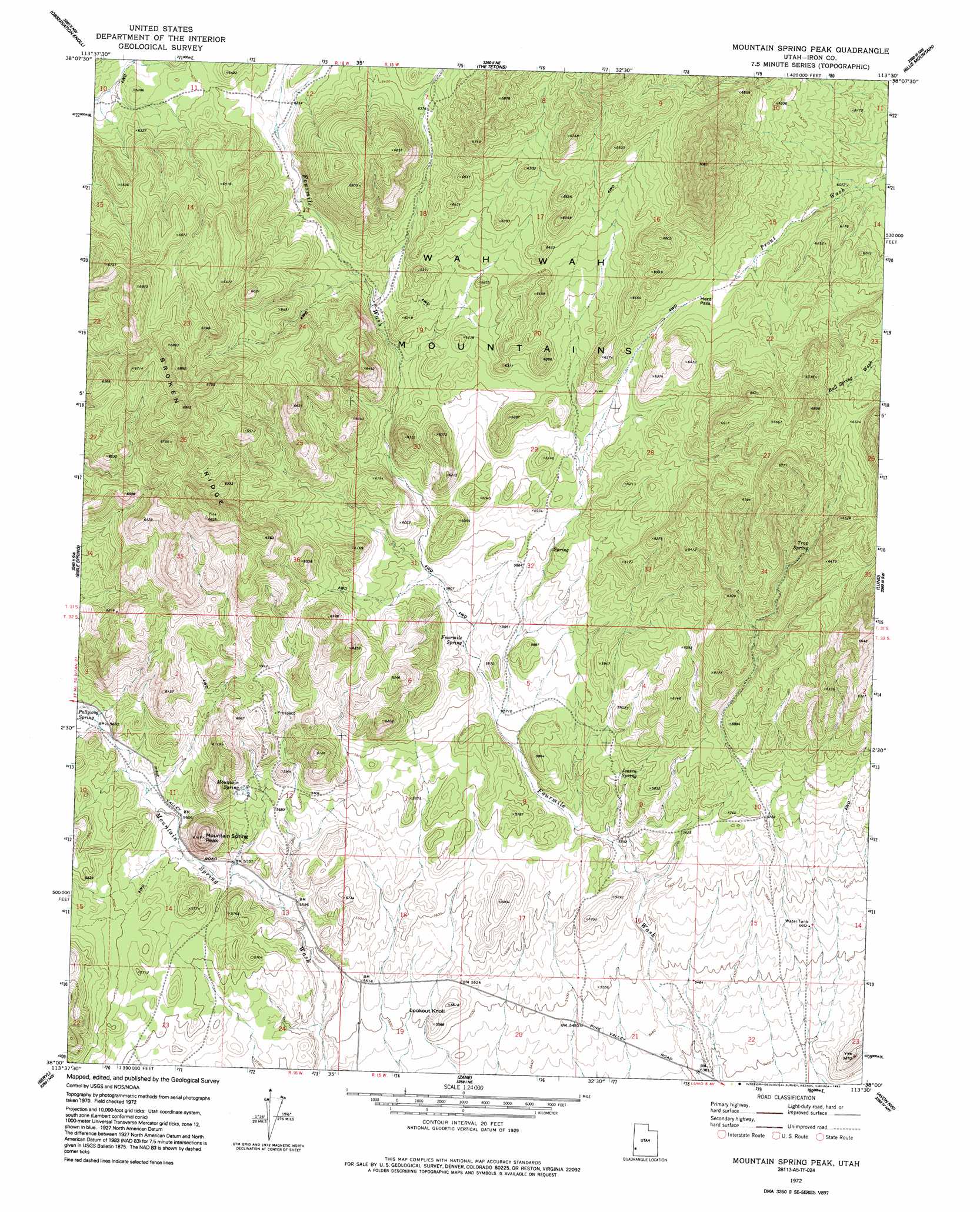
USGS Topo Quad 38113a5 - 1:24,000 scale
| Topo Map Name: | Mountain Spring Peak |
| USGS Topo Quad ID: | 38113a5 |
| Print Size: | ca. 21 1/4" wide x 27" high |
| Southeast Coordinates: | 38° N latitude / 113.5° W longitude |
| Map Center Coordinates: | 38.0625° N latitude / 113.5625° W longitude |
| U.S. State: | UT |
| Filename: | o38113a5.jpg |
| Download Map JPG Image: | Mountain Spring Peak topo map 1:24,000 scale |
| Map Type: | Topographic |
| Topo Series: | 7.5´ |
| Map Scale: | 1:24,000 |
| Source of Map Images: | United States Geological Survey (USGS) |
| Alternate Map Versions: |
Mountain Spring Peak UT 1972, updated 1974 Download PDF Buy paper map Mountain Spring Peak UT 1972, updated 1992 Download PDF Buy paper map Mountain Spring Peak UT 2010 Download PDF Buy paper map Mountain Spring Peak UT 2014 Download PDF Buy paper map |
1:24,000 Topo Quads surrounding Mountain Spring Peak
Buckhorn Spring |
Pine Grove Reservoir |
Lamerdorf Peak |
Frisco Sw |
White Mountain |
Pinto Spring |
Observation Knoll |
The Tetons |
Blue Mountain |
Burns Knoll |
Steamboat Mountain |
Bible Spring |
Mountain Spring Peak |
Lund |
Latimer |
Bannion Spring |
Beryl |
Zane |
Avon Nw |
Avon |
Heist |
Yale Crossing |
Clark Farm |
Antelope Peak |
Avon Se |
> Back to 38113a1 at 1:100,000 scale
> Back to 38112a1 at 1:250,000 scale
> Back to U.S. Topo Maps home
Mountain Spring Peak topo map: Gazetteer
Mountain Spring Peak: Gaps
Herd Pass elevation 1904m 6246′Mountain Spring Peak: Ridges
Broken Ridge elevation 1980m 6496′Mountain Spring Peak: Springs
Fourmile Spring elevation 1756m 5761′Jensen Spring elevation 1743m 5718′
Mountain Spring elevation 1748m 5734′
Trap Spring elevation 1904m 6246′
Mountain Spring Peak: Summits
Lookout Knoll elevation 1714m 5623′Mountain Spring Peak elevation 1874m 6148′
Mountain Spring Peak digital topo map on disk
Buy this Mountain Spring Peak topo map showing relief, roads, GPS coordinates and other geographical features, as a high-resolution digital map file on DVD: