Steamboat Mountain Sw Topo Map Utah
To zoom in, hover over the map of Steamboat Mountain Sw
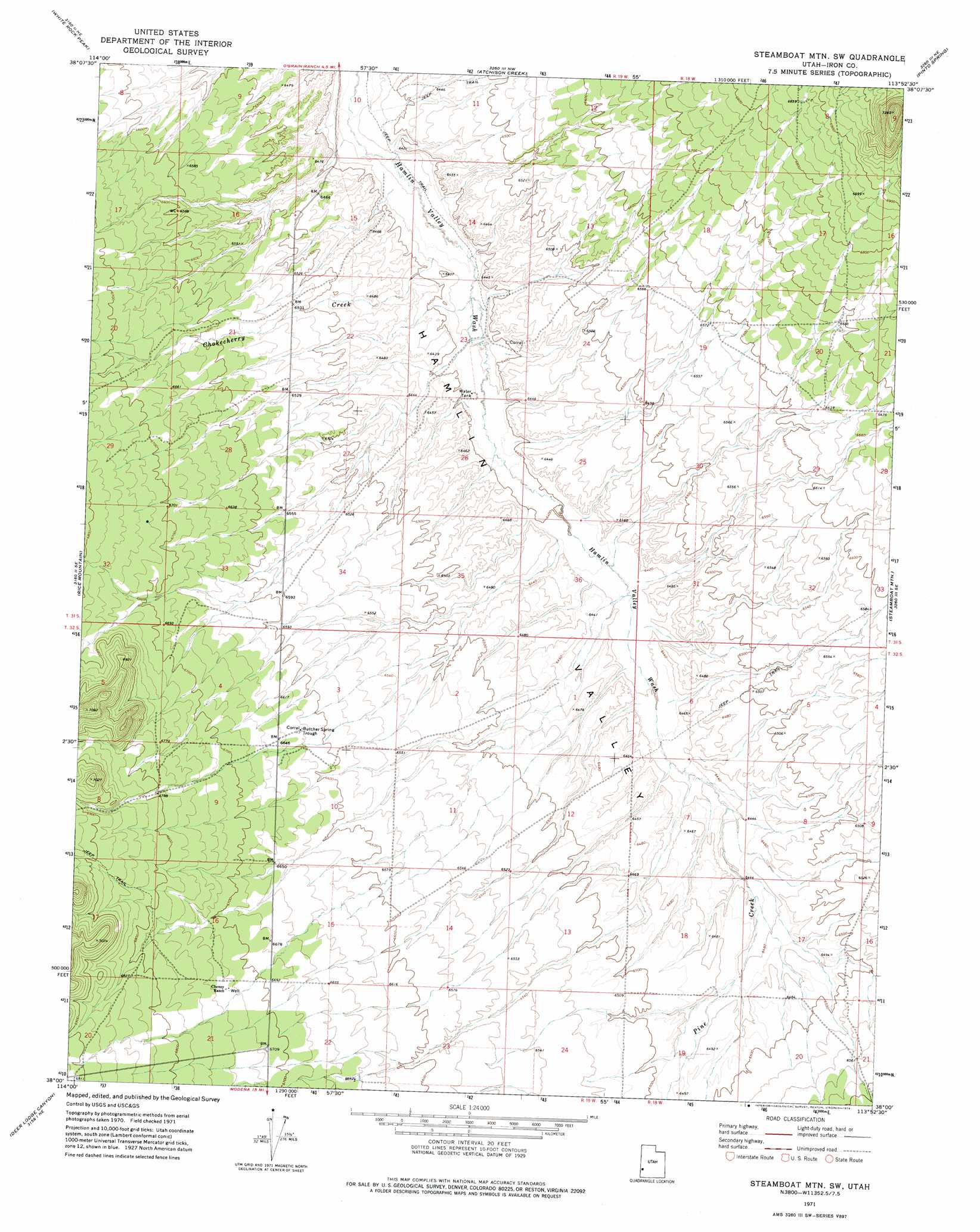
USGS Topo Quad 38113a8 - 1:24,000 scale
| Topo Map Name: | Steamboat Mountain Sw |
| USGS Topo Quad ID: | 38113a8 |
| Print Size: | ca. 21 1/4" wide x 27" high |
| Southeast Coordinates: | 38° N latitude / 113.875° W longitude |
| Map Center Coordinates: | 38.0625° N latitude / 113.9375° W longitude |
| U.S. State: | UT |
| Filename: | o38113a8.jpg |
| Download Map JPG Image: | Steamboat Mountain Sw topo map 1:24,000 scale |
| Map Type: | Topographic |
| Topo Series: | 7.5´ |
| Map Scale: | 1:24,000 |
| Source of Map Images: | United States Geological Survey (USGS) |
| Alternate Map Versions: |
Steamboat Mtn SW UT 1971, updated 1974 Download PDF Buy paper map Steamboat Mountain SW UT 2010 Download PDF Buy paper map Steamboat Mountain SW UT 2014 Download PDF Buy paper map |
1:24,000 Topo Quads surrounding Steamboat Mountain Sw
Miller Canyon |
Gleason Basin |
Miners Cabin Wash |
Buckhorn Spring |
Pine Grove Reservoir |
Buck Wash Well |
White Rock Peak |
Atchison Creek |
Pinto Spring |
Observation Knoll |
Eagle Valley Reservoir |
Rice Mountain |
Steamboat Mountain Sw |
Steamboat Mountain |
Bible Spring |
Ursine |
Deer Lodge Canyon |
Eightmile Spring |
Bannion Spring |
Beryl |
Panaca Summit |
Prohibition Flat |
Modena |
Heist |
Yale Crossing |
> Back to 38113a1 at 1:100,000 scale
> Back to 38112a1 at 1:250,000 scale
> Back to U.S. Topo Maps home
Steamboat Mountain Sw topo map: Gazetteer
Steamboat Mountain Sw: Streams
Chokecherry Creek elevation 1945m 6381′Pine Creek elevation 1965m 6446′
Steamboat Mountain Sw digital topo map on disk
Buy this Steamboat Mountain Sw topo map showing relief, roads, GPS coordinates and other geographical features, as a high-resolution digital map file on DVD: