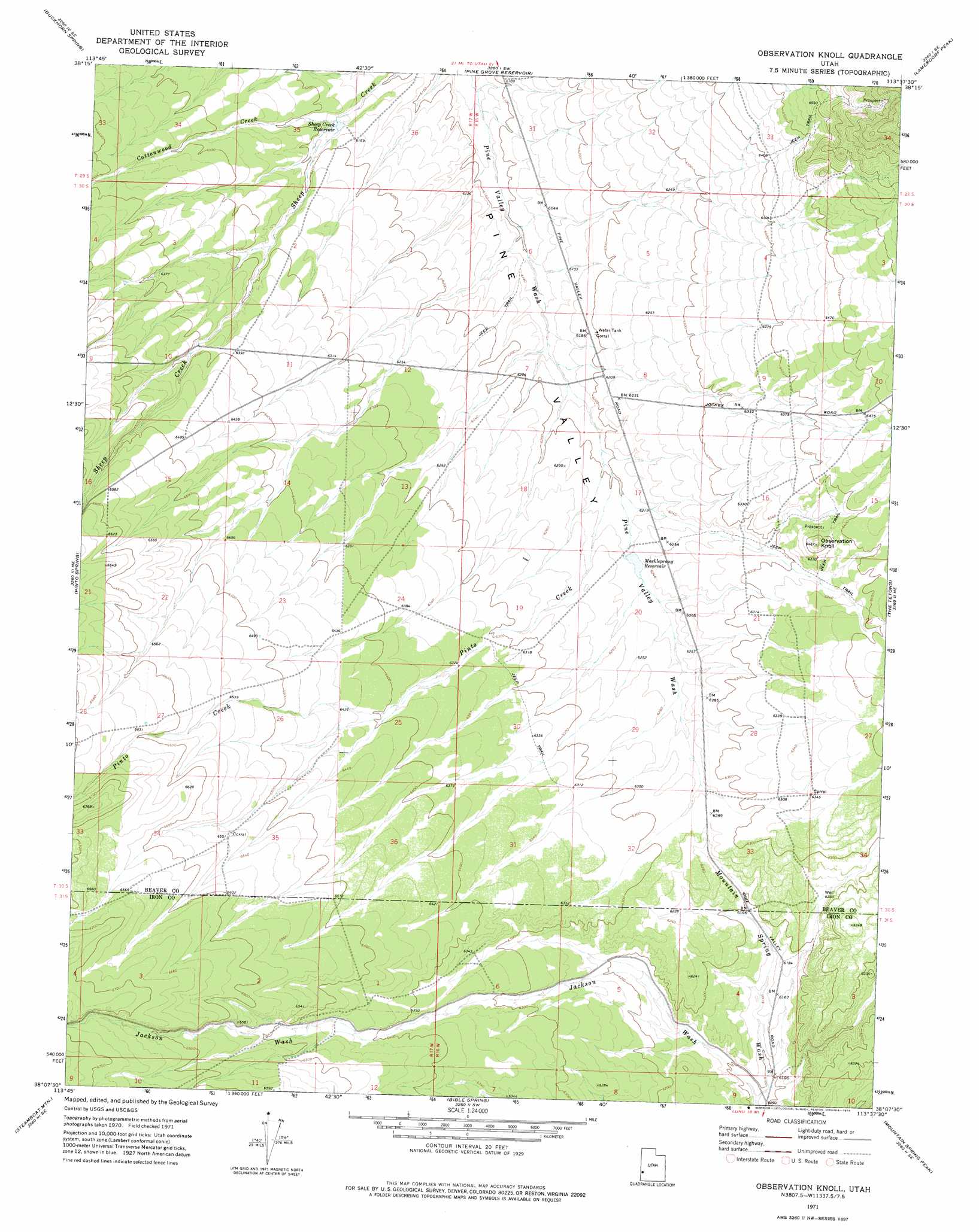
Observation Knoll Topo Map Utah
To zoom in, hover over the map of Observation Knoll
USGS Topo Quad 38113b6 - 1:24,000 scale
| Topo Map Name: | Observation Knoll |
| USGS Topo Quad ID: | 38113b6 |
| Print Size: | ca. 21 1/4" wide x 27" high |
| Southeast Coordinates: | 38.125° N latitude / 113.625° W longitude |
| Map Center Coordinates: | 38.1875° N latitude / 113.6875° W longitude |
| U.S. State: | UT |
| Filename: | o38113b6.jpg |
| Download Map JPG Image: | Observation Knoll topo map 1:24,000 scale |
| Map Type: | Topographic |
| Topo Series: | 7.5´ |
| Map Scale: | 1:24,000 |
| Source of Map Images: | United States Geological Survey (USGS) |
| Alternate Map Versions: |
Observation Knoll UT 1971, updated 1974 Download PDF Buy paper map Observation Knoll UT 2010 Download PDF Buy paper map Observation Knoll UT 2014 Download PDF Buy paper map |
1:24,000 Topo Quads surrounding Observation Knoll
Lopers Spring |
Sawtooth Peak |
Lamerdorf Peak Nw |
Sewing Machine Pass |
Wallaces Peak |
Miners Cabin Wash |
Buckhorn Spring |
Pine Grove Reservoir |
Lamerdorf Peak |
Frisco Sw |
Atchison Creek |
Pinto Spring |
Observation Knoll |
The Tetons |
Blue Mountain |
Steamboat Mountain Sw |
Steamboat Mountain |
Bible Spring |
Mountain Spring Peak |
Lund |
Eightmile Spring |
Bannion Spring |
Beryl |
Zane |
Avon Nw |
> Back to 38113a1 at 1:100,000 scale
> Back to 38112a1 at 1:250,000 scale
> Back to U.S. Topo Maps home
Observation Knoll topo map: Gazetteer
Observation Knoll: Reservoirs
Mackleprang Reservoir elevation 1898m 6227′Sheep Creek Reservoir elevation 1880m 6167′
Observation Knoll: Streams
Cottonwood Creek elevation 1875m 6151′Pinto Creek elevation 1891m 6204′
Observation Knoll: Summits
Observation Knoll elevation 1970m 6463′Observation Knoll: Valleys
Jackson Wash elevation 1854m 6082′Observation Knoll digital topo map on disk
Buy this Observation Knoll topo map showing relief, roads, GPS coordinates and other geographical features, as a high-resolution digital map file on DVD: