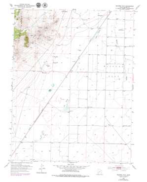
Milford Flat Topo Map Utah
To zoom in, hover over the map of Milford Flat
USGS Topo Quad 38113c1 - 1:24,000 scale
| Topo Map Name: | Milford Flat |
| USGS Topo Quad ID: | 38113c1 |
| Print Size: | ca. 21 1/4" wide x 27" high |
| Southeast Coordinates: | 38.25° N latitude / 113° W longitude |
| Map Center Coordinates: | 38.3125° N latitude / 113.0625° W longitude |
| U.S. State: | UT |
| Filename: | o38113c1.jpg |
| Download Map JPG Image: | Milford Flat topo map 1:24,000 scale |
| Map Type: | Topographic |
| Topo Series: | 7.5´ |
| Map Scale: | 1:24,000 |
| Source of Map Images: | United States Geological Survey (USGS) |
| Alternate Map Versions: |
Milford Flat UT 1953, updated 1955 Download PDF Buy paper map Milford Flat UT 1953, updated 1974 Download PDF Buy paper map Milford Flat UT 2011 Download PDF Buy paper map Milford Flat UT 2014 Download PDF Buy paper map |
1:24,000 Topo Quads surrounding Milford Flat
> Back to 38113a1 at 1:100,000 scale
> Back to 38112a1 at 1:250,000 scale
> Back to U.S. Topo Maps home
Milford Flat topo map: Gazetteer
Milford Flat: Airports
Flying M Ranch Airport elevation 1538m 5045′Milford Flat: Bends
Grassy Bend elevation 1528m 5013′Milford Flat: Flats
Milford Flat elevation 1528m 5013′Milford Flat: Lakes
Sand Pond elevation 1524m 5000′Milford Flat: Mines
Estelle Mine elevation 1673m 5488′Gold Crown Mine elevation 1627m 5337′
Maud-S Mine elevation 1690m 5544′
Vicksburg Mine elevation 1694m 5557′
Milford Flat: Populated Places
Cook Corner elevation 1531m 5022′Laho elevation 1528m 5013′
Upton elevation 1520m 4986′
Milford Flat: Springs
Hay Springs elevation 1524m 5000′Tadpole Springs elevation 1516m 4973′
Milford Flat: Summits
Mollies Nipple elevation 1593m 5226′Milford Flat: Valleys
Elephant Canyon elevation 1652m 5419′Milford Flat: Wells
Carlton Well elevation 1522m 4993′Hearn Well elevation 1527m 5009′
Martin Well elevation 1532m 5026′
Rollins Well elevation 1528m 5013′
Smelter Well elevation 1516m 4973′
Tomsik Well elevation 1525m 5003′
Milford Flat digital topo map on disk
Buy this Milford Flat topo map showing relief, roads, GPS coordinates and other geographical features, as a high-resolution digital map file on DVD:


