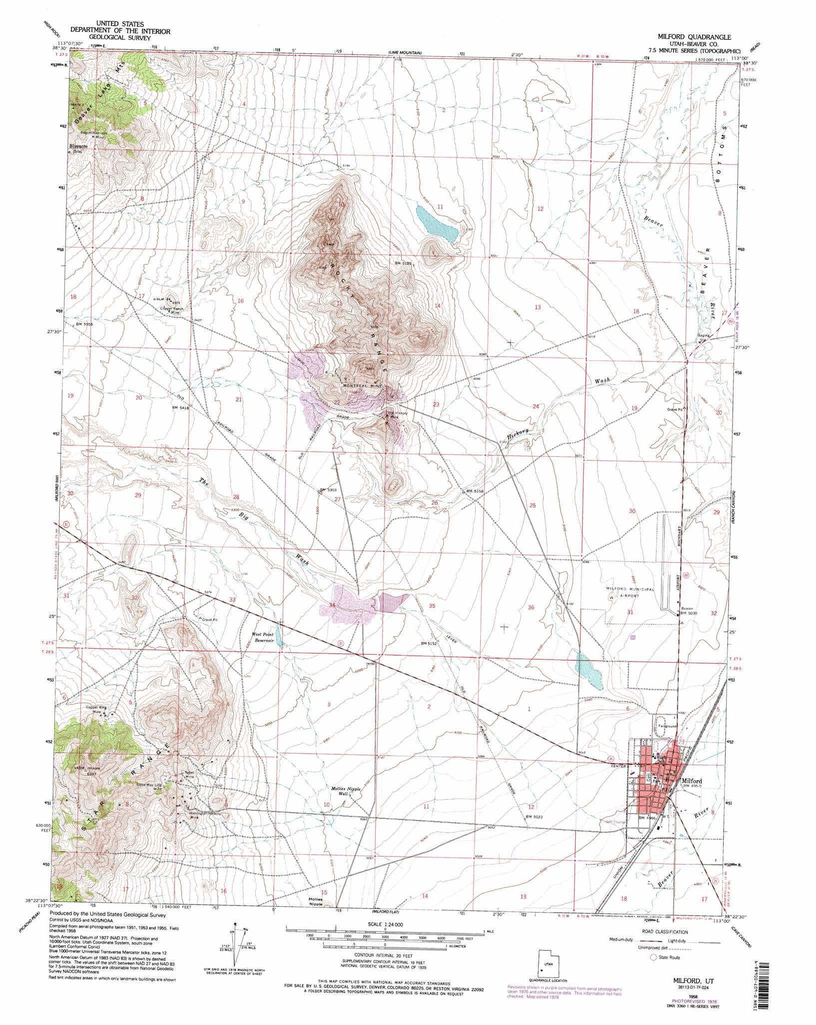
Milford Topo Map Utah
To zoom in, hover over the map of Milford
USGS Topo Quad 38113d1 - 1:24,000 scale
| Topo Map Name: | Milford |
| USGS Topo Quad ID: | 38113d1 |
| Print Size: | ca. 21 1/4" wide x 27" high |
| Southeast Coordinates: | 38.375° N latitude / 113° W longitude |
| Map Center Coordinates: | 38.4375° N latitude / 113.0625° W longitude |
| U.S. State: | UT |
| Filename: | o38113d1.jpg |
| Download Map JPG Image: | Milford topo map 1:24,000 scale |
| Map Type: | Topographic |
| Topo Series: | 7.5´ |
| Map Scale: | 1:24,000 |
| Source of Map Images: | United States Geological Survey (USGS) |
| Alternate Map Versions: |
Milford UT 1958, updated 1960 Download PDF Buy paper map Milford UT 1958, updated 1976 Download PDF Buy paper map Milford UT 1958, updated 1995 Download PDF Buy paper map Milford UT 2010 Download PDF Buy paper map Milford UT 2014 Download PDF Buy paper map |
1:24,000 Topo Quads surrounding Milford
Brown Knoll |
Iron Mine Pass |
Red Rock Knoll |
Black Rock |
Antelope Spring |
Frisco Peak |
High Rock |
Lime Mountain |
Read |
Pinnacle Pass |
Frisco |
Milford Nw |
Milford |
Ranch Canyon |
Bearskin Mountain |
White Mountain |
Picacho Peak |
Milford Flat |
Cave Canyon |
Adamsville |
Burns Knoll |
Thermo |
Ninemile Knoll |
Minersville |
Minersville Reservoir |
> Back to 38113a1 at 1:100,000 scale
> Back to 38112a1 at 1:250,000 scale
> Back to U.S. Topo Maps home
Milford topo map: Gazetteer
Milford: Airports
Milford Municipal Airport elevation 1534m 5032′Milford: Dams
Big Wash Dam elevation 1615m 5298′Lower Big Wash Dam elevation 1580m 5183′
Milford: Mines
Beaver-Harrison Mine elevation 1781m 5843′Copper King Mine elevation 1747m 5731′
Copper Ranch Mine elevation 1663m 5456′
Harrington-Hickory Mine elevation 1656m 5433′
Little May Lilly Mine elevation 1706m 5597′
Montreal Mine elevation 1759m 5770′
Old Hickory Mine elevation 1645m 5396′
Rebel Mine elevation 1675m 5495′
Milford: Populated Places
Milford elevation 1514m 4967′Milford: Post Offices
Milford Post Office elevation 1514m 4967′Milford: Ranges
Rocky Range elevation 1819m 5967′Milford: Reservoirs
Big Wash Reservoir elevation 1615m 5298′Lower Big Wash Reservoir elevation 1580m 5183′
West Point Reservoir elevation 1605m 5265′
Milford: Valleys
Hickory Wash elevation 1507m 4944′The Big Wash elevation 1579m 5180′
Milford: Wells
Mollies Nipple Well elevation 1557m 5108′Milford digital topo map on disk
Buy this Milford topo map showing relief, roads, GPS coordinates and other geographical features, as a high-resolution digital map file on DVD: