Sawtooth Peak Topo Map Utah
To zoom in, hover over the map of Sawtooth Peak
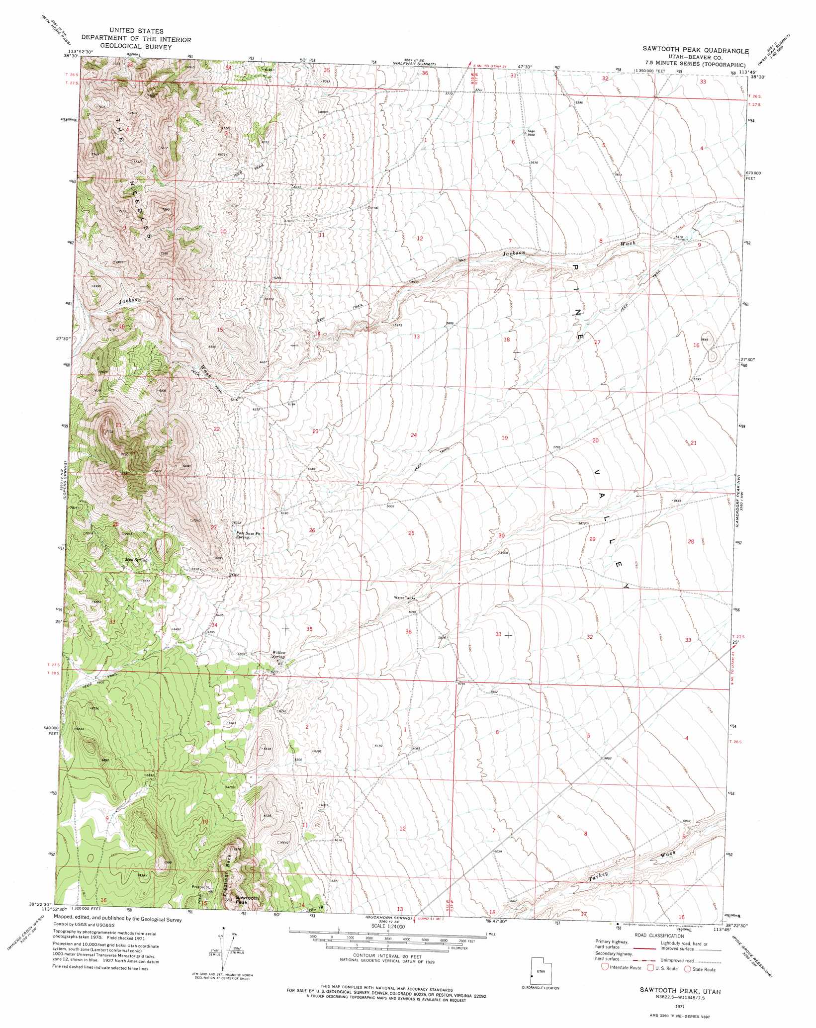
USGS Topo Quad 38113d7 - 1:24,000 scale
| Topo Map Name: | Sawtooth Peak |
| USGS Topo Quad ID: | 38113d7 |
| Print Size: | ca. 21 1/4" wide x 27" high |
| Southeast Coordinates: | 38.375° N latitude / 113.75° W longitude |
| Map Center Coordinates: | 38.4375° N latitude / 113.8125° W longitude |
| U.S. State: | UT |
| Filename: | o38113d7.jpg |
| Download Map JPG Image: | Sawtooth Peak topo map 1:24,000 scale |
| Map Type: | Topographic |
| Topo Series: | 7.5´ |
| Map Scale: | 1:24,000 |
| Source of Map Images: | United States Geological Survey (USGS) |
| Alternate Map Versions: |
Sawtooth Peak UT 1971, updated 1974 Download PDF Buy paper map Sawtooth Peak UT 2010 Download PDF Buy paper map Sawtooth Peak UT 2014 Download PDF Buy paper map |
1:24,000 Topo Quads surrounding Sawtooth Peak
Tweedy Wash |
Mormon Gap |
Tunnel Spring |
Pine Valley Hardpan North |
Grassy Cove |
Miller Wash |
Mountain Home Pass |
Halfway Summit |
Pine Valley Hardpan South |
Wah Wah Summit |
Hamlin Well |
Lopers Spring |
Sawtooth Peak |
Lamerdorf Peak Nw |
Sewing Machine Pass |
Gleason Basin |
Miners Cabin Wash |
Buckhorn Spring |
Pine Grove Reservoir |
Lamerdorf Peak |
White Rock Peak |
Atchison Creek |
Pinto Spring |
Observation Knoll |
The Tetons |
> Back to 38113a1 at 1:100,000 scale
> Back to 38112a1 at 1:250,000 scale
> Back to U.S. Topo Maps home
Sawtooth Peak topo map: Gazetteer
Sawtooth Peak: Ridges
Elephant Back elevation 2155m 7070′Sawtooth Peak: Springs
Mud Spring elevation 2031m 6663′Pots Sum Pa Spring elevation 1928m 6325′
Willow Spring elevation 1915m 6282′
Sawtooth Peak: Summits
Sawtooth Peak elevation 2197m 7208′Sawtooth Peak digital topo map on disk
Buy this Sawtooth Peak topo map showing relief, roads, GPS coordinates and other geographical features, as a high-resolution digital map file on DVD: