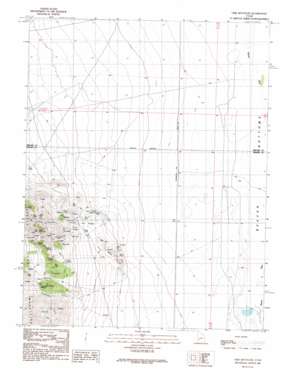
Lime Mountain Topo Map Utah
To zoom in, hover over the map of Lime Mountain
USGS Topo Quad 38113e1 - 1:24,000 scale
| Topo Map Name: | Lime Mountain |
| USGS Topo Quad ID: | 38113e1 |
| Print Size: | ca. 21 1/4" wide x 27" high |
| Southeast Coordinates: | 38.5° N latitude / 113° W longitude |
| Map Center Coordinates: | 38.5625° N latitude / 113.0625° W longitude |
| U.S. State: | UT |
| Filename: | o38113e1.jpg |
| Download Map JPG Image: | Lime Mountain topo map 1:24,000 scale |
| Map Type: | Topographic |
| Topo Series: | 7.5´ |
| Map Scale: | 1:24,000 |
| Source of Map Images: | United States Geological Survey (USGS) |
| Alternate Map Versions: |
Lime Mountain UT 1989, updated 1989 Download PDF Buy paper map Lime Mountain UT 2010 Download PDF Buy paper map Lime Mountain UT 2014 Download PDF Buy paper map |
1:24,000 Topo Quads surrounding Lime Mountain
> Back to 38113e1 at 1:100,000 scale
> Back to 38112a1 at 1:250,000 scale
> Back to U.S. Topo Maps home
Lime Mountain topo map: Gazetteer
Lime Mountain: Bends
Beaver Bottoms elevation 1492m 4895′Lime Mountain: Mines
Copper Mountain Mine elevation 1600m 5249′Galena Mine elevation 1864m 6115′
Independence Mine elevation 1776m 5826′
North Star Mine elevation 1671m 5482′
Skylark Mine elevation 2002m 6568′
Ute Mine elevation 1619m 5311′
Lime Mountain: Springs
Bardsley Spring elevation 1835m 6020′Brownfield Tunnel Spring elevation 1851m 6072′
Douglas Spring elevation 1833m 6013′
Smith Spring elevation 1772m 5813′
Lime Mountain: Summits
Badger Knolls elevation 1658m 5439′Lime Mountain elevation 2104m 6902′
Lime Mountain: Valleys
Brownfield Canyon elevation 1696m 5564′Lime Mountain digital topo map on disk
Buy this Lime Mountain topo map showing relief, roads, GPS coordinates and other geographical features, as a high-resolution digital map file on DVD:


