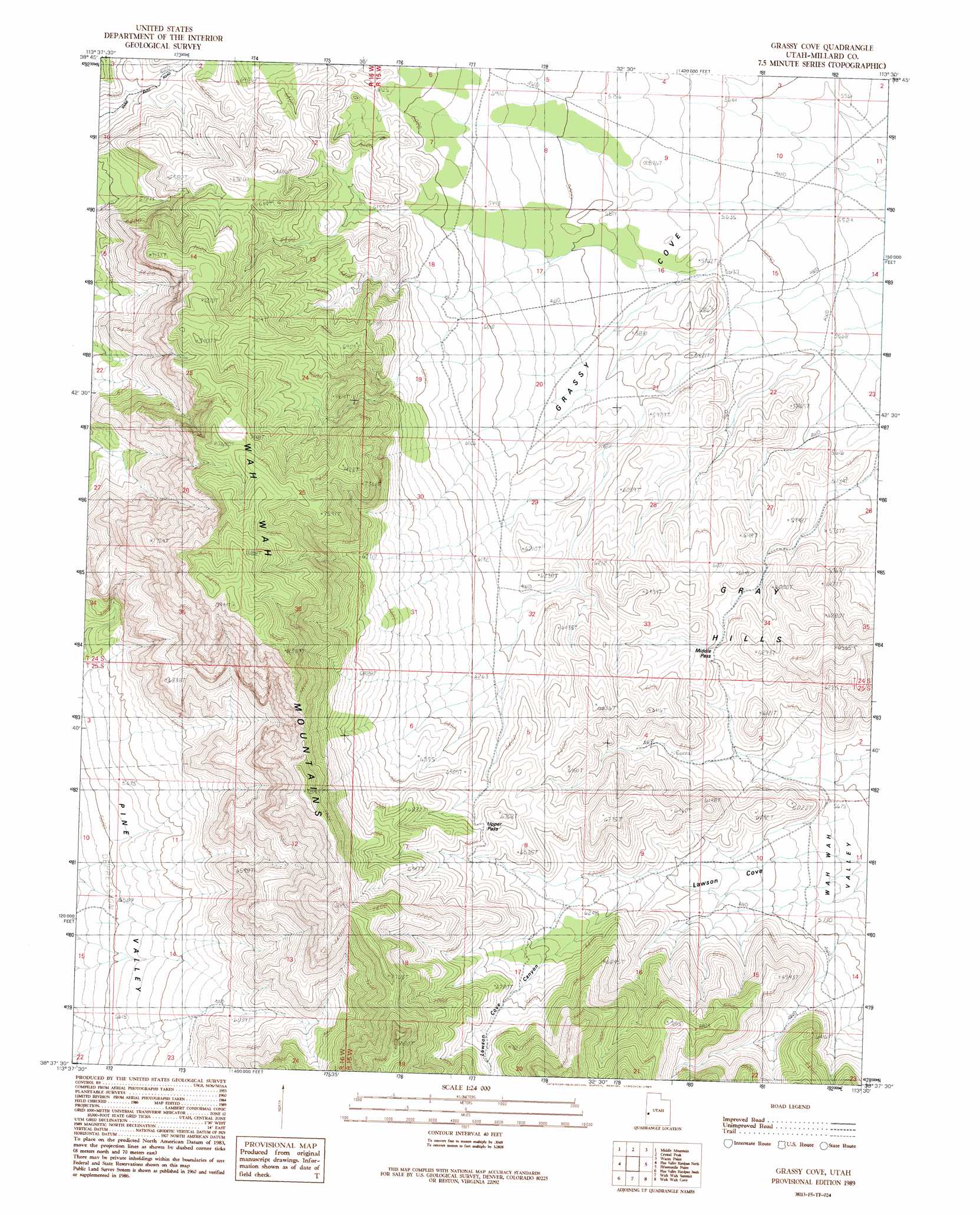
Grassy Cove Topo Map Utah
To zoom in, hover over the map of Grassy Cove
USGS Topo Quad 38113f5 - 1:24,000 scale
| Topo Map Name: | Grassy Cove |
| USGS Topo Quad ID: | 38113f5 |
| Print Size: | ca. 21 1/4" wide x 27" high |
| Southeast Coordinates: | 38.625° N latitude / 113.5° W longitude |
| Map Center Coordinates: | 38.6875° N latitude / 113.5625° W longitude |
| U.S. State: | UT |
| Filename: | o38113f5.jpg |
| Download Map JPG Image: | Grassy Cove topo map 1:24,000 scale |
| Map Type: | Topographic |
| Topo Series: | 7.5´ |
| Map Scale: | 1:24,000 |
| Source of Map Images: | United States Geological Survey (USGS) |
| Alternate Map Versions: |
Grassy Cove UT 1989, updated 1989 Download PDF Buy paper map Grassy Cove UT 2010 Download PDF Buy paper map Grassy Cove UT 2014 Download PDF Buy paper map |
1:24,000 Topo Quads surrounding Grassy Cove
Deadman Point |
Pyramid Knoll |
King Top |
The Barn |
Burnout Canyon |
Big Jensen Pass |
Middle Mountain |
Crystal Peak |
Warm Point |
Red Tops |
Tunnel Spring |
Pine Valley Hardpan North |
Grassy Cove |
Fifteenmile Point |
Brown Knoll |
Halfway Summit |
Pine Valley Hardpan South |
Wah Wah Summit |
Wah Wah Cove |
Frisco Peak |
Sawtooth Peak |
Lamerdorf Peak Nw |
Sewing Machine Pass |
Wallaces Peak |
Frisco |
> Back to 38113e1 at 1:100,000 scale
> Back to 38112a1 at 1:250,000 scale
> Back to U.S. Topo Maps home
Grassy Cove topo map: Gazetteer
Grassy Cove: Basins
Grassy Cove elevation 1681m 5515′Grassy Cove: Gaps
Middle Pass elevation 1831m 6007′Upper Pass elevation 1982m 6502′
Grassy Cove: Valleys
Lawson Cove Canyon elevation 1981m 6499′Grassy Cove digital topo map on disk
Buy this Grassy Cove topo map showing relief, roads, GPS coordinates and other geographical features, as a high-resolution digital map file on DVD: