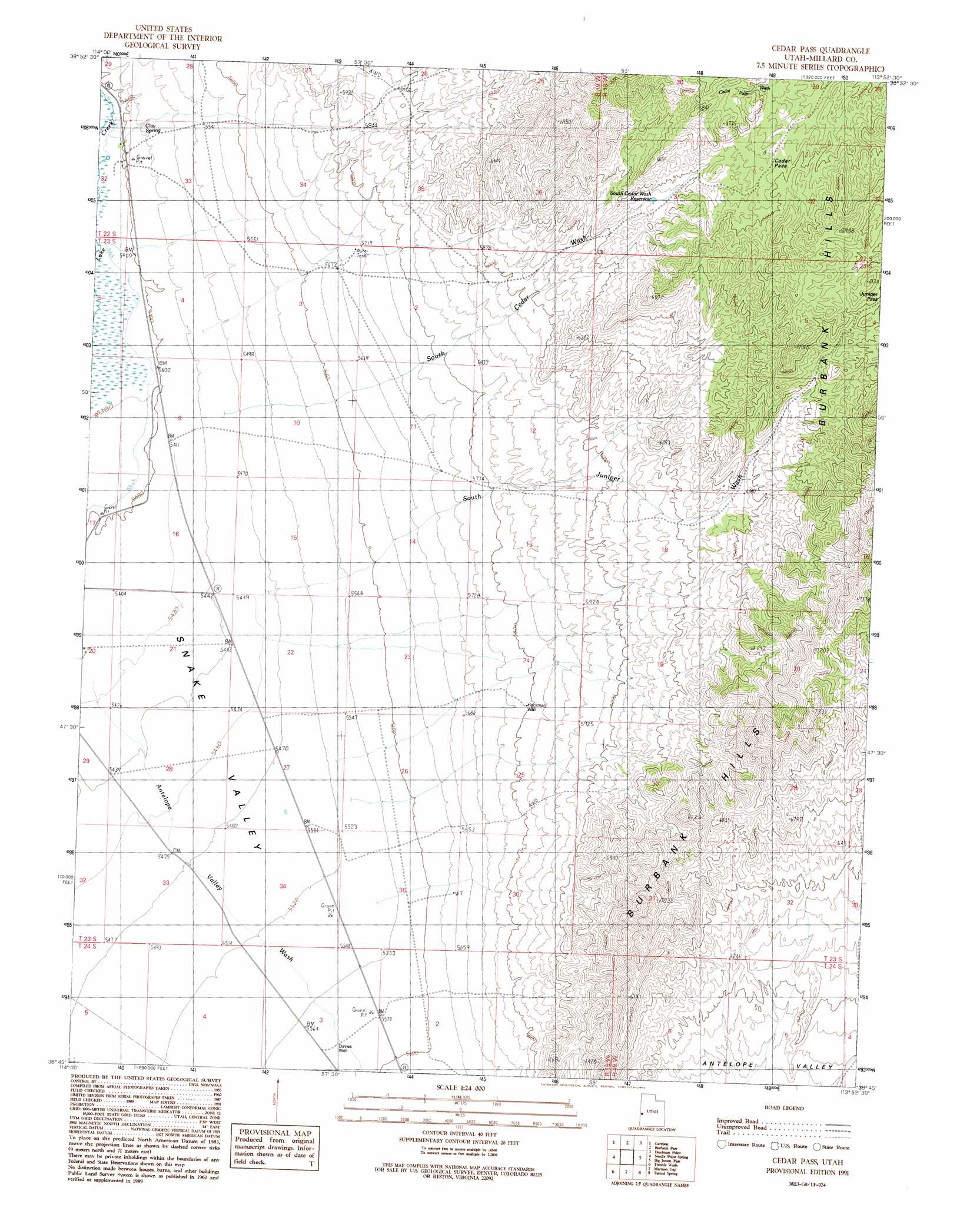
Cedar Pass Topo Map Utah
To zoom in, hover over the map of Cedar Pass
USGS Topo Quad 38113g8 - 1:24,000 scale
| Topo Map Name: | Cedar Pass |
| USGS Topo Quad ID: | 38113g8 |
| Print Size: | ca. 21 1/4" wide x 27" high |
| Southeast Coordinates: | 38.75° N latitude / 113.875° W longitude |
| Map Center Coordinates: | 38.8125° N latitude / 113.9375° W longitude |
| U.S. State: | UT |
| Filename: | o38113g8.jpg |
| Download Map JPG Image: | Cedar Pass topo map 1:24,000 scale |
| Map Type: | Topographic |
| Topo Series: | 7.5´ |
| Map Scale: | 1:24,000 |
| Source of Map Images: | United States Geological Survey (USGS) |
| Alternate Map Versions: |
Cedar Pass UT 1991, updated 1991 Download PDF Buy paper map Cedar Pass UT 2011 Download PDF Buy paper map Cedar Pass UT 2014 Download PDF Buy paper map |
1:24,000 Topo Quads surrounding Cedar Pass
Lehman Caves |
Baker |
Eskdale |
Buckskin Hills |
Thompson Knoll |
Kious Spring |
Garrison |
Burbank Pass |
Deadman Point |
Pyramid Knoll |
Arch Canyon |
Needle Point Spring |
Cedar Pass |
Big Jensen Pass |
Middle Mountain |
Big Springs |
Tweedy Wash |
Mormon Gap |
Tunnel Spring |
Pine Valley Hardpan North |
Hyde Well |
Miller Wash |
Mountain Home Pass |
Halfway Summit |
Pine Valley Hardpan South |
> Back to 38113e1 at 1:100,000 scale
> Back to 38112a1 at 1:250,000 scale
> Back to U.S. Topo Maps home
Cedar Pass topo map: Gazetteer
Cedar Pass: Arroyos
South Juniper Wash elevation 1767m 5797′Cedar Pass: Gaps
Cedar Pass elevation 1996m 6548′Juniper Pass elevation 2074m 6804′
Cedar Pass: Reservoirs
South Cedar Wash Reservoir elevation 1931m 6335′Cedar Pass: Springs
Clay Spring elevation 1659m 5442′Cedar Pass: Valleys
South Cedar Wash elevation 1732m 5682′Cedar Pass: Wells
Davies Well elevation 1701m 5580′Hockman Well elevation 1766m 5793′
Cedar Pass digital topo map on disk
Buy this Cedar Pass topo map showing relief, roads, GPS coordinates and other geographical features, as a high-resolution digital map file on DVD: