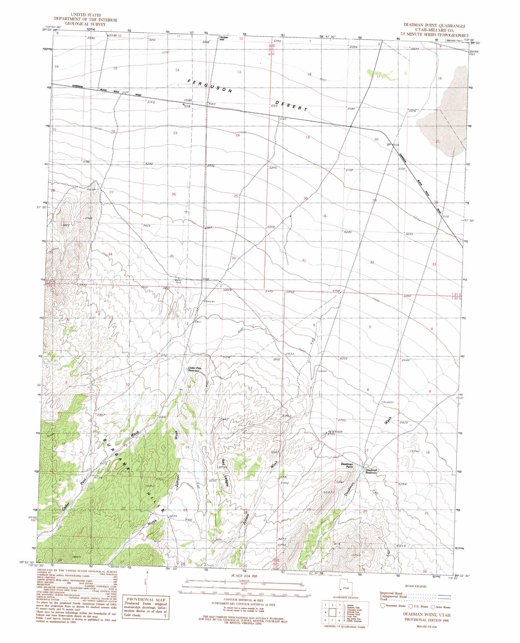
Deadman Point Topo Map Utah
To zoom in, hover over the map of Deadman Point
USGS Topo Quad 38113h7 - 1:24,000 scale
| Topo Map Name: | Deadman Point |
| USGS Topo Quad ID: | 38113h7 |
| Print Size: | ca. 21 1/4" wide x 27" high |
| Southeast Coordinates: | 38.875° N latitude / 113.75° W longitude |
| Map Center Coordinates: | 38.9375° N latitude / 113.8125° W longitude |
| U.S. State: | UT |
| Filename: | o38113h7.jpg |
| Download Map JPG Image: | Deadman Point topo map 1:24,000 scale |
| Map Type: | Topographic |
| Topo Series: | 7.5´ |
| Map Scale: | 1:24,000 |
| Source of Map Images: | United States Geological Survey (USGS) |
| Alternate Map Versions: |
Deadman Point UT 1991, updated 1991 Download PDF Buy paper map Deadman Point UT 2010 Download PDF Buy paper map Deadman Point UT 2014 Download PDF Buy paper map |
1:24,000 Topo Quads surrounding Deadman Point
The Cove |
Hole In The Ground |
Knoll Hill |
Conger Mountain |
Dowdell Canyon |
Baker |
Eskdale |
Buckskin Hills |
Thompson Knoll |
Bullgrass Knoll |
Garrison |
Burbank Pass |
Deadman Point |
Pyramid Knoll |
King Top |
Needle Point Spring |
Cedar Pass |
Big Jensen Pass |
Middle Mountain |
Crystal Peak |
Tweedy Wash |
Mormon Gap |
Tunnel Spring |
Pine Valley Hardpan North |
Grassy Cove |
> Back to 38113e1 at 1:100,000 scale
> Back to 38112a1 at 1:250,000 scale
> Back to U.S. Topo Maps home
Deadman Point topo map: Gazetteer
Deadman Point: Arroyos
Cedar Pass Wash elevation 1744m 5721′Jensen Wash elevation 1573m 5160′
North Juniper Wash elevation 1744m 5721′
Deadman Point: Benches
Red Ledges elevation 1828m 5997′Deadman Point: Cliffs
Deadman Point elevation 1801m 5908′Deadman Point: Reservoirs
Cedar Pass Reservoir elevation 1742m 5715′Deadman Reservoir elevation 1775m 5823′
Deadman Point: Wells
Hardpan Well elevation 1539m 5049′Deadman Point digital topo map on disk
Buy this Deadman Point topo map showing relief, roads, GPS coordinates and other geographical features, as a high-resolution digital map file on DVD: