Rosencrans Knolls Topo Map Nevada
To zoom in, hover over the map of Rosencrans Knolls
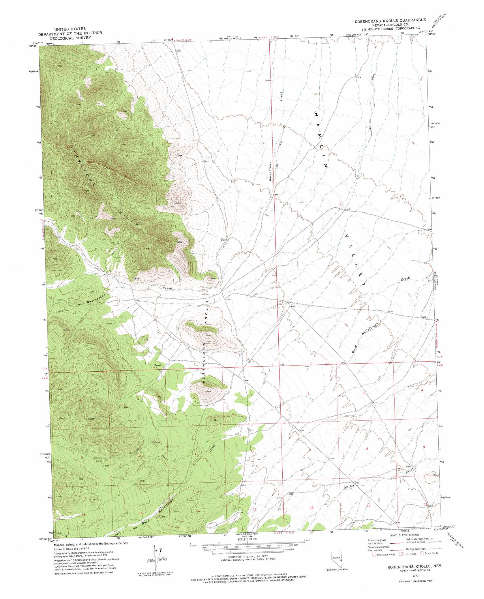
USGS Topo Quad 38114d2 - 1:24,000 scale
| Topo Map Name: | Rosencrans Knolls |
| USGS Topo Quad ID: | 38114d2 |
| Print Size: | ca. 21 1/4" wide x 27" high |
| Southeast Coordinates: | 38.375° N latitude / 114.125° W longitude |
| Map Center Coordinates: | 38.4375° N latitude / 114.1875° W longitude |
| U.S. State: | NV |
| Filename: | o38114d2.jpg |
| Download Map JPG Image: | Rosencrans Knolls topo map 1:24,000 scale |
| Map Type: | Topographic |
| Topo Series: | 7.5´ |
| Map Scale: | 1:24,000 |
| Source of Map Images: | United States Geological Survey (USGS) |
| Alternate Map Versions: |
Rosencrans Knolls NV 1972, updated 1974 Download PDF Buy paper map Rosencrans Knolls NV 2012 Download PDF Buy paper map Rosencrans Knolls NV 2014 Download PDF Buy paper map |
1:24,000 Topo Quads surrounding Rosencrans Knolls
Indian Springs Knolls |
Red Ledges |
Big Springs |
Tweedy Wash |
Mormon Gap |
The Gouge Eye |
Wells Summit |
Hyde Well |
Miller Wash |
Mountain Home Pass |
Horse Corral Pass |
Atlanta |
Rosencrans Knolls |
Hamlin Well |
Lopers Spring |
Schoolmarm Basin |
Trail Canyon |
Miller Canyon |
Gleason Basin |
Miners Cabin Wash |
Mount Wilson |
Parsnip Peak |
Buck Wash Well |
White Rock Peak |
Atchison Creek |
> Back to 38114a1 at 1:100,000 scale
> Back to 38114a1 at 1:250,000 scale
> Back to U.S. Topo Maps home
Rosencrans Knolls topo map: Gazetteer
Rosencrans Knolls: Summits
Rosencrans Knolls elevation 2092m 6863′Rosencrans Knolls digital topo map on disk
Buy this Rosencrans Knolls topo map showing relief, roads, GPS coordinates and other geographical features, as a high-resolution digital map file on DVD: