Mustang Well Topo Map Nevada
To zoom in, hover over the map of Mustang Well
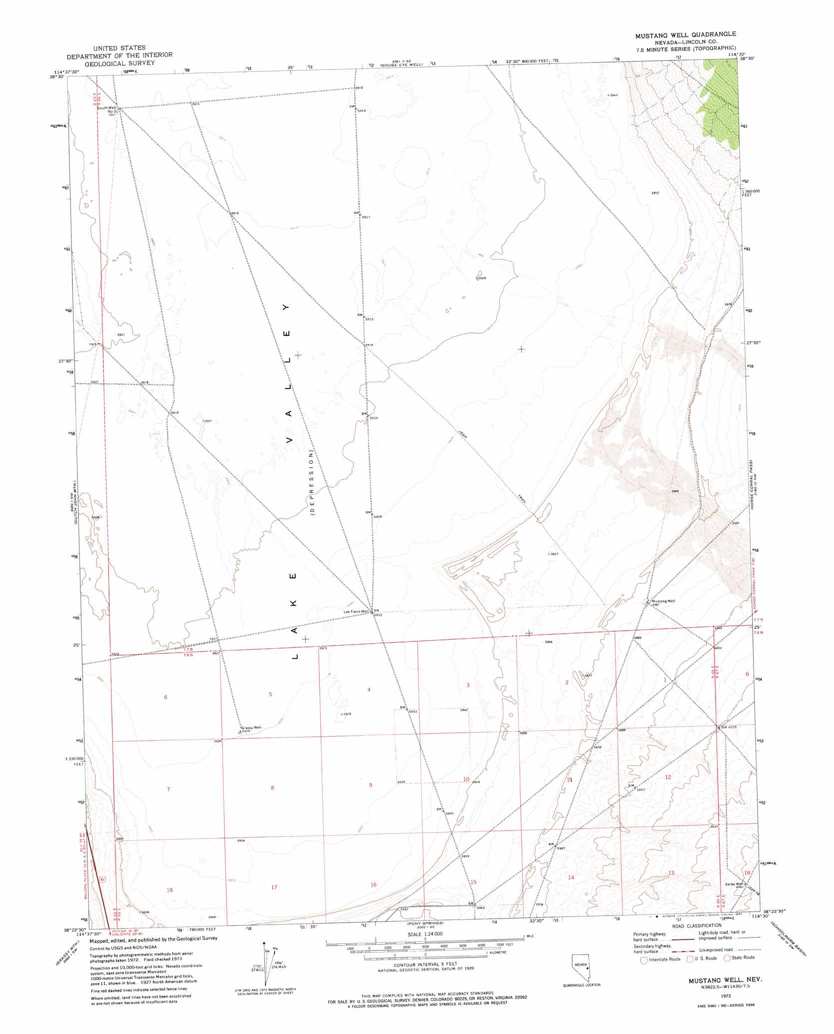
USGS Topo Quad 38114d5 - 1:24,000 scale
| Topo Map Name: | Mustang Well |
| USGS Topo Quad ID: | 38114d5 |
| Print Size: | ca. 21 1/4" wide x 27" high |
| Southeast Coordinates: | 38.375° N latitude / 114.5° W longitude |
| Map Center Coordinates: | 38.4375° N latitude / 114.5625° W longitude |
| U.S. State: | NV |
| Filename: | o38114d5.jpg |
| Download Map JPG Image: | Mustang Well topo map 1:24,000 scale |
| Map Type: | Topographic |
| Topo Series: | 7.5´ |
| Map Scale: | 1:24,000 |
| Source of Map Images: | United States Geological Survey (USGS) |
| Alternate Map Versions: |
Mustang Well NV 1973, updated 1977 Download PDF Buy paper map Mustang Well NV 2012 Download PDF Buy paper map Mustang Well NV 2014 Download PDF Buy paper map |
1:24,000 Topo Quads surrounding Mustang Well
Parker Station |
Mount Grafton |
Mount Grafton Ne |
Indian Springs Knolls |
Red Ledges |
Shingle Pass Se |
Milk Ranch Spring |
Gouge Eye Well |
The Gouge Eye |
Wells Summit |
Sidehill Spring |
Dutch John Mountain |
Mustang Well |
Horse Corral Pass |
Atlanta |
Sidehill Pass |
Grassy Mountain |
Pony Springs |
Schoolmarm Basin |
Trail Canyon |
Bailey Wash |
Fairview Peak |
Bristol Range Ne |
Mount Wilson |
Parsnip Peak |
> Back to 38114a1 at 1:100,000 scale
> Back to 38114a1 at 1:250,000 scale
> Back to U.S. Topo Maps home
Mustang Well topo map: Gazetteer
Mustang Well: Streams
Wilson Creek elevation 1826m 5990′Mustang Well: Wells
Grassy Well elevation 1809m 5935′Lee Travis Well elevation 1809m 5935′
Mustang Well elevation 1824m 5984′
South Well Number Three elevation 1806m 5925′
Valley Well elevation 1854m 6082′
Mustang Well digital topo map on disk
Buy this Mustang Well topo map showing relief, roads, GPS coordinates and other geographical features, as a high-resolution digital map file on DVD: