Hyde Well Topo Map Nevada
To zoom in, hover over the map of Hyde Well
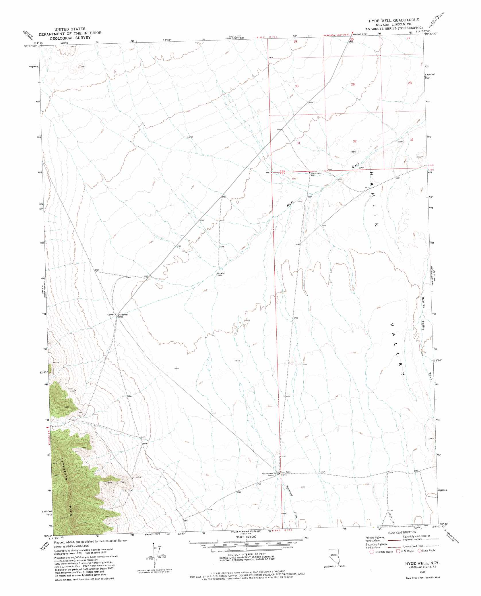
USGS Topo Quad 38114e2 - 1:24,000 scale
| Topo Map Name: | Hyde Well |
| USGS Topo Quad ID: | 38114e2 |
| Print Size: | ca. 21 1/4" wide x 27" high |
| Southeast Coordinates: | 38.5° N latitude / 114.125° W longitude |
| Map Center Coordinates: | 38.5625° N latitude / 114.1875° W longitude |
| U.S. State: | NV |
| Filename: | o38114e2.jpg |
| Download Map JPG Image: | Hyde Well topo map 1:24,000 scale |
| Map Type: | Topographic |
| Topo Series: | 7.5´ |
| Map Scale: | 1:24,000 |
| Source of Map Images: | United States Geological Survey (USGS) |
| Alternate Map Versions: |
Hyde Well NV 1972, updated 1974 Download PDF Buy paper map Hyde Well NV 1972, updated 1982 Download PDF Buy paper map Hyde Well NV 2012 Download PDF Buy paper map Hyde Well NV 2014 Download PDF Buy paper map |
1:24,000 Topo Quads surrounding Hyde Well
Minerva |
Minerva Canyon |
Arch Canyon |
Needle Point Spring |
Cedar Pass |
Indian Springs Knolls |
Red Ledges |
Big Springs |
Tweedy Wash |
Mormon Gap |
The Gouge Eye |
Wells Summit |
Hyde Well |
Miller Wash |
Mountain Home Pass |
Horse Corral Pass |
Atlanta |
Rosencrans Knolls |
Hamlin Well |
Lopers Spring |
Schoolmarm Basin |
Trail Canyon |
Miller Canyon |
Gleason Basin |
Miners Cabin Wash |
> Back to 38114e1 at 1:100,000 scale
> Back to 38114a1 at 1:250,000 scale
> Back to U.S. Topo Maps home
Hyde Well topo map: Gazetteer
Hyde Well: Streams
East Ditch elevation 1729m 5672′Rosencrans Creek elevation 1733m 5685′
West Ditch elevation 1733m 5685′
Hyde Well: Wells
Hyde Well elevation 1747m 5731′Monument Well elevation 1729m 5672′
Rosencrans Well elevation 1757m 5764′
Hyde Well digital topo map on disk
Buy this Hyde Well topo map showing relief, roads, GPS coordinates and other geographical features, as a high-resolution digital map file on DVD: