Shingle Pass Topo Map Nevada
To zoom in, hover over the map of Shingle Pass
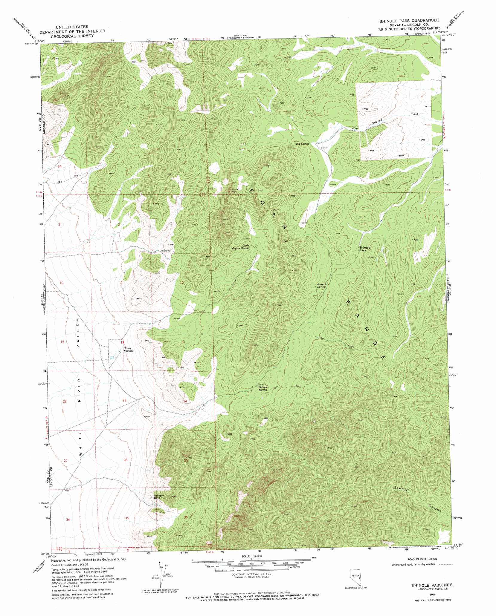
USGS Topo Quad 38114e8 - 1:24,000 scale
| Topo Map Name: | Shingle Pass |
| USGS Topo Quad ID: | 38114e8 |
| Print Size: | ca. 21 1/4" wide x 27" high |
| Southeast Coordinates: | 38.5° N latitude / 114.875° W longitude |
| Map Center Coordinates: | 38.5625° N latitude / 114.9375° W longitude |
| U.S. State: | NV |
| Filename: | o38114e8.jpg |
| Download Map JPG Image: | Shingle Pass topo map 1:24,000 scale |
| Map Type: | Topographic |
| Topo Series: | 7.5´ |
| Map Scale: | 1:24,000 |
| Source of Map Images: | United States Geological Survey (USGS) |
| Alternate Map Versions: |
Shingle Pass NV 1969, updated 1971 Download PDF Buy paper map Shingle Pass NV 2012 Download PDF Buy paper map Shingle Pass NV 2015 Download PDF Buy paper map |
1:24,000 Topo Quads surrounding Shingle Pass
Douglas |
Lund |
Brown Knoll |
Bullwhack Summit |
Cattle Camp Spring |
Moorman Spring Nw |
Hardy Springs |
Haggerty Spring |
Parker Station |
Mount Grafton |
Moorman Spring |
Moorman Spring Se |
Shingle Pass |
Shingle Pass Se |
Milk Ranch Spring |
Sunnyside Nw |
Sunnyside |
Cave Valley Well |
Sidehill Spring |
Dutch John Mountain |
Hot Creek Butte |
Gap Mountain |
Silver King Well |
Sidehill Pass |
Grassy Mountain |
> Back to 38114e1 at 1:100,000 scale
> Back to 38114a1 at 1:250,000 scale
> Back to U.S. Topo Maps home
Shingle Pass topo map: Gazetteer
Shingle Pass: Gaps
Shingle Pass elevation 2122m 6961′Shingle Pass: Springs
Big Spring elevation 2121m 6958′Granite Spring elevation 2088m 6850′
Little Geyser Spring elevation 2102m 6896′
Shingle Spring elevation 1964m 6443′
Silver Springs elevation 1819m 5967′
Shingle Pass: Summits
Shingle Peak elevation 2995m 9826′Shingle Pass digital topo map on disk
Buy this Shingle Pass topo map showing relief, roads, GPS coordinates and other geographical features, as a high-resolution digital map file on DVD: