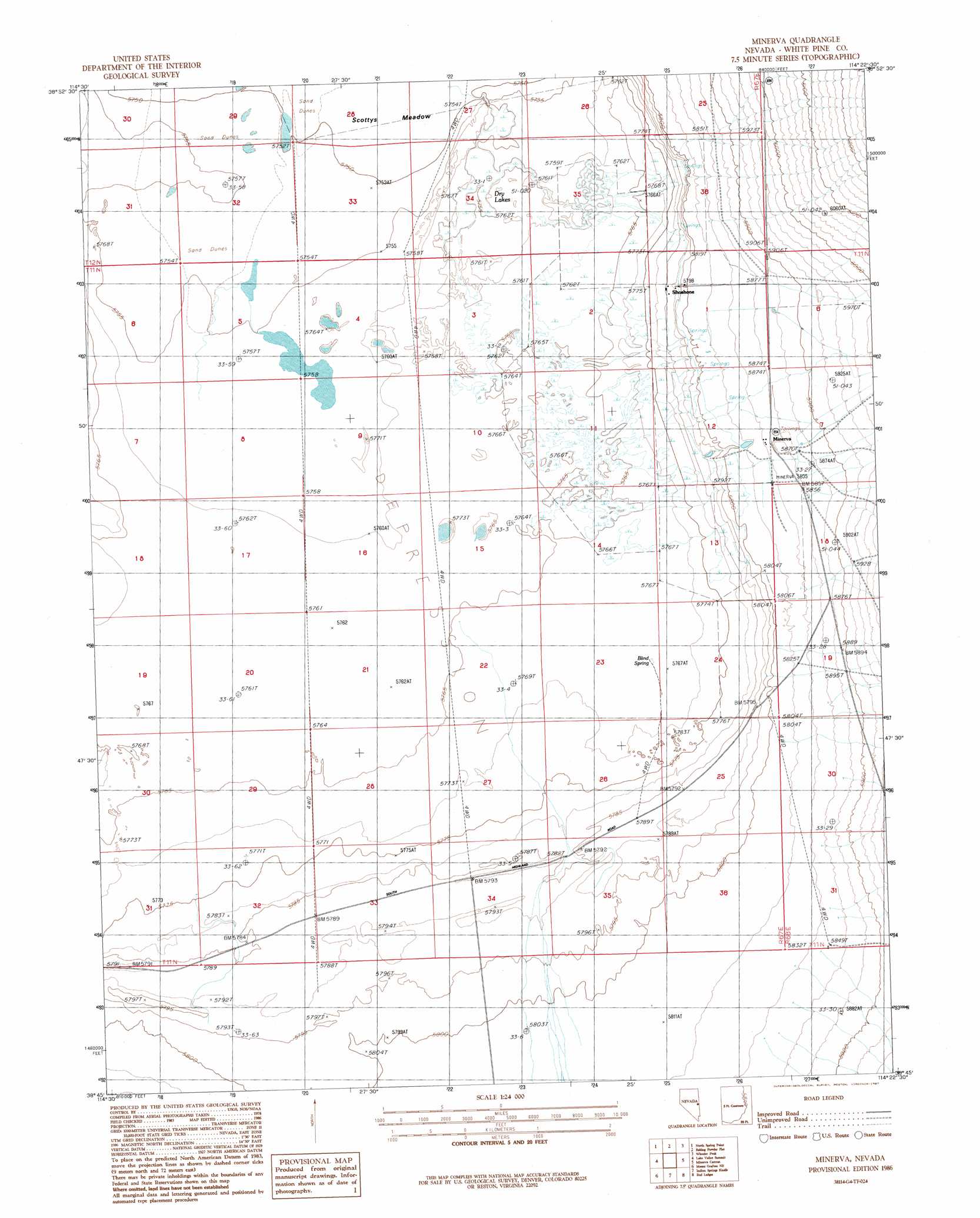
Minerva Topo Map Nevada
To zoom in, hover over the map of Minerva
USGS Topo Quad 38114g4 - 1:24,000 scale
| Topo Map Name: | Minerva |
| USGS Topo Quad ID: | 38114g4 |
| Print Size: | ca. 21 1/4" wide x 27" high |
| Southeast Coordinates: | 38.75° N latitude / 114.375° W longitude |
| Map Center Coordinates: | 38.8125° N latitude / 114.4375° W longitude |
| U.S. State: | NV |
| Filename: | o38114g4.jpg |
| Download Map JPG Image: | Minerva topo map 1:24,000 scale |
| Map Type: | Topographic |
| Topo Series: | 7.5´ |
| Map Scale: | 1:24,000 |
| Source of Map Images: | United States Geological Survey (USGS) |
| Alternate Map Versions: |
Minerva NV 1986, updated 1987 Download PDF Buy paper map Minerva NV 2012 Download PDF Buy paper map Minerva NV 2014 Download PDF Buy paper map |
1:24,000 Topo Quads surrounding Minerva
Connors Pass |
Majors Place |
Hogum |
Windy Peak |
Lehman Caves |
Horse Camp Springs |
North Spring Point |
Baking Powder Flat |
Wheeler Peak |
Kious Spring |
Cattle Camp Spring |
Lake Valley Summit |
Minerva |
Minerva Canyon |
Arch Canyon |
Mount Grafton |
Mount Grafton Ne |
Indian Springs Knolls |
Red Ledges |
Big Springs |
Milk Ranch Spring |
Gouge Eye Well |
The Gouge Eye |
Wells Summit |
Hyde Well |
> Back to 38114e1 at 1:100,000 scale
> Back to 38114a1 at 1:250,000 scale
> Back to U.S. Topo Maps home
Minerva topo map: Gazetteer
Minerva: Flats
Baking Powder Flat elevation 1755m 5757′Minerva: Lakes
Dry Lakes elevation 1756m 5761′Minerva: Populated Places
Minerva elevation 1786m 5859′Shoshone elevation 1765m 5790′
Minerva: Post Offices
Shoshone Post Office elevation 1765m 5790′Minerva: Springs
Blind Spring elevation 1760m 5774′Minerva digital topo map on disk
Buy this Minerva topo map showing relief, roads, GPS coordinates and other geographical features, as a high-resolution digital map file on DVD: