Garrison Topo Map Nevada
To zoom in, hover over the map of Garrison
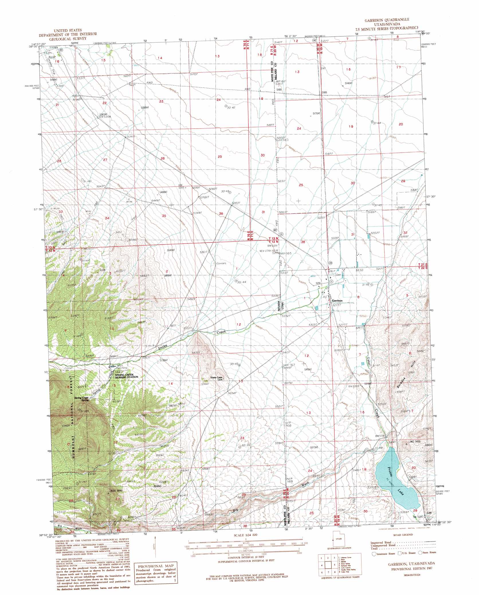
USGS Topo Quad 38114h1 - 1:24,000 scale
| Topo Map Name: | Garrison |
| USGS Topo Quad ID: | 38114h1 |
| Print Size: | ca. 21 1/4" wide x 27" high |
| Southeast Coordinates: | 38.875° N latitude / 114° W longitude |
| Map Center Coordinates: | 38.9375° N latitude / 114.0625° W longitude |
| U.S. States: | NV, UT |
| Filename: | o38114h1.jpg |
| Download Map JPG Image: | Garrison topo map 1:24,000 scale |
| Map Type: | Topographic |
| Topo Series: | 7.5´ |
| Map Scale: | 1:24,000 |
| Source of Map Images: | United States Geological Survey (USGS) |
| Alternate Map Versions: |
Garrison UT 1987, updated 1987 Download PDF Buy paper map Garrison UT 2012 Download PDF Buy paper map Garrison UT 2014 Download PDF Buy paper map Garrison UT 2017 Download PDF Buy paper map |
| FStopo: | US Forest Service topo Garrison is available: Download FStopo PDF Download FStopo TIF |
1:24,000 Topo Quads surrounding Garrison
Sacramento Pass |
Old Mans Canyon |
The Cove |
Hole In The Ground |
Knoll Hill |
Windy Peak |
Lehman Caves |
Baker |
Eskdale |
Buckskin Hills |
Wheeler Peak |
Kious Spring |
Garrison |
Burbank Pass |
Deadman Point |
Minerva Canyon |
Arch Canyon |
Needle Point Spring |
Cedar Pass |
Big Jensen Pass |
Red Ledges |
Big Springs |
Tweedy Wash |
Mormon Gap |
Tunnel Spring |
> Back to 38114e1 at 1:100,000 scale
> Back to 38114a1 at 1:250,000 scale
> Back to U.S. Topo Maps home
Garrison topo map: Gazetteer
Garrison: Airports
Baker Landing Strip elevation 1643m 5390′Garrison Airport elevation 1588m 5209′
Garrison: Dams
Pruess Lake Dam elevation 1645m 5396′Garrison: Populated Places
Garrison elevation 1608m 5275′Garrison: Post Offices
Garrison Post Office elevation 1608m 5275′Garrison: Reservoirs
Pruess Lake elevation 1645m 5396′Garrison: Springs
Spring Creek Spring elevation 1865m 6118′Garrison: Streams
Big Wash elevation 1634m 5360′Lake Creek elevation 1585m 5200′
Snake Creek elevation 1594m 5229′
Snake Creek elevation 1594m 5229′
Spring Creek elevation 1774m 5820′
Garrison: Valleys
Big Wash elevation 1647m 5403′Garrison digital topo map on disk
Buy this Garrison topo map showing relief, roads, GPS coordinates and other geographical features, as a high-resolution digital map file on DVD: