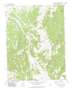
Horse Camp Springs Topo Map Nevada
To zoom in, hover over the map of Horse Camp Springs
USGS Topo Quad 38114h6 - 1:24,000 scale
| Topo Map Name: | Horse Camp Springs |
| USGS Topo Quad ID: | 38114h6 |
| Print Size: | ca. 21 1/4" wide x 27" high |
| Southeast Coordinates: | 38.875° N latitude / 114.625° W longitude |
| Map Center Coordinates: | 38.9375° N latitude / 114.6875° W longitude |
| U.S. State: | NV |
| Filename: | o38114h6.jpg |
| Download Map JPG Image: | Horse Camp Springs topo map 1:24,000 scale |
| Map Type: | Topographic |
| Topo Series: | 7.5´ |
| Map Scale: | 1:24,000 |
| Source of Map Images: | United States Geological Survey (USGS) |
| Alternate Map Versions: |
Horse Camp Springs NV 1973, updated 1977 Download PDF Buy paper map Horse Camp Springs NV 2012 Download PDF Buy paper map Horse Camp Springs NV 2014 Download PDF Buy paper map |
1:24,000 Topo Quads surrounding Horse Camp Springs
> Back to 38114e1 at 1:100,000 scale
> Back to 38114a1 at 1:250,000 scale
> Back to U.S. Topo Maps home
Horse Camp Springs topo map: Gazetteer
Horse Camp Springs: Reservoirs
Horse Camp Reservoir elevation 2140m 7020′Horse Camp Springs: Springs
Bennett Spring elevation 2581m 8467′Buck Spring elevation 2443m 8015′
Cherry Spring elevation 2300m 7545′
Cold Springs elevation 2555m 8382′
Cougar Spring elevation 2451m 8041′
Horse Camp Springs elevation 2293m 7522′
Limerock Spring elevation 2268m 7440′
North Horse Camp Spring elevation 2308m 7572′
Rock Spring elevation 2535m 8316′
South Horse Camp Spring elevation 2312m 7585′
Stevens Spring elevation 2480m 8136′
Summit Spring elevation 2456m 8057′
Horse Camp Springs digital topo map on disk
Buy this Horse Camp Springs topo map showing relief, roads, GPS coordinates and other geographical features, as a high-resolution digital map file on DVD:


