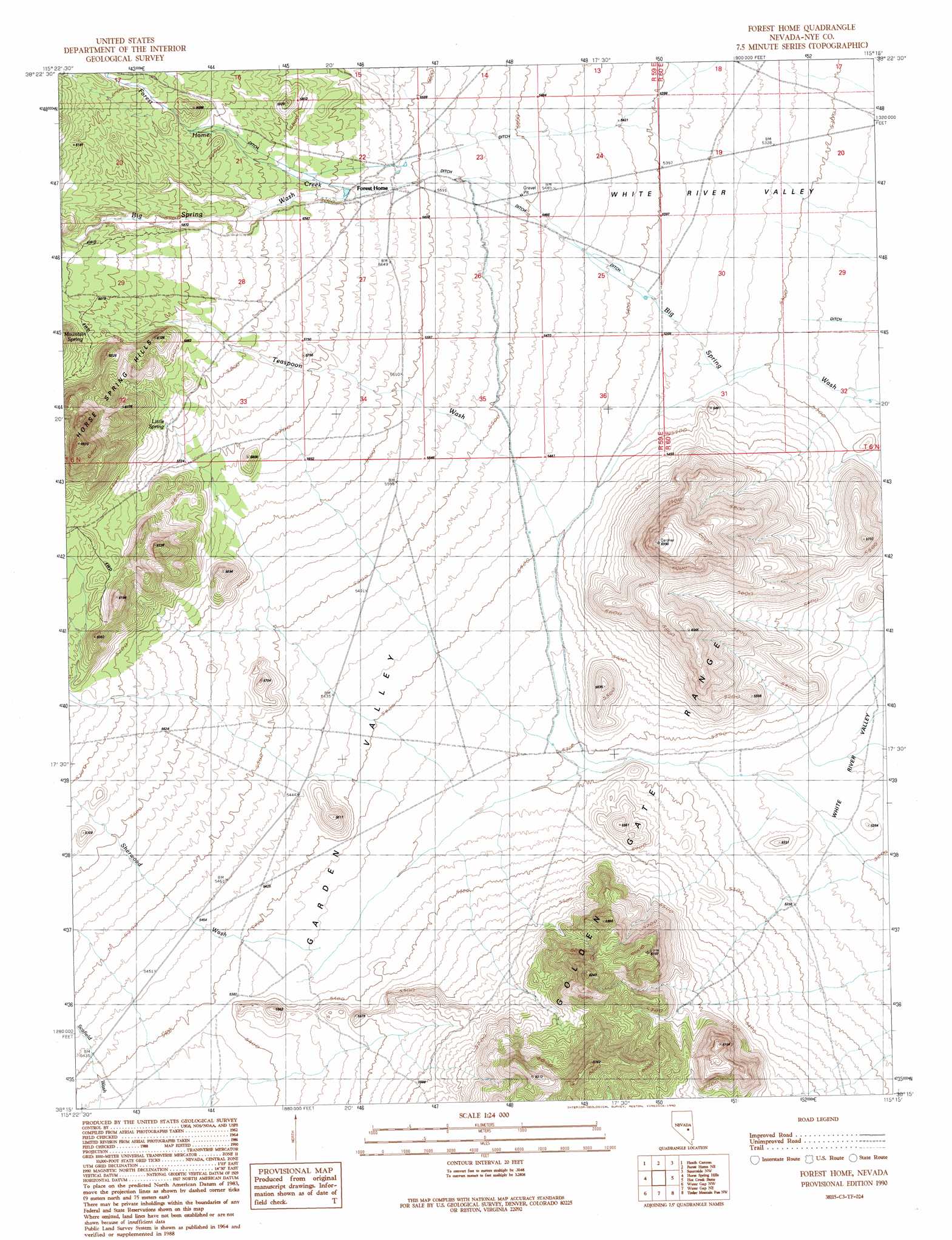
Forest Home Topo Map Nevada
To zoom in, hover over the map of Forest Home
USGS Topo Quad 38115c3 - 1:24,000 scale
| Topo Map Name: | Forest Home |
| USGS Topo Quad ID: | 38115c3 |
| Print Size: | ca. 21 1/4" wide x 27" high |
| Southeast Coordinates: | 38.25° N latitude / 115.25° W longitude |
| Map Center Coordinates: | 38.3125° N latitude / 115.3125° W longitude |
| U.S. State: | NV |
| Filename: | o38115c3.jpg |
| Download Map JPG Image: | Forest Home topo map 1:24,000 scale |
| Map Type: | Topographic |
| Topo Series: | 7.5´ |
| Map Scale: | 1:24,000 |
| Source of Map Images: | United States Geological Survey (USGS) |
| Alternate Map Versions: |
Forest Home NV 1990, updated 1990 Download PDF Buy paper map Forest Home NV 2012 Download PDF Buy paper map Forest Home NV 2014 Download PDF Buy paper map |
1:24,000 Topo Quads surrounding Forest Home
Blue Eagle Springs |
Blue Eagle Mountain |
Wells Station |
Moorman Spring |
Moorman Spring Se |
Bullwhacker Springs |
Heath Canyon |
Forest Home Ne |
Sunnyside Nw |
Sunnyside |
Troy Canyon |
Horse Spring Hills |
Forest Home |
Hot Creek Butte |
Gap Mountain |
Adaven |
Water Gap Nw |
Water Gap Ne |
Timber Mountain Pass Nw |
Timber Mountain Pass Ne |
Wadsworth Ranch |
Water Gap West |
Water Gap East |
Timber Mountain Pass West |
Timber Mountain Pass East |
> Back to 38115a1 at 1:100,000 scale
> Back to 38114a1 at 1:250,000 scale
> Back to U.S. Topo Maps home
Forest Home topo map: Gazetteer
Forest Home: Gaps
Moon River Gap elevation 1611m 5285′Forest Home: Reservoirs
Forest Home Reservoir Number 1 elevation 1618m 5308′Forest Home Reservoir Number 2 elevation 1648m 5406′
Forest Home Reservoir Number 3 elevation 1598m 5242′
Forest Home Reservoir Number 4 elevation 1731m 5679′
Forest Home: Springs
Little Spring elevation 1775m 5823′Forest Home: Streams
Forest Home Creek elevation 1731m 5679′Sherwood Wash elevation 1634m 5360′
Teaspoon Wash elevation 1645m 5396′
Forest Home digital topo map on disk
Buy this Forest Home topo map showing relief, roads, GPS coordinates and other geographical features, as a high-resolution digital map file on DVD: