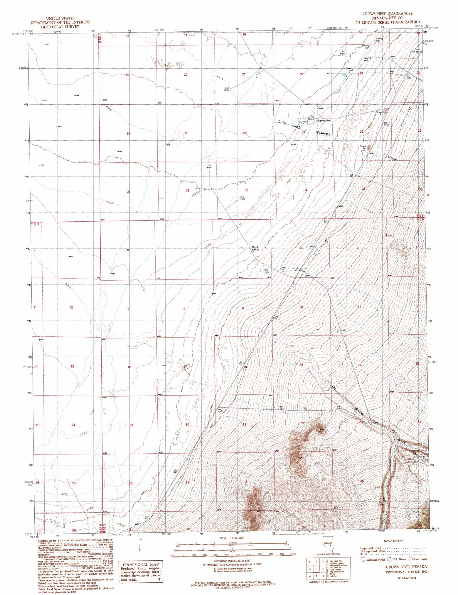
Crows Nest Topo Map Nevada
To zoom in, hover over the map of Crows Nest
USGS Topo Quad 38115c6 - 1:24,000 scale
| Topo Map Name: | Crows Nest |
| USGS Topo Quad ID: | 38115c6 |
| Print Size: | ca. 21 1/4" wide x 27" high |
| Southeast Coordinates: | 38.25° N latitude / 115.625° W longitude |
| Map Center Coordinates: | 38.3125° N latitude / 115.6875° W longitude |
| U.S. State: | NV |
| Filename: | o38115c6.jpg |
| Download Map JPG Image: | Crows Nest topo map 1:24,000 scale |
| Map Type: | Topographic |
| Topo Series: | 7.5´ |
| Map Scale: | 1:24,000 |
| Source of Map Images: | United States Geological Survey (USGS) |
| Alternate Map Versions: |
Crows Nest NV 1990, updated 1990 Download PDF Buy paper map Crows Nest NV 2012 Download PDF Buy paper map Crows Nest NV 2014 Download PDF Buy paper map |
1:24,000 Topo Quads surrounding Crows Nest
Black Rock Summit |
Lockes |
Blue Eagle Springs Sw |
Blue Eagle Springs |
Blue Eagle Mountain |
The Wall |
The Wall Ne |
Christian Spring |
Bullwhacker Springs |
Heath Canyon |
The Wall Sw |
The Wall Se |
Crows Nest |
Troy Canyon |
Horse Spring Hills |
Goat Ranch Well |
Big Creek Ranch |
Nyala |
Adaven |
Water Gap Nw |
Eds Well |
Goat Ranch Springs |
Badger Gulch |
Wadsworth Ranch |
Water Gap West |
> Back to 38115a1 at 1:100,000 scale
> Back to 38114a1 at 1:250,000 scale
> Back to U.S. Topo Maps home
Crows Nest topo map: Gazetteer
Crows Nest: Flats
Evans Field elevation 1447m 4747′Crows Nest: Populated Places
Crows Nest elevation 1451m 4760′Crows Nest: Springs
Blind Spring elevation 1460m 4790′Crows Nest Spring elevation 1451m 4760′
Crows Nest: Streams
Bordoli Creek elevation 1681m 5515′Hooper Creek elevation 1657m 5436′
Little Meadows Creek elevation 1443m 4734′
Ox Spring Wash elevation 1461m 4793′
Crows Nest: Valleys
Hooper Canyon elevation 1666m 5465′Crows Nest digital topo map on disk
Buy this Crows Nest topo map showing relief, roads, GPS coordinates and other geographical features, as a high-resolution digital map file on DVD: