The Wall Ne Topo Map Nevada
To zoom in, hover over the map of The Wall Ne
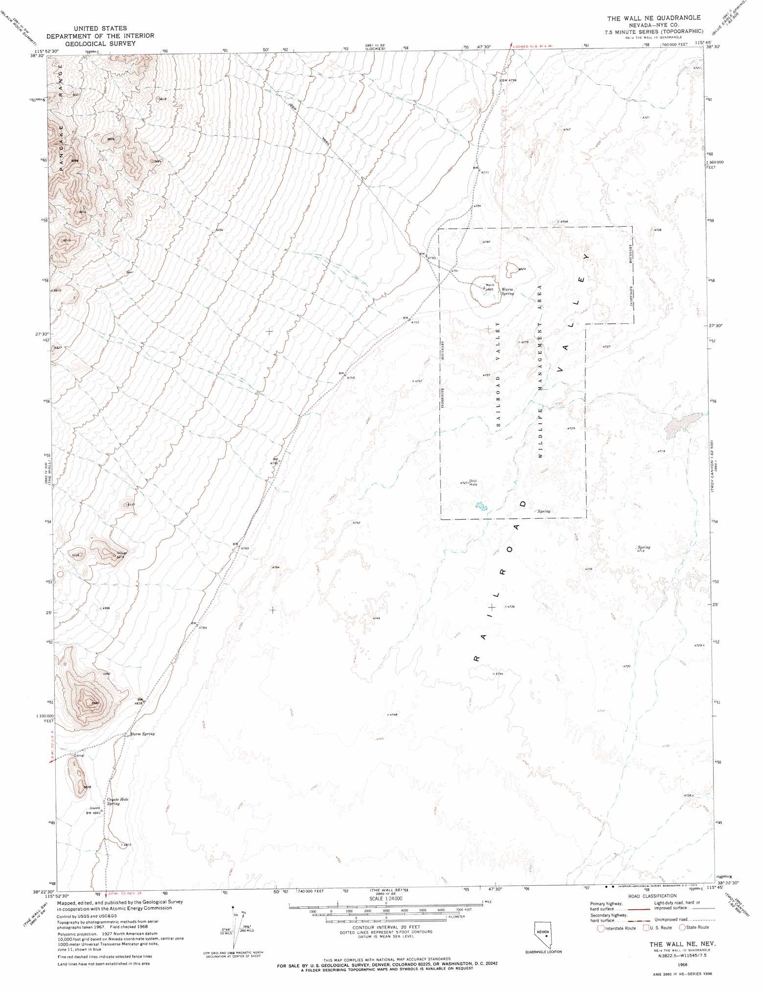
USGS Topo Quad 38115d7 - 1:24,000 scale
| Topo Map Name: | The Wall Ne |
| USGS Topo Quad ID: | 38115d7 |
| Print Size: | ca. 21 1/4" wide x 27" high |
| Southeast Coordinates: | 38.375° N latitude / 115.75° W longitude |
| Map Center Coordinates: | 38.4375° N latitude / 115.8125° W longitude |
| U.S. State: | NV |
| Filename: | o38115d7.jpg |
| Download Map JPG Image: | The Wall Ne topo map 1:24,000 scale |
| Map Type: | Topographic |
| Topo Series: | 7.5´ |
| Map Scale: | 1:24,000 |
| Source of Map Images: | United States Geological Survey (USGS) |
| Alternate Map Versions: |
The Wall NE NV 1968, updated 1973 Download PDF Buy paper map The Wall NE NV 2012 Download PDF Buy paper map The Wall NE NV 2014 Download PDF Buy paper map |
1:24,000 Topo Quads surrounding The Wall Ne
Chaos Creek |
Portuguese Mountain Nw |
Portuguese Mountain |
Meteorite Crater |
Blue Eagle Springs Ne |
Moores Station Se |
Black Rock Summit |
Lockes |
Blue Eagle Springs Sw |
Blue Eagle Springs |
Lunar Crater |
The Wall |
The Wall Ne |
Christian Spring |
Bullwhacker Springs |
Chuck Wagon Flat |
The Wall Sw |
The Wall Se |
Crows Nest |
Troy Canyon |
Echo Canyon |
Goat Ranch Well |
Big Creek Ranch |
Nyala |
Adaven |
> Back to 38115a1 at 1:100,000 scale
> Back to 38114a1 at 1:250,000 scale
> Back to U.S. Topo Maps home
The Wall Ne topo map: Gazetteer
The Wall Ne: Springs
Coyote Hole Spring elevation 1469m 4819′Storm Spring elevation 1465m 4806′
Warm Spring elevation 1464m 4803′
The Wall Ne digital topo map on disk
Buy this The Wall Ne topo map showing relief, roads, GPS coordinates and other geographical features, as a high-resolution digital map file on DVD: