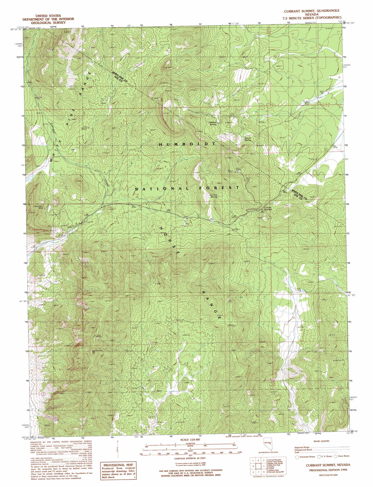
Currant Summit Topo Map Nevada
To zoom in, hover over the map of Currant Summit
USGS Topo Quad 38115g3 - 1:24,000 scale
| Topo Map Name: | Currant Summit |
| USGS Topo Quad ID: | 38115g3 |
| Print Size: | ca. 21 1/4" wide x 27" high |
| Southeast Coordinates: | 38.75° N latitude / 115.25° W longitude |
| Map Center Coordinates: | 38.8125° N latitude / 115.3125° W longitude |
| U.S. State: | NV |
| Filename: | o38115g3.jpg |
| Download Map JPG Image: | Currant Summit topo map 1:24,000 scale |
| Map Type: | Topographic |
| Topo Series: | 7.5´ |
| Map Scale: | 1:24,000 |
| Source of Map Images: | United States Geological Survey (USGS) |
| Alternate Map Versions: |
Currant Summit NV 1990, updated 1990 Download PDF Buy paper map Currant Summit NV 2012 Download PDF Buy paper map Currant Summit NV 2014 Download PDF Buy paper map |
| FStopo: | US Forest Service topo Currant Summit is available: Download FStopo PDF Download FStopo TIF |
1:24,000 Topo Quads surrounding Currant Summit
Green Springs |
Indian Garden Mountain |
Easter Springs |
Blackjack Springs |
Preston Reservoir |
Duckwater Ne |
Currant Mountain |
Horse Track Spring |
Badger Hole Spring |
Preston |
Duckwater Se |
White Pine Peak |
Currant Summit |
Douglas |
Lund |
Blue Eagle Springs Ne |
Currant |
Callaway Well |
Moorman Spring Nw |
Hardy Springs |
Blue Eagle Springs |
Blue Eagle Mountain |
Wells Station |
Moorman Spring |
Moorman Spring Se |
> Back to 38115e1 at 1:100,000 scale
> Back to 38114a1 at 1:250,000 scale
> Back to U.S. Topo Maps home
Currant Summit topo map: Gazetteer
Currant Summit: Mines
Ala-Mar East Mine elevation 2232m 7322′Ala-Mar West Mine elevation 2341m 7680′
Gold Point Mine elevation 2024m 6640′
Currant Summit: Populated Places
Gold Point (historical) elevation 1908m 6259′Currant Summit: Springs
Hidden Spring elevation 2139m 7017′Secret Spring elevation 2114m 6935′
Summit Spring elevation 2083m 6833′
Currant Summit: Summits
Currant Summit elevation 2209m 7247′Currant Summit digital topo map on disk
Buy this Currant Summit topo map showing relief, roads, GPS coordinates and other geographical features, as a high-resolution digital map file on DVD: