Badger Hole Spring Topo Map Nevada
To zoom in, hover over the map of Badger Hole Spring
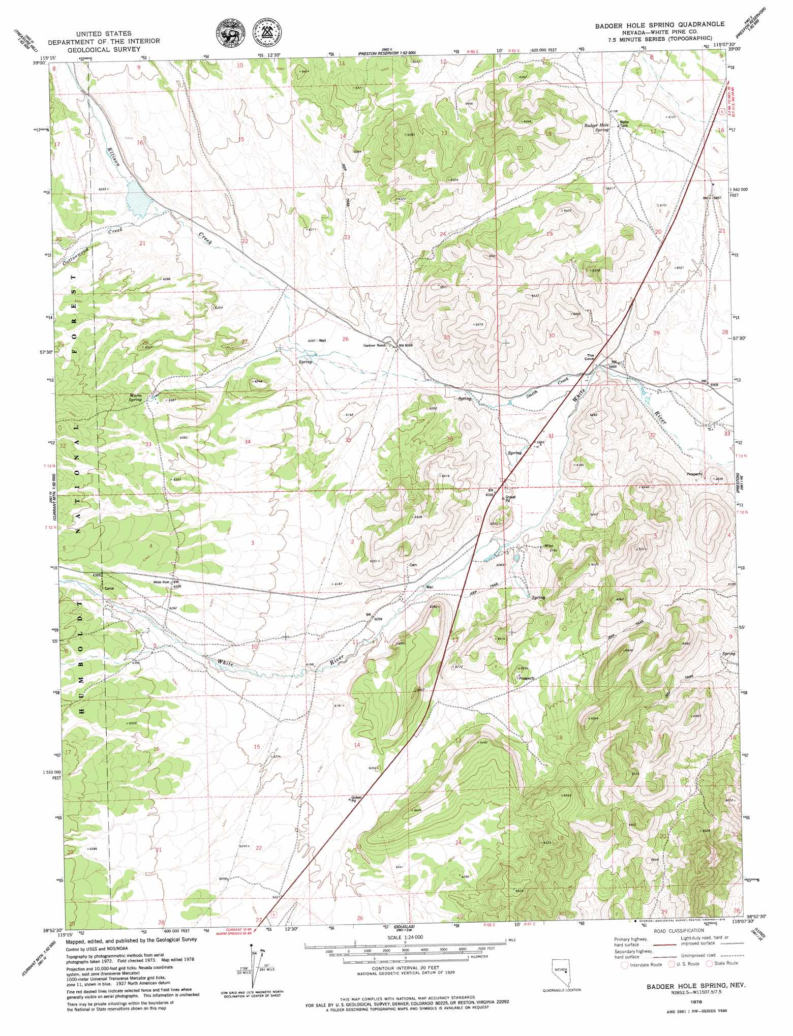
USGS Topo Quad 38115h2 - 1:24,000 scale
| Topo Map Name: | Badger Hole Spring |
| USGS Topo Quad ID: | 38115h2 |
| Print Size: | ca. 21 1/4" wide x 27" high |
| Southeast Coordinates: | 38.875° N latitude / 115.125° W longitude |
| Map Center Coordinates: | 38.9375° N latitude / 115.1875° W longitude |
| U.S. State: | NV |
| Filename: | o38115h2.jpg |
| Download Map JPG Image: | Badger Hole Spring topo map 1:24,000 scale |
| Map Type: | Topographic |
| Topo Series: | 7.5´ |
| Map Scale: | 1:24,000 |
| Source of Map Images: | United States Geological Survey (USGS) |
| Alternate Map Versions: |
Badger Hole Spring NV 1978, updated 1979 Download PDF Buy paper map Badger Hole Spring NV 2012 Download PDF Buy paper map Badger Hole Spring NV 2014 Download PDF Buy paper map |
| FStopo: | US Forest Service topo Badger Hole Spring is available: Download FStopo PDF Download FStopo TIF |
1:24,000 Topo Quads surrounding Badger Hole Spring
Treasure Hill |
Limestone Peak |
Railroad Crossing Dam |
Giroux Wash |
Ely |
Indian Garden Mountain |
Easter Springs |
Blackjack Springs |
Preston Reservoir |
Ward Mountain |
Currant Mountain |
Horse Track Spring |
Badger Hole Spring |
Preston |
Sawmill Canyon |
White Pine Peak |
Currant Summit |
Douglas |
Lund |
Brown Knoll |
Currant |
Callaway Well |
Moorman Spring Nw |
Hardy Springs |
Haggerty Spring |
> Back to 38115e1 at 1:100,000 scale
> Back to 38114a1 at 1:250,000 scale
> Back to U.S. Topo Maps home
Badger Hole Spring topo map: Gazetteer
Badger Hole Spring: Basins
The Cove elevation 1804m 5918′Badger Hole Spring: Mines
Windous Mine elevation 1854m 6082′Badger Hole Spring: Populated Places
Barnes (historical) elevation 1787m 5862′Stockville (historical) elevation 1831m 6007′
Badger Hole Spring: Post Offices
Barnes Post Office (historical) elevation 1787m 5862′Stockville Post Office (historical) elevation 1831m 6007′
Badger Hole Spring: Springs
Badger Hole Spring elevation 1877m 6158′Warm Spring elevation 1933m 6341′
Badger Hole Spring: Streams
Cottonwood Creek elevation 1901m 6236′Ellison Creek elevation 1858m 6095′
Smith Creek elevation 1799m 5902′
Badger Hole Spring digital topo map on disk
Buy this Badger Hole Spring topo map showing relief, roads, GPS coordinates and other geographical features, as a high-resolution digital map file on DVD: