Reveille Topo Map Nevada
To zoom in, hover over the map of Reveille
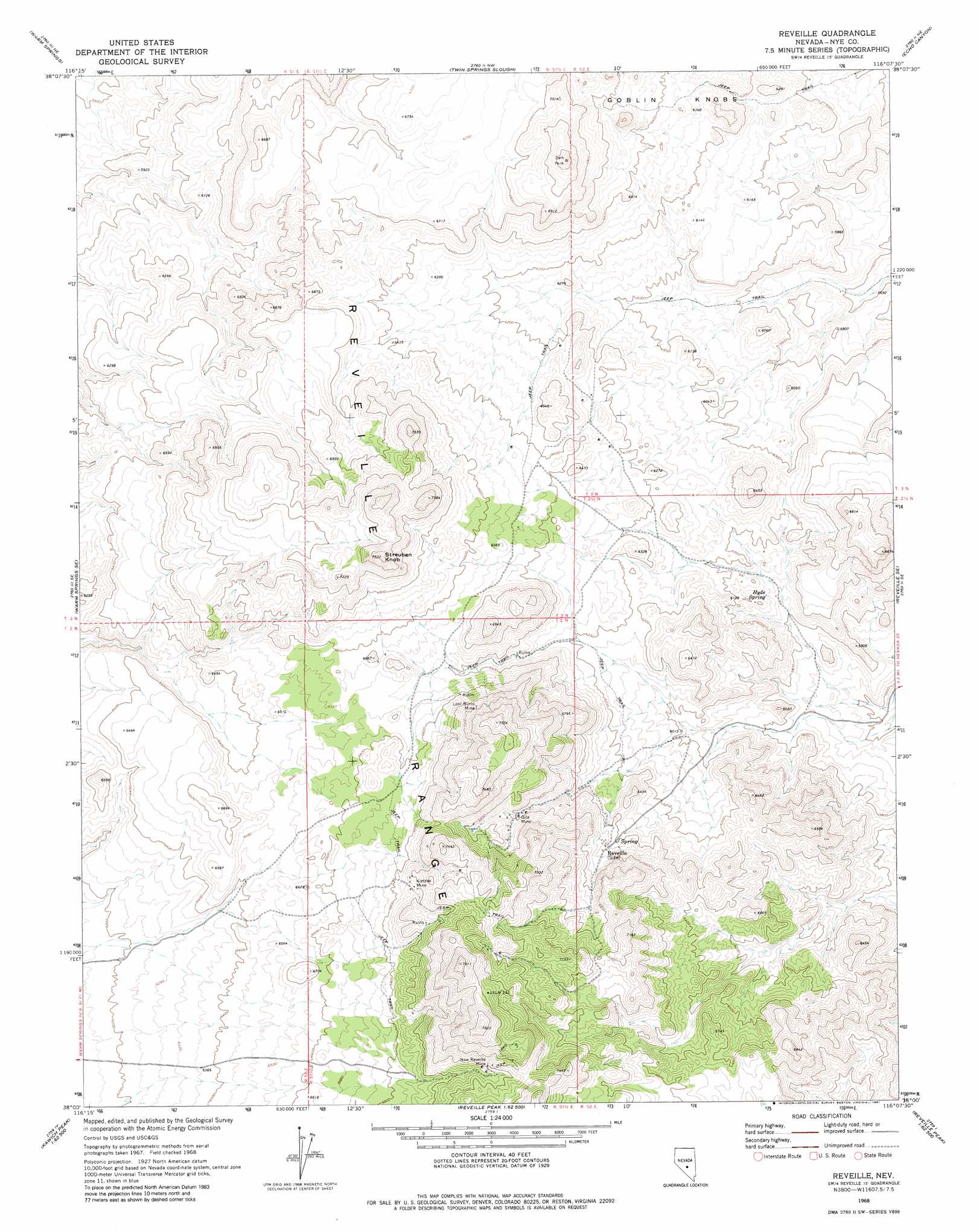
USGS Topo Quad 38116a2 - 1:24,000 scale
| Topo Map Name: | Reveille |
| USGS Topo Quad ID: | 38116a2 |
| Print Size: | ca. 21 1/4" wide x 27" high |
| Southeast Coordinates: | 38° N latitude / 116.125° W longitude |
| Map Center Coordinates: | 38.0625° N latitude / 116.1875° W longitude |
| U.S. State: | NV |
| Filename: | o38116a2.jpg |
| Download Map JPG Image: | Reveille topo map 1:24,000 scale |
| Map Type: | Topographic |
| Topo Series: | 7.5´ |
| Map Scale: | 1:24,000 |
| Source of Map Images: | United States Geological Survey (USGS) |
| Alternate Map Versions: |
Reveille NV 1968, updated 1973 Download PDF Buy paper map Reveille NV 1968, updated 1981 Download PDF Buy paper map Reveille NV 2012 Download PDF Buy paper map Reveille NV 2014 Download PDF Buy paper map |
1:24,000 Topo Quads surrounding Reveille
Tybo |
Tybo Well |
Buckwheat Rim |
Chuck Wagon Flat |
The Wall Sw |
Warm Springs Summit |
Warm Springs |
Twin Springs Slough |
Echo Canyon |
Goat Ranch Well |
Bellehelen |
Warm Springs Se |
Reveille |
Reveille Se |
Eds Well |
Kawich Peak |
Kawich Peak Ne |
Reveille Peak Nw |
Freds Well |
Quinn Canyon Springs Nw |
Kawich Peak Sw |
Georges Well |
Reveille Peak |
Reveille Peak Se |
Black Top |
> Back to 38116a1 at 1:100,000 scale
> Back to 38116a1 at 1:250,000 scale
> Back to U.S. Topo Maps home
Reveille topo map: Gazetteer
Reveille: Mines
Andrews Mine elevation 2085m 6840′Arrowhead Extension Mine elevation 1909m 6263′
Arrowhead Mine elevation 1923m 6309′
Dooley Mine elevation 2085m 6840′
Gila Mine elevation 2022m 6633′
Kietzke Mine elevation 2109m 6919′
Liberty Mine elevation 2085m 6840′
Lost Burro Mine elevation 2090m 6856′
New Reveille Mine elevation 2206m 7237′
Silvermonial Mine elevation 2192m 7191′
Summit Mine elevation 2085m 6840′
Van Moner Mine elevation 2085m 6840′
Vulcan Mine elevation 2085m 6840′
Reveille: Populated Places
New Reveille (historical) elevation 2193m 7194′Old Reveille (historical) elevation 2008m 6587′
Reveille (historical) elevation 1972m 6469′
Reveille: Post Offices
Arrowhead Post Office (historical) elevation 1996m 6548′Reveille Post Office (historical) elevation 2193m 7194′
Reveille Post Office (historical) elevation 1971m 6466′
Reveille: Ranges
Reveille Range elevation 2025m 6643′Reveille: Springs
Hyde Spring elevation 1793m 5882′Reveille: Summits
Streuben Knob elevation 2281m 7483′Reveille digital topo map on disk
Buy this Reveille topo map showing relief, roads, GPS coordinates and other geographical features, as a high-resolution digital map file on DVD: