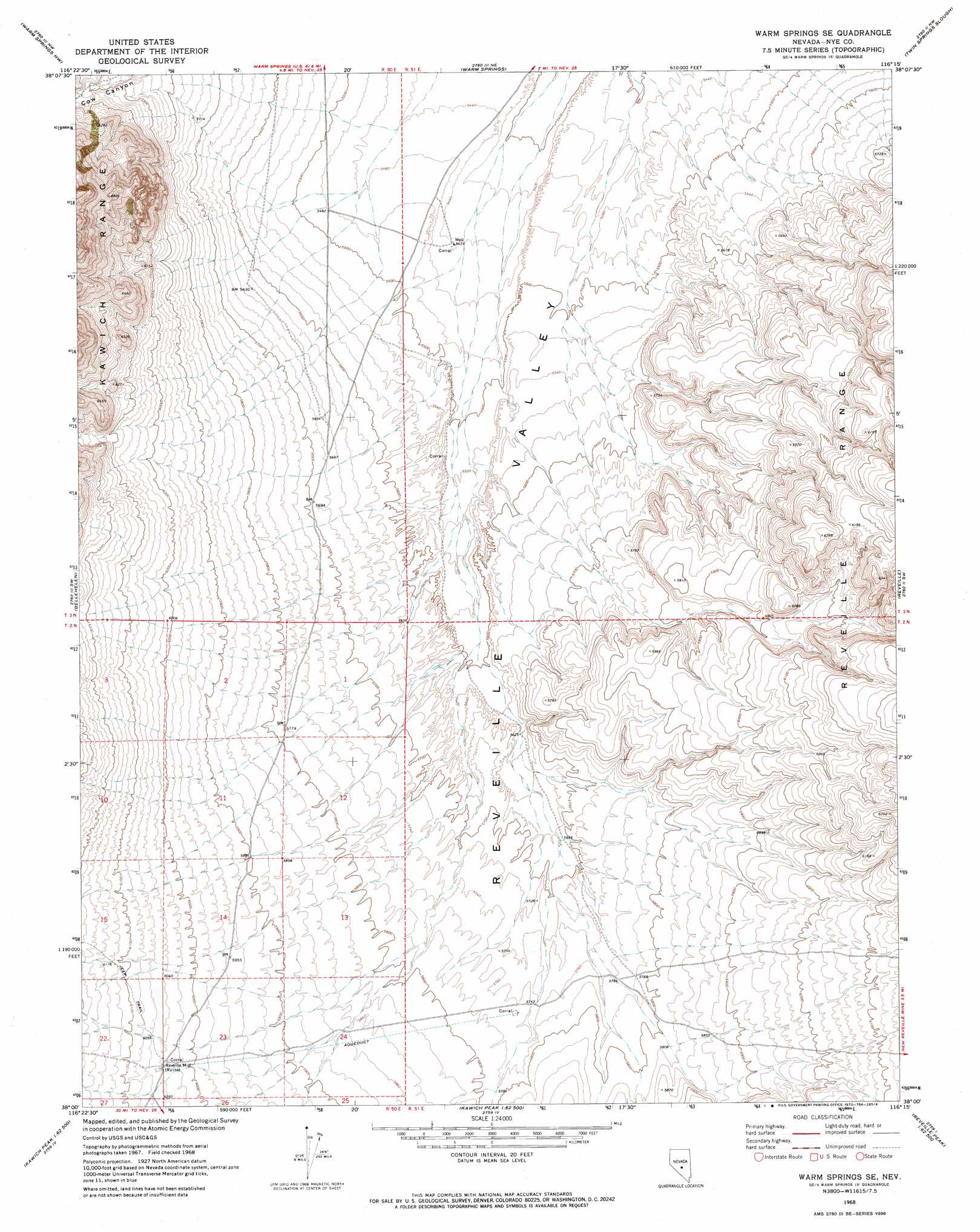
Warm Springs Se Topo Map Nevada
To zoom in, hover over the map of Warm Springs Se
USGS Topo Quad 38116a3 - 1:24,000 scale
| Topo Map Name: | Warm Springs Se |
| USGS Topo Quad ID: | 38116a3 |
| Print Size: | ca. 21 1/4" wide x 27" high |
| Southeast Coordinates: | 38° N latitude / 116.25° W longitude |
| Map Center Coordinates: | 38.0625° N latitude / 116.3125° W longitude |
| U.S. State: | NV |
| Filename: | o38116a3.jpg |
| Download Map JPG Image: | Warm Springs Se topo map 1:24,000 scale |
| Map Type: | Topographic |
| Topo Series: | 7.5´ |
| Map Scale: | 1:24,000 |
| Source of Map Images: | United States Geological Survey (USGS) |
| Alternate Map Versions: |
Warm Springs SE NV 1968, updated 1973 Download PDF Buy paper map Warm Springs SE NV 1968, updated 1973 Download PDF Buy paper map Warm Springs SE NV 2012 Download PDF Buy paper map Warm Springs SE NV 2014 Download PDF Buy paper map |
1:24,000 Topo Quads surrounding Warm Springs Se
Georges Canyon Rim Se |
Tybo |
Tybo Well |
Buckwheat Rim |
Chuck Wagon Flat |
Stone Cabin Ranch Ne |
Warm Springs Summit |
Warm Springs |
Twin Springs Slough |
Echo Canyon |
Stone Cabin Ranch Se |
Bellehelen |
Warm Springs Se |
Reveille |
Reveille Se |
Stinking Spring |
Kawich Peak |
Kawich Peak Ne |
Reveille Peak Nw |
Freds Well |
Breen Creek |
Kawich Peak Sw |
Georges Well |
Reveille Peak |
Reveille Peak Se |
> Back to 38116a1 at 1:100,000 scale
> Back to 38116a1 at 1:250,000 scale
> Back to U.S. Topo Maps home
Warm Springs Se digital topo map on disk
Buy this Warm Springs Se topo map showing relief, roads, GPS coordinates and other geographical features, as a high-resolution digital map file on DVD: