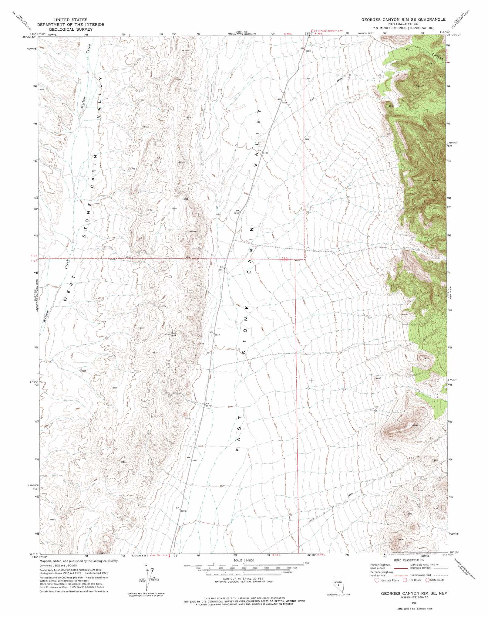
Georges Canyon Rim Se Topo Map Nevada
To zoom in, hover over the map of Georges Canyon Rim Se
USGS Topo Quad 38116c5 - 1:24,000 scale
| Topo Map Name: | Georges Canyon Rim Se |
| USGS Topo Quad ID: | 38116c5 |
| Print Size: | ca. 21 1/4" wide x 27" high |
| Southeast Coordinates: | 38.25° N latitude / 116.5° W longitude |
| Map Center Coordinates: | 38.3125° N latitude / 116.5625° W longitude |
| U.S. State: | NV |
| Filename: | o38116c5.jpg |
| Download Map JPG Image: | Georges Canyon Rim Se topo map 1:24,000 scale |
| Map Type: | Topographic |
| Topo Series: | 7.5´ |
| Map Scale: | 1:24,000 |
| Source of Map Images: | United States Geological Survey (USGS) |
| Alternate Map Versions: |
Georges Canyon Rim SE NV 1971, updated 1974 Download PDF Buy paper map Georges Canyon Rim SE NV 2012 Download PDF Buy paper map Georges Canyon Rim SE NV 2014 Download PDF Buy paper map |
1:24,000 Topo Quads surrounding Georges Canyon Rim Se
Belmont East |
Elkhorn Canyon |
Eagle Pass |
Little Fish Lake |
Hobble Canyon |
Big Ten Peak East |
Mccann Canyon |
Mcintyre Summit |
Flagstaff Mountain |
Blue Jay Spring |
Saulsbury Basin |
Georges Canyon Rim |
Georges Canyon Rim Se |
Tybo |
Tybo Well |
Mud Spring |
Stone Cabin Ranch |
Stone Cabin Ranch Ne |
Warm Springs Summit |
Warm Springs |
Yellow Cone |
Stone Cabin Ranch Sw |
Stone Cabin Ranch Se |
Bellehelen |
Warm Springs Se |
> Back to 38116a1 at 1:100,000 scale
> Back to 38116a1 at 1:250,000 scale
> Back to U.S. Topo Maps home
Georges Canyon Rim Se topo map: Gazetteer
Georges Canyon Rim Se: Valleys
Kiln Canyon elevation 2006m 6581′Georges Canyon Rim Se digital topo map on disk
Buy this Georges Canyon Rim Se topo map showing relief, roads, GPS coordinates and other geographical features, as a high-resolution digital map file on DVD: