Antelope Spring Topo Map Nevada
To zoom in, hover over the map of Antelope Spring
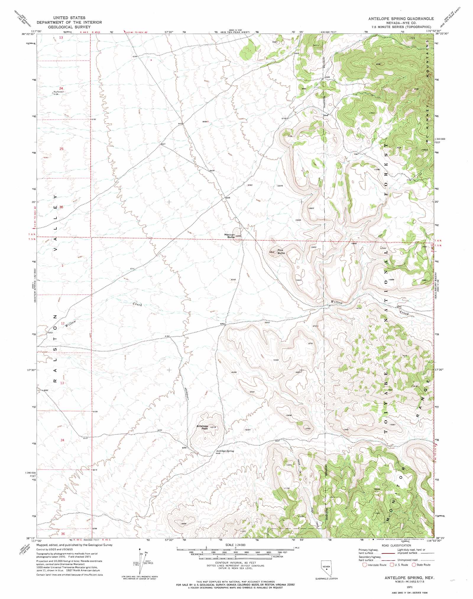
USGS Topo Quad 38116c8 - 1:24,000 scale
| Topo Map Name: | Antelope Spring |
| USGS Topo Quad ID: | 38116c8 |
| Print Size: | ca. 21 1/4" wide x 27" high |
| Southeast Coordinates: | 38.25° N latitude / 116.875° W longitude |
| Map Center Coordinates: | 38.3125° N latitude / 116.9375° W longitude |
| U.S. State: | NV |
| Filename: | o38116c8.jpg |
| Download Map JPG Image: | Antelope Spring topo map 1:24,000 scale |
| Map Type: | Topographic |
| Topo Series: | 7.5´ |
| Map Scale: | 1:24,000 |
| Source of Map Images: | United States Geological Survey (USGS) |
| Alternate Map Versions: |
Antelope Spring NV 1971, updated 1974 Download PDF Buy paper map Antelope Spring NV 2012 Download PDF Buy paper map Antelope Spring NV 2014 Download PDF Buy paper map |
| FStopo: | US Forest Service topo Antelope Spring is available: Download FStopo PDF Download FStopo TIF |
1:24,000 Topo Quads surrounding Antelope Spring
Seyler Peak |
Manhattan |
Belmont West |
Belmont East |
Elkhorn Canyon |
Baxter Spring Nw |
Baxter Spring |
Big Ten Peak West |
Big Ten Peak East |
Mccann Canyon |
San Antonio Well |
Henrys Well |
Antelope Spring |
Saulsbury Basin |
Georges Canyon Rim |
Rays |
Thumder Mountain |
Hannapah |
Mud Spring |
Stone Cabin Ranch |
Tonopah |
East Of Tonopah |
Mckinney Tanks |
Yellow Cone |
Stone Cabin Ranch Sw |
> Back to 38116a1 at 1:100,000 scale
> Back to 38116a1 at 1:250,000 scale
> Back to U.S. Topo Maps home
Antelope Spring topo map: Gazetteer
Antelope Spring: Springs
Antelope Spring elevation 1972m 6469′Nickel Spring elevation 2037m 6683′
Willow Spring elevation 2281m 7483′
Wood Chopper Spring elevation 2018m 6620′
Antelope Spring: Summits
Antelope Peak elevation 2042m 6699′Kinney Peak elevation 2101m 6893′
Mexican Butte elevation 1985m 6512′
Pink Butte elevation 2076m 6811′
Antelope Spring: Valleys
Mine Canyon elevation 2115m 6938′Antelope Spring digital topo map on disk
Buy this Antelope Spring topo map showing relief, roads, GPS coordinates and other geographical features, as a high-resolution digital map file on DVD: